Valdez, Colorado
Valdez is an unincorporated community and a census-designated place (CDP) located in Las Animas County, Colorado, United States. The population of the Valdez CDP was 47 at the United States Census 2010.[4] Las Animas County governs the unincorporated community. The Trinidad post office (Zip Code 81082) serves the area.[3]
Valdez, Colorado | |
|---|---|
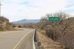 Entering Valdez from the east on Colorado State Highway 12. | |
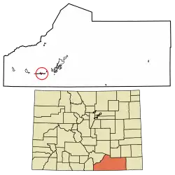 Location of the Valdez CDP in Las Animas County, Colorado. | |
 Valdez Location of the Valdez CDP in the United States. | |
| Coordinates: 37°07′26″N 104°40′46″W[1] | |
| Country | |
| State | |
| County | Las Animas County |
| Government | |
| • Type | unincorporated community |
| Area | |
| • Total | 1.609 sq mi (4.166 km2) |
| • Land | 1.609 sq mi (4.166 km2) |
| • Water | 0.000 sq mi (0.000 km2) |
| Elevation | 6,503 ft (1,982 m) |
| Population (2010) | |
| • Total | 47 |
| • Density | 29/sq mi (11/km2) |
| Time zone | UTC-7 (MST) |
| • Summer (DST) | UTC-6 (MDT) |
| ZIP Code[3] | Trinidad 81082 |
| Area code(s) | 719 |
| GNIS feature[2] | Valdez CDP |
Geography
Valdez is in western Las Animas County, in the valley of the Purgatoire River. It is bordered to the west by Segundo. Colorado State Highway 12 runs along the northern edge of the community, leading east (downriver) 13 miles (21 km) to Trinidad, the county seat, and west (upriver) 20 miles (32 km) to Stonewall Gap.
The Valdez CDP has an area of 1,029 acres (4.166 km2), all land.[1]
Demographics
The United States Census Bureau initially defined the Valdez CDP for the United States Census 2010.
| Year | Pop. | ±% |
|---|---|---|
| 2010 | 47 | — |
| 2020 | — | |
| Source: United States Census Bureau | ||
See also
- Outline of Colorado
- State of Colorado
- Colorado cities and towns
- Colorado counties
References
- "State of Colorado Census Designated Places - BAS20 - Data as of January 1, 2020". United States Census Bureau. Retrieved December 23, 2020.
- "U.S. Board on Geographic Names: Domestic Names". United States Geological Survey. Retrieved December 23, 2020.
- "Zip Code 81082 Map and Profile". zipdatamaps.com. 2020. Retrieved December 23, 2020.
- "2010: DEC Summary File 1". United States Census Bureau. Retrieved December 23, 2020.
External links
Municipalities and communities of Las Animas County, Colorado, United States | ||
|---|---|---|
| City | 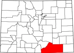 Map of Colorado highlighting Las Animas County | |
| Towns | ||
| CDPs | ||
| Unincorporated communities | ||
| Ghost towns | ||
| ||