Elboya, Calgary
Elboya is a residential neighbourhood in the southwest quadrant of Calgary, Alberta. It is bounded by the Elbow River to the north, 4th Street SW / 45 Avenue SW / Macleod Trail to the east, 50 Avenue S to the south and Elbow Drive to the west. Stanley Park borders the community to the northeast.
Elboya | |
|---|---|
Neighbourhood | |
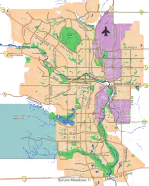 Elboya Location of Elboya in Calgary | |
| Coordinates: 51°00′35″N 114°04′35″W | |
| Country | |
| Province | |
| City | |
| Quadrant | SW |
| Ward | 11 |
| Established | 1947 |
| Annexed | 1910 |
| Government | |
| • Mayor | Naheed Nenshi |
| • Administrative body | Calgary City Council |
| • Councillor | Jeromy Farkas |
| Area | |
| • Total | 1.0 km2 (0.4 sq mi) |
| Elevation | 1,075 m (3,527 ft) |
| Population (2006)[2] | |
| • Total | 1,683 |
| • Average Income | $62,374 |
| Website | Elboya Community Association |
It was annexed to the City of Calgary in 1910, and was established as a neighbourhood in 1947, when most of the development occurred. It is represented in the Calgary City Council by the Ward 11 councillor.[1]
Demographics
In the City of Calgary's 2012 municipal census, Elboya had a population of 1,712 living in 783 dwellings, a -2% change from its 2011 population of 1,747.[3] With a land area of 0.7 km2 (0.27 sq mi), it had a population density of 2,450/km2 (6,300/sq mi) in 2012.[4][3]
Residents in this community had a median household income of $62,374 in 2000, and there were 16% low income residents living in the neighbourhood.[5] As of 2000, 17.1% of the residents were immigrants. A proportion of 37.4% of the buildings were condominiums or apartments, and 39.2% of the housing was used for renting.[2]
Education
The community is served by the Elboya Bilingual Elementary & Junior High public school and St. Anthony (Catholic school).
See also
References
- "Calgary Elections". City of Calgary. 2017. Retrieved November 12, 2017.
- City of Calgary (2006). "Elboya Community Statistics" (PDF). Archived from the original (PDF) on 2008-04-11. Retrieved 2007-05-10.
- "2012 Civic Census Results" (PDF). City of Calgary. 2012. Retrieved February 4, 2013.
- "Community Boundaries" (Esri shapefile). City of Calgary. Retrieved February 5, 2013.
- City of Calgary (2004). "Ward 11 Profile" (PDF). Archived from the original (PDF) on 2007-08-09. Retrieved 2007-05-10.
External links
Places adjacent to Elboya, Calgary | ||||||||||
|---|---|---|---|---|---|---|---|---|---|---|
| ||||||||||