Chaparral, Calgary
Chaparral is a residential neighbourhood in the southeast quadrant of Calgary, Alberta. It is located at the southern edge of the city, south of the Stoney Trail. To the east it is bordered by the Bow River Valley, to the south by 194 Avenue SE, and to the west by Macleod Trail. It has three sub sections that are not officially recognized, Lake Chaparral, Chaparral Valley, and Chaparral Ridge.
Chaparral | |
|---|---|
Neighbourhood | |
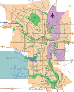 Chaparral Location of Chaparral in Calgary | |
| Coordinates: 50°53′09″N 114°01′31″W | |
| Country | |
| Province | |
| City | |
| Quadrant | SE |
| Ward | 14 |
| Established | 1995 |
| Government | |
| • Mayor | Naheed Nenshi |
| • Administrative body | Calgary City Council |
| • Councillor | Peter Demong |
| Elevation | 1,040 m (3,410 ft) |
| Population (2011)[2] | |
| • Total | 11,151 |
| • Average Income | $79,761 |
| Website | Chaparral Community Association |
Chaparral was established in 1995, and named for the mediterranean climate biome. The centerpiece of the neighbourhood is a 32-acre (130,000 m2) artificial lake and a 21-acre (85,000 m2) park with two waterfalls. It is represented in the Calgary City Council by the Ward 14 councillor, who is currently Peter Demong.
Demographics
In the City of Calgary's 2012 municipal census, Chaparral had a population of 11,552 living in 3,759 dwellings, a 3.6% increase from its 2011 population of 11,151.[2] With a land area of 5.4 km2 (2.1 sq mi), it had a population density of 2,139/km2 (5,540/sq mi) in 2012.[2][3]
Residents in this community had a median household income of $79,761 in 2000, and there were 4.4% low income residents living in the neighbourhood.[4] As of 2000, 14.7% of the residents were immigrants. A proportion of 5.2% of the buildings were condominiums or apartments, and 2.4% of the housing was used for renting.[5]
Education
This neighbourhood has one public elementary school: Chaparral Elementary School. (K-6) This neighbourhood has one Catholic elementary school: Saint Sebastian Elementary School. (k-6)
Transit
Chaparral is served by Calgary Transit Bus Route 78 (South)
See also
References
- "Calgary Elections". City of Calgary. 2017. Retrieved November 12, 2017.
- "2012 Civic Census Results" (PDF). City of Calgary. 2012. Retrieved February 4, 2013.
- "Community Boundaries" (Esri shapefile). City of Calgary. Retrieved February 5, 2013.
- City of Calgary (2004). "Ward 14 Profile" (PDF). Archived from the original (PDF) on 2007-08-09. Retrieved 2007-05-11.
- City of Calgary (2006). "Chaparral Community Statistics" (PDF). Archived from the original (PDF) on 2006-10-07. Retrieved 2007-05-11.
External links
Places adjacent to Chaparral, Calgary | |
|---|---|