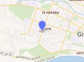
Elgin, New Zealand
Elgin is a suburb of Gisborne, in the Gisborne District of New Zealand's North Island. It is located east and north of Awapuni, south of Te Hapara and west of Gisborne Central.[2]
Elgin | |
|---|---|
Suburb | |
| |
| Country | New Zealand |
| Local authority | Gisborne |
| Electoral ward | Gisborne |
| Population (2018)[1] | |
| • Total | 2,583 |
| Airport(s) | Gisborne Airport |
| Makaraka | Te Hapara | Mangapapa |
|
|
Gisborne Central | |
| Awapuni |
Demographics
| Year | Pop. | ±% p.a. |
|---|---|---|
| 2006 | 2,301 | — |
| 2013 | 2,295 | −0.04% |
| 2018 | 2,583 | +2.39% |
| Source: [1] | ||
Elgin had a population of 2,583 at the 2018 New Zealand census, an increase of 288 people (12.5%) since the 2013 census, and an increase of 282 people (12.3%) since the 2006 census. There were 843 households. There were 1,287 males and 1,296 females, giving a sex ratio of 0.99 males per female. The median age was 31 years (compared with 37.4 years nationally), with 660 people (25.6%) aged under 15 years, 597 (23.1%) aged 15 to 29, 1,008 (39.0%) aged 30 to 64, and 318 (12.3%) aged 65 or older.
Ethnicities were 40.0% European/Pākehā, 69.0% Māori, 8.9% Pacific peoples, 2.2% Asian, and 1.3% other ethnicities (totals add to more than 100% since people could identify with multiple ethnicities).
The proportion of people born overseas was 6.2%, compared with 27.1% nationally.
Although some people objected to giving their religion, 48.5% had no religion, 34.6% were Christian, 0.2% were Hindu, 0.1% were Buddhist and 7.9% had other religions.
Of those at least 15 years old, 135 (7.0%) people had a bachelor or higher degree, and 528 (27.5%) people had no formal qualifications. The median income was $22,100, compared with $31,800 nationally. The employment status of those at least 15 was that 861 (44.8%) people were employed full-time, 267 (13.9%) were part-time, and 156 (8.1%) were unemployed.[1]
Parks
The Reynolds Creek Reserve and Sandown Park is a local park which allows dogs on leashes.[3]
Education
Elgin School is a Year 1-6 state primary school[4][5] with a roll of 61.[6]
Cobham School is also a Year 1-6 state primary school[7] with a roll of 35.[8]
Both schools are co-educational. Rolls are as of March 2020.[9]
References
- "Statistical area 1 dataset for 2018 Census". Statistics New Zealand. March 2020. Elgin (206000). 2018 Census place summary: Elgin
- Hariss, Gavin. "Elgin, Gisborne". topomap.co.nz. NZ Topo Map.
- "Gisborne Parks and Reserves". gdc.govt.nz. Gisborne District Council.
- "Official School Website". elgin.schoolzone.net.nz. Archived from the original on 7 July 2007. Retrieved 5 August 2019.
- "Education Review Office Report". ero.govt.nz. Education Review Office.
- "Ministry of Education School Profile". educationcounts.govt.nz. Ministry of Education.
- "Education Review Office Report". ero.govt.nz. Education Review Office.
- "Ministry of Education School Profile". educationcounts.govt.nz. Ministry of Education.
- "New Zealand Schools Directory". New Zealand Ministry of Education. Retrieved 26 April 2020.