Awapuni, Gisborne
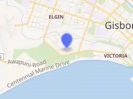
Awapuni is a suburb of the New Zealand city of Gisborne, located in the southwest of the city.[2] It is named after the Awapuni lagoon, where the Waipaoa River runs into the ocean.[3] The New Zealand Ministry for Culture and Heritage gives a translation of "blocked-up river" for Awapuni.[4]
Awapuni | |
|---|---|
Suburb | |
| |
| Country | New Zealand |
| Local authority | Gisborne |
| Electoral ward | Gisborne |
| Population (2018)[1] | |
| • Total | 969 |
| Makaraka | Elgin | Gisborne Central |
|
|
Victoria | |
| (Poverty Bay) |
The local Awapuni Pā, also known as Te Kuri a Tuatai, is a tribal meeting place of the Rongowhakaata hapū of Ruapani, Ngāi Tāwhiri and Te Whānau a Iwi.[5] It includes the Whareroa meeting house.[6]
Demographics
| Year | Pop. | ±% p.a. |
|---|---|---|
| 2006 | 864 | — |
| 2013 | 828 | −0.61% |
| 2018 | 969 | +3.20% |
| Source: [1] | ||
The statistical area of Makaraka-Awapuni, which also covers Makaraka, had a population of 969 at the 2018 New Zealand census, an increase of 141 people (17.0%) since the 2013 census, and an increase of 105 people (12.2%) since the 2006 census. There were 345 households. There were 504 males and 465 females, giving a sex ratio of 1.08 males per female. The median age was 44.6 years (compared with 37.4 years nationally), with 171 people (17.6%) aged under 15 years, 159 (16.4%) aged 15 to 29, 459 (47.4%) aged 30 to 64, and 180 (18.6%) aged 65 or older.
Ethnicities were 74.0% European/Pākehā, 38.1% Māori, 3.7% Pacific peoples, 3.4% Asian, and 2.2% other ethnicities (totals add to more than 100% since people could identify with multiple ethnicities).
The proportion of people born overseas was 11.5%, compared with 27.1% nationally.
Although some people objected to giving their religion, 50.5% had no religion, 35.0% were Christian, 0.6% were Hindu, 0.6% were Buddhist and 4.6% had other religions.
Of those at least 15 years old, 117 (14.7%) people had a bachelor or higher degree, and 186 (23.3%) people had no formal qualifications. The median income was $29,400, compared with $31,800 nationally. The employment status of those at least 15 was that 417 (52.3%) people were employed full-time, 111 (13.9%) were part-time, and 27 (3.4%) were unemployed.[1]
Parks
Awapuni has three sports grounds: Awapuni Stadium, the Oval Reserve cricket and rugby ground, and Watson Park.[7]
Midway Beach includes a beach, barbecue area, horse riding area, jet skiing area, kite surfing area, dog walking area, and the Kopututea Sand Dunes.[7]
Adventure Playground includes a picnic area and public toilets.[7]
Education
Awapuni School is a Year 1-6 co-educational state primary school[8][9] with a roll of 250 as of March 2020.[10][11]
References
- "Statistical area 1 dataset for 2018 Census". Statistics New Zealand. March 2020. Makaraka-Awapuni (205600). 2018 Census place summary: Makaraka-Awapuni
- Hariss, Gavin. "Awapuni, Gisborne". topomap.co.nz. NZ Topo Map.
- Grant-Taylor, Thomas Ludovic (1966). "Waipaoa River". teara.govt.nz. Te Ara - the Encyclopedia of New Zealand.
- "1000 Māori place names". New Zealand Ministry for Culture and Heritage. 6 August 2019.
- "Māori Maps". maorimaps.com. Te Potiki National Trust.
- "Te Kāhui Māngai directory". tkm.govt.nz. Te Puni Kōkiri.
- "Gisborne Parks and Reserves". gdc.govt.nz. Gisborne District Council.
- "Awapuni School Official School Website". awapuni.school.nz.
- "Awapuni School Education Review Office Report". ero.govt.nz. Education Review Office.
- "New Zealand Schools Directory". New Zealand Ministry of Education. Retrieved 26 April 2020.
- "Awapuni School Ministry of Education School Profile". educationcounts.govt.nz. Ministry of Education.