Mangapapa
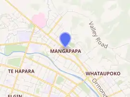
Mangapapa is a suburb of the New Zealand city of Gisborne. It is located in the north of the city. Whataupoko lies to the southeast and Te Hapara to the south, separated from Mangapapa by the Taruheru River.
Mangapapa | |
|---|---|
Suburb | |
| |
| Country | New Zealand |
| Local authority | Gisborne |
| Electoral ward | Gisborne |
| Population (2018)[1] | |
| • Total | 4,530 |
| Riverdale, New Zealand | ||
| Te Hapara |
|
Mangapapa |
| Elgin | Gisborne Central | Whataupoko |
Gisborne Hospital is located in Mangapapa, as was the former Cook Hospital.[2] In 2006, the New Zealand census calculated the total population of the Mangapapa suburb to be 4,263.[3]
Demographics
| Year | Pop. | ±% p.a. |
|---|---|---|
| 2006 | 4,260 | — |
| 2013 | 4,194 | −0.22% |
| 2018 | 4,530 | +1.55% |
| Source: [1] | ||
Mangapapa, comprising the statistical areas of Mangapapa North, Mangapapa East and Mangapapa South, had a population of 4,530 at the 2018 New Zealand census, an increase of 336 people (8.0%) since the 2013 census, and an increase of 270 people (6.3%) since the 2006 census. There were 1,554 households. There were 2,193 males and 2,340 females, giving a sex ratio of 0.94 males per female, with 1,134 people (25.0%) aged under 15 years, 948 (20.9%) aged 15 to 29, 1,887 (41.7%) aged 30 to 64, and 558 (12.3%) aged 65 or older.
Ethnicities were 63.2% European/Pākehā, 50.7% Māori, 4.6% Pacific peoples, 3.6% Asian, and 1.5% other ethnicities (totals add to more than 100% since people could identify with multiple ethnicities).
The proportion of people born overseas was 9.2%, compared with 27.1% nationally.
Although some people objected to giving their religion, 53.1% had no religion, 33.6% were Christian, 0.3% were Hindu, 0.2% were Muslim, 0.4% were Buddhist and 4.8% had other religions.
Of those at least 15 years old, 459 (13.5%) people had a bachelor or higher degree, and 762 (22.4%) people had no formal qualifications. The employment status of those at least 15 was that 1,716 (50.5%) people were employed full-time, 510 (15.0%) were part-time, and 168 (4.9%) were unemployed.[1]
| Name | Population | Households | Median age | Median income |
|---|---|---|---|---|
| Mangapapa North | 1,425 | 477 | 31.9 years | $27,500[4] |
| Mangapapa East | 1,179 | 447 | 38.7 years | $33,200[5] |
| Mangapapa South | 1,926 | 630 | 31 years | $25,300[6] |
| New Zealand | 37.4 years | $31,800 |
Parks
Atkinson Street Park is a local park and dog walking area, located in Mangapapa.[7]
Education
Mangapapa School is a state coeducational contributing primary school[8] with a roll of 453 as of March 2020.[9] The school was opened 1903.[10][11][12]
References
- "Statistical area 1 dataset for 2018 Census". Statistics New Zealand. March 2020. Mangapapa North (205900), Mangapapa East (206200) and Mangapapa South (206300).
- Ray White Real Estate, Gisborne Archived 2010-05-23 at the Wayback Machine
- Statistics New Zealand Data
- 2018 Census place summary: Mangapapa North
- 2018 Census place summary: Mangapapa East
- 2018 Census place summary: Mangapapa South
- "Gisborne Parks and Reserves". gdc.govt.nz. Gisborne District Council.
- Poverty Bay and the East Coast Progress of Education
- "New Zealand Schools Directory". New Zealand Ministry of Education. Retrieved 26 April 2020.
- "Mangapapa Official School Website". mangapapa.school.nz.
- "Ministry of Education School Profile". educationcounts.govt.nz. Ministry of Education.
- "Education Review Office Report". ero.govt.nz. Education Review Office.
