Elk Mountain, Wyoming
Elk Mountain is a town in Carbon County, Wyoming, United States. The population was 191 at the 2010 census. The town shares its name with a mountain 7 miles (11 km) southwest of town.
Elk Mountain, Wyoming | |
|---|---|
_oblique_aerial.jpg.webp) Aerial photo of Elk Mountain, looking northeast | |
 Location of Elk Mountain in Carbon County, Wyoming. | |
 Elk Mountain, Wyoming Location in the United States | |
| Coordinates: 41°41′11″N 106°24′52″W | |
| Country | United States |
| State | Wyoming |
| County | Carbon |
| Government | |
| • Mayor | Morgan Irene (Republican) |
| Area | |
| • Total | 0.28 sq mi (0.72 km2) |
| • Land | 0.28 sq mi (0.72 km2) |
| • Water | 0.00 sq mi (0.00 km2) |
| Elevation | 7,264 ft (2,214 m) |
| Population | |
| • Total | 191 |
| • Estimate (2019)[3] | 185 |
| • Density | 667.87/sq mi (258.22/km2) |
| Time zone | UTC-7 (Mountain (MST)) |
| • Summer (DST) | UTC-6 (MDT) |
| ZIP code | 82324 |
| Area code(s) | 307 |
| FIPS code | 56-24025[4] |
| GNIS feature ID | 1588236[5] |
Geography
Elk Mountain is located at 41°41′11″N 106°24′52″W (41.686517, -106.414535).[6]
According to the United States Census Bureau, the town has a total area of 0.28 square miles (0.73 km2), all land.[7]
Demographics
| Historical population | |||
|---|---|---|---|
| Census | Pop. | %± | |
| 1910 | 98 | — | |
| 1920 | 89 | −9.2% | |
| 1930 | 54 | −39.3% | |
| 1940 | 107 | 98.1% | |
| 1950 | 196 | 83.2% | |
| 1960 | 190 | −3.1% | |
| 1970 | 127 | −33.2% | |
| 1980 | 338 | 166.1% | |
| 1990 | 174 | −48.5% | |
| 2000 | 192 | 10.3% | |
| 2010 | 191 | −0.5% | |
| 2019 (est.) | 185 | [3] | −3.1% |
| U.S. Decennial Census[8] | |||
2010 census
As of the census[2] of 2010, there were 191 people, 76 households, and 58 families residing in the town. The population density was 682.1 inhabitants per square mile (263.4/km2). There were 109 housing units at an average density of 389.3 per square mile (150.3/km2). The racial makeup of the town was 98.4% White, 1.0% African American, and 0.5% Native American. Hispanic or Latino of any race were 0.5% of the population.
There were 76 households, of which 28.9% had children under the age of 18 living with them, 72.4% were married couples living together, 1.3% had a female householder with no husband present, 2.6% had a male householder with no wife present, and 23.7% were non-families. 23.7% of all households were made up of individuals, and 13.2% had someone living alone who was 65 years of age or older. The average household size was 2.51 and the average family size was 2.95.
The median age in the town was 45.1 years. 20.4% of residents were under the age of 18; 6.4% were between the ages of 18 and 24; 23.1% were from 25 to 44; 32% were from 45 to 64; and 18.3% were 65 years of age or older. The gender makeup of the town was 49.2% male and 50.8% female.
2000 census
As of the census[4] of 2000, there were 192 people, 74 households, and 52 families residing in the town. The population density was 676.5 people per square mile (264.8/km2). There were 116 housing units at an average density of 408.7 per square mile (160.0/km2). The racial makeup of the town was 95.83% White, 1.04% Native American, 2.08% from other races, and 1.04% from two or more races. Hispanic or Latino of any race were 5.21% of the population.
There were 74 households, out of which 35.1% had children under the age of 18 living with them, 63.5% were married couples living together, 5.4% had a female householder with no husband present, and 29.7% were non-families. 28.4% of all households were made up of individuals, and 14.9% had someone living alone who was 65 years of age or older. The average household size was 2.59 and the average family size was 3.17.
In the town, the population was spread out, with 30.2% under the age of 18, 4.2% from 18 to 24, 26.0% from 25 to 44, 25.5% from 45 to 64, and 14.1% who were 65 years of age or older. The median age was 36 years. For every 100 females, there were 120.7 males. For every 100 females age 18 and over, there were 106.2 males.
The median income for a household in the town was $40,313, and the median income for a family was $46,042. Males had a median income of $27,500 versus $23,125 for females. The per capita income for the town was $14,463. None of the families and 4.3% of the population were living below the poverty line, including no under eighteens and 14.3% of those over 64.
Education
Public education in the town of Elk Mountain is provided by Carbon County School District #2. Zoned campuses include Elk Mountain Elementary School (grades K-6) and H.E.M. Junior/Senior High School (grades 7-12).
Elk Mountain has a public library, a branch of the Carbon County Library System.[9]
Government/Election's
Elk Mountain's current system of government is municipal government. 5 council members are headed by the office of the Mayor. The current mayor of the town is Morgan Irene (Republican) whom took office in early January of 2011.
List of Recent Former Mayors
1. Barbara Bonner (Republican)/ In office from 1994-2006
2. Rick Christopherson (Democrat)/ In office from 2007-2011
3. Morgan Irene (Republican)/ In office from 2011-present
Elections Sytem
The Town of Elk Mountain, elects if officials by holding election every 2-4 years based upon the position of office open. The office is won when said candidate wins the popular vote.
Election of 2002
In 2002, The town of Elk Mountain had 2 out of 5 council seats open for reelection and the Mayor portion open for reelection. The two open council seat were won and filled by incumbents Craig Jones (Republican) and Penny Nesvik (Republican). Longtime Mayor Barbra Bonner ran for reelection for a third term. She was challenged by local townperson Al Santilli (Democrat). Bonner defeated Santilli and was reelected for a third term by winning the majority of the vote.
Bonner=83
Santilli=31
Election of 2006
In 2006, The town of Elk Mountain had 2 out of 5 council seats open for reelection and the Mayor portion open for election. The two open council seat were won and filled by incumbent Jennifer Bowen (Republican) and new member Jim Richards (Republican). Longtime Mayor Barbra Bonner did not run for reelection for a 4th term. Local residents Rick Christopherson (Democrat) and Dorthy Booth (Republican), ran against eachother for the position of Mayor. Christopherson won the election by winning the majority of the vote.
Christopherson=64
Booth=32
References
- "2019 U.S. Gazetteer Files". United States Census Bureau. Retrieved August 7, 2020.
- "U.S. Census website". United States Census Bureau. Retrieved 2012-12-14.
- "Population and Housing Unit Estimates". United States Census Bureau. May 24, 2020. Retrieved May 27, 2020.
- "U.S. Census website". United States Census Bureau. Retrieved 2008-01-31.
- "US Board on Geographic Names". United States Geological Survey. 2007-10-25. Retrieved 2008-01-31.
- "US Gazetteer files: 2010, 2000, and 1990". United States Census Bureau. 2011-02-12. Retrieved 2011-04-23.
- "US Gazetteer files 2010". United States Census Bureau. Archived from the original on 2012-01-24. Retrieved 2012-12-14.
- "Census of Population and Housing". Census.gov. Retrieved June 4, 2015.
- "Wyoming Public Libraries". PublicLibraries.com. Retrieved 13 June 2019.
Municipalities and communities of Carbon County, Wyoming, United States | ||
|---|---|---|
| Cities | 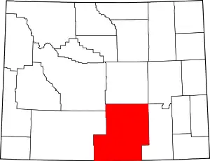 | |
| Towns | ||
| CDPs | ||
| Unincorporated communities | ||
| Ghost towns | ||
| ||
Notable residents
Chompers
2006–Present
| Authority control |
|---|