Ely, Iowa
Ely is a city in Linn County, Iowa, United States. The population was 1,776 at the 2010 census. It is part of the Cedar Rapids Metropolitan Statistical Area.
Ely, Iowa | |
|---|---|
 | |
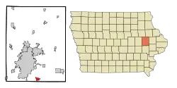 Location of Ely, Iowa | |
| Coordinates: 41°52′32″N 91°34′59″W | |
| Country | |
| State | |
| County | Linn |
| Area | |
| • Total | 1.66 sq mi (4.31 km2) |
| • Land | 1.66 sq mi (4.30 km2) |
| • Water | 0.00 sq mi (0.01 km2) |
| Elevation | 738 ft (225 m) |
| Population | |
| • Total | 1,776 |
| • Estimate (2019)[3] | 2,343 |
| • Density | 1,413.15/sq mi (545.50/km2) |
| Time zone | UTC-6 (Central (CST)) |
| • Summer (DST) | UTC-5 (CDT) |
| ZIP code | 52227 |
| Area code(s) | 319 |
| FIPS code | 19-25365 |
| GNIS feature ID | 0456356 |
History
Ely was laid out in 1872 as an outgrowth on the Burlington, Cedar Rapids and Northern Railway.[4]
National Register of Historic Places
Two properties in Ely are listed on the National Register of Historic Places:
Geography
Ely is located at 41°52′32″N 91°34′59″W (41.875431, -91.583061).[5]
According to the United States Census Bureau, the city has a total area of 1.44 square miles (3.73 km2), all land.[6]
Demographics
| Year | Pop. | ±% |
|---|---|---|
| 1910 | 161 | — |
| 1920 | 174 | +8.1% |
| 1930 | 172 | −1.1% |
| 1940 | 170 | −1.2% |
| 1950 | 155 | −8.8% |
| 1960 | 226 | +45.8% |
| 1970 | 275 | +21.7% |
| 1980 | 425 | +54.5% |
| 1990 | 517 | +21.6% |
| 2000 | 1,149 | +122.2% |
| 2010 | 1,776 | +54.6% |
| 2019 | 2,343 | +31.9% |
| Source:"U.S. Census website". United States Census Bureau. Retrieved 2020-03-28. and Iowa Data Center Source: | ||
2010 census
As of the census[2] of 2010, there were 1,776 people, 628 households, and 466 families living in the city. The population density was 1,233.3 inhabitants per square mile (476.2/km2). There were 650 housing units at an average density of 451.4 per square mile (174.3/km2). The racial makeup of the city was 97.5% White, 0.3% African American, 0.1% Native American, 0.5% Asian, 0.6% from other races, and 1.0% from two or more races. Hispanic or Latino of any race were 2.3% of the population.
There were 628 households, of which 48.4% had children under the age of 18 living with them, 62.9% were married couples living together, 7.5% had a female householder with no husband present, 3.8% had a male householder with no wife present, and 25.8% were non-families. 18.0% of all households were made up of individuals, and 4.5% had someone living alone who was 65 years of age or older. The average household size was 2.83 and the average family size was 3.29.
The median age in the city was 33.2 years. 32.7% of residents were under the age of 18; 6.3% were between the ages of 18 and 24; 33.2% were from 25 to 44; 22.2% were from 45 to 64; and 5.7% were 65 years of age or older. The gender makeup of the city was 50.5% male and 49.5% female.
2000 census
As of the census[8] of 2000, there were 1,149 people, 424 households, and 315 families living in the city. The population density was 848.1 people per square mile (328.6/km2). There were 434 housing units at an average density of 320.3 per square mile (124.1/km2). The racial makeup of the city was 98.09% White, 0.35% African American, 0.26% Native American, 0.17% Asian, 0.09% from other races, and 1.04% from two or more races. Hispanic or Latino of any race were 0.96% of the population.
There were 424 households, of which 42.2% had children under the age of 18 living with them, 61.8% were married couples living together, 9.4% had a female householder with no husband present, and 25.7% were non-families. 17.9% of all households were made up of individuals, and 6.4% had someone living alone who was 65 years of age or older. The average household size was 2.71 and the average family size was 3.10.
In the city, the population was spread out, with 29.2% under the age of 18, 9.6% from 18 to 24, 34.0% from 25 to 44, 20.5% from 45 to 64, and 6.7% who were 65 years of age or older. The median age was 32 years. For every 100 females, there were 98.8 males. For every 100 females age 18 and over, there were 91.3 males.
The median income for a household in the city was $57,250, and the median income for a family was $62,500. Males had a median income of $41,292 versus $29,286 for females. The per capita income for the city was $20,936. About 2.4% of families and 5.8% of the population were below the poverty line, including 7.0% of those under age 18 and 8.5% of those age 65 or over.
References
- "2019 U.S. Gazetteer Files". United States Census Bureau. Retrieved July 17, 2020.
- "U.S. Census website". United States Census Bureau. Retrieved 2012-05-11.
- "Population and Housing Unit Estimates". United States Census Bureau. May 24, 2020. Retrieved May 27, 2020.
- The History of Linn County, Iowa: Containing a History of the County, Its Cities, Towns, &c. Western Historical Company. 1878. p. 584.
- "US Gazetteer files: 2010, 2000, and 1990". United States Census Bureau. 2011-02-12. Retrieved 2011-04-23.
- "US Gazetteer files 2010". United States Census Bureau. Archived from the original on 2012-01-25. Retrieved 2012-05-11.
- "Census of Population and Housing". Census.gov. Retrieved June 4, 2015.
- "U.S. Census website". United States Census Bureau. Retrieved 2008-01-31.
External links
| Wikimedia Commons has media related to Ely, Iowa. |
- Historic Ely, Iowa (History of Ely & area) https://www.elyhistory.com/
- City of Ely Official Website
- Economic Development Group of Ely, nonprofit
- City Data Statistical Data and more about Ely
Municipalities and communities of Linn County, Iowa, United States | ||
|---|---|---|
| Cities | Map of Iowa highlighting Linn County | |
| Townships | ||
| Unincorporated communities | ||
| Footnotes | ‡This populated place also has portions in an adjacent county or counties | |
| ||
| Authority control |
|---|