Robins, Iowa
Robins is a city in Linn County, Iowa, United States. The population was 3,142 at the 2010 census. It is a suburb of Cedar Rapids and part of the Cedar Rapids Metropolitan Statistical Area.[4]
Robins, Iowa | |
|---|---|
| Motto(s): "Community. Family. Friends." | |
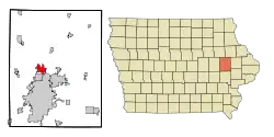 Location of Robins, Iowa | |
| Coordinates: 42°4′22″N 91°40′7″W | |
| Country | |
| State | |
| County | Linn |
| Area | |
| • Total | 6.03 sq mi (15.62 km2) |
| • Land | 6.02 sq mi (15.60 km2) |
| • Water | 0.01 sq mi (0.02 km2) |
| Elevation | 850 ft (259 m) |
| Population | |
| • Total | 3,142 |
| • Estimate (2019)[3] | 3,537 |
| • Density | 587.15/sq mi (226.71/km2) |
| Time zone | UTC-6 (Central (CST)) |
| • Summer (DST) | UTC-5 (CDT) |
| ZIP code | 52328 |
| Area code(s) | 319 |
| FIPS code | 19-67800 |
| GNIS feature ID | 0460699 |
Geography
Robins is located at 42°4′22″N 91°40′7″W (42.072916, -91.668538).[5]
According to the United States Census Bureau, the city has a total area of 5.84 square miles (15.13 km2), of which 5.83 square miles (15.10 km2) is land and 0.01 square miles (0.03 km2) is water.[6]
Demographics
| Year | Pop. | ±% |
|---|---|---|
| 1920 | 110 | — |
| 1930 | 190 | +72.7% |
| 1940 | 205 | +7.9% |
| 1950 | 272 | +32.7% |
| 1960 | 426 | +56.6% |
| 1970 | 663 | +55.6% |
| 1980 | 726 | +9.5% |
| 1990 | 875 | +20.5% |
| 2000 | 1,806 | +106.4% |
| 2010 | 3,142 | +74.0% |
| 2019 | 3,537 | +12.6% |
| "U.S. Census website". United States Census Bureau. Retrieved 2010-11-16. and Iowa Data Center Source: | ||
2010 census
As of the census[2] of 2010, there were 3,142 people, 1,034 households, and 911 families living in the city. The population density was 538.9 inhabitants per square mile (208.1/km2). There were 1,072 housing units at an average density of 183.9 per square mile (71.0/km2). The racial makeup of the city was 95.6% White, 0.7% African American, 0.1% Native American, 2.1% Asian, 0.1% Pacific Islander, 0.5% from other races, and 1.0% from two or more races. Hispanic or Latino of any race were 1.3% of the population.
There were 1,034 households, of which 46.5% had children under the age of 18 living with them, 83.8% were married couples living together, 1.8% had a female householder with no husband present, 2.4% had a male householder with no wife present, and 11.9% were non-families. 8.6% of all households were made up of individuals, and 3.5% had someone living alone who was 65 years of age or older. The average household size was 3.04 and the average family size was 3.23.
The median age in the city was 39.1 years. 31.1% of residents were under the age of 18; 4.7% were between the ages of 18 and 24; 24.5% were from 25 to 44; 31.6% were from 45 to 64; and 8% were 65 years of age or older. The gender makeup of the city was 51.1% male and 48.9% female.
2000 census
As of the census[4] of 2000, there were 1,806 people, 592 households, and 520 families living in the city. The population density was 472.3 people per square mile (182.5/km2). There were 603 housing units at an average density of 157.7 per square mile (60.9/km2). The racial makeup of the city was 98.17% White, 0.17% Native American, 0.50% Asian, 0.11% from other races, and 1.05% from two or more races. Hispanic or Latino of any race were 1.38% of the population.
There were 592 households, out of which 46.5% had children under the age of 18 living with them, 83.6% were married couples living together, 2.2% had a female householder with no husband present, and 12.0% were non-families. 9.3% of all households were made up of individuals, and 1.9% had someone living alone who was 65 years of age or older. The average household size was 3.05 and the average family size was 3.27.
In the city, the population was spread out, with 33.0% under the age of 18, 4.5% from 18 to 24, 30.5% from 25 to 44, 26.5% from 45 to 64, and 5.6% who were 65 years of age or older. The median age was 37 years. For every 100 females, there were 109.8 males. For every 100 females age 18 and over, there were 108.6 males.
The median income for a household in the city was $74,211, and the median income for a family was $76,666. Males had a median income of $51,520 versus $33,500 for females. The per capita income for the city was $25,078. About 0.4% of families and 1.2% of the population were below the poverty line, including 1.2% of those under age 18 and none of those age 65 or over.
Education
Most of Robins is in the Cedar Rapids Community School District.[8]
Zoned schools for Robins:[9]
References
- "2019 U.S. Gazetteer Files". United States Census Bureau. Retrieved July 17, 2020.
- "U.S. Census website". United States Census Bureau. Retrieved 2012-05-11.
- "Population and Housing Unit Estimates". United States Census Bureau. May 24, 2020. Retrieved May 27, 2020.
- "United States Census Bureau". American Factfinder Robins, Iowa. Archived from the original on 2020-02-12. Retrieved 2010-11-16.
- "US Gazetteer files: 2010, 2000, and 1990". United States Census Bureau. 2011-02-12. Retrieved 2011-04-23.
- "US Gazetteer files 2010". United States Census Bureau. Archived from the original on 2012-01-25. Retrieved 2012-05-11.
- "Census of Population and Housing". Census.gov. Retrieved June 4, 2015.
- "Cedar Rapids" (PDF). Iowa Department of Education. Retrieved 2020-04-07.
- "2010 CENSUS - CENSUS BLOCK MAP: Robins city, IA" (PDF). U.S. Census Bureau. Retrieved 2020-04-07.
- "Elementary School Boundaries" (PDF). Cedar Rapids Community School District. Retrieved 2020-04-07.
- "Middle School Boundaries High School Boundaries" (PDF). Cedar Rapids Community School District. Retrieved 2020-04-07.
External links
- City Data Statistical Data and more about Robins, Iowa
Municipalities and communities of Linn County, Iowa, United States | ||
|---|---|---|
| Cities | Map of Iowa highlighting Linn County | |
| Townships | ||
| Unincorporated communities | ||
| Footnotes | ‡This populated place also has portions in an adjacent county or counties | |
| ||
| Authority control |
|---|
