Walford, Iowa
Walford is a city in Benton and Linn counties in the U.S. state of Iowa. The population was 1,463 at the 2010 census. It is part of the Cedar Rapids Metropolitan Statistical Area.
Walford, Iowa | |
|---|---|
 | |
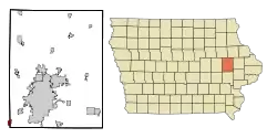 Location of Walford, Iowa | |
| Coordinates: 41°52′41″N 91°50′6″W | |
| Country | United States |
| State | |
| Counties | Benton, Linn |
| Government | |
| • Type | Mayor Council |
| • Mayor | [1] |
| Area | |
| • Total | 0.98 sq mi (2.55 km2) |
| • Land | 0.98 sq mi (2.55 km2) |
| • Water | 0.00 sq mi (0.00 km2) |
| Elevation | 804 ft (245 m) |
| Population | |
| • Total | 1,463 |
| • Estimate (2019)[4] | 1,445 |
| • Density | 1,469.99/sq mi (567.62/km2) |
| Time zone | UTC-6 (Central (CST)) |
| • Summer (DST) | UTC-5 (CDT) |
| ZIP code | 52351 |
| Area code(s) | 319 |
| FIPS code | 19-81840 |
| GNIS feature ID | 0462607 |
| Website | http://www.cityofwalford.com |
History
Walford was originally called Terry, and under the latter name was laid out in the year 1884 when the Chicago, Milwaukee and St. Paul Railroad was extended to that point.[5] In 1889, the town's name was changed to Walford, primarily at the behest of the U.S. Postal Service due to the similarity of names between Terry and Perry, Iowa. In 1897, Walford gained national attention when the general store burned down, leaving a charred corpse; since two men were missing, news stories about the identity of the corpse and the hunt for the survivor made the headlines for weeks.[6]
Geography
Walford is located at 41°52′41″N 91°50′6″W (41.877932, -91.834930).[7]
According to the United States Census Bureau, the city has a total area of 1.11 square miles (2.87 km2), all land.[8]
Demographics
| Year | Pop. | ±% |
|---|---|---|
| 1960 | 264 | — |
| 1970 | 286 | +8.3% |
| 1980 | 285 | −0.3% |
| 1990 | 303 | +6.3% |
| 2000 | 1,224 | +304.0% |
| 2010 | 1,463 | +19.5% |
| 2019 | 1,445 | −1.2% |
| Source:"U.S. Census website". United States Census Bureau. Retrieved 2020-03-29. and Iowa Data Center Source: | ||
2010 census
As of the census[3] of 2010, there were 1,463 people, 479 households, and 414 families living in the city. The population density was 1,318.0 inhabitants per square mile (508.9/km2). There were 492 housing units at an average density of 443.2 per square mile (171.1/km2). The racial makeup of the city was 98.6% White, 0.1% African American, 0.1% Native American, 0.3% Asian, 0.1% from other races, and 0.8% from two or more races. Hispanic or Latino of any race were 0.6% of the population.
There were 479 households, of which 52.0% had children under the age of 18 living with them, 75.6% were married couples living together, 7.3% had a female householder with no husband present, 3.5% had a male householder with no wife present, and 13.6% were non-families. 10.0% of all households were made up of individuals, and 2.8% had someone living alone who was 65 years of age or older. The average household size was 3.05 and the average family size was 3.29.
The median age in the city was 35.1 years. 33.4% of residents were under the age of 18; 5.6% were between the ages of 18 and 24; 30.4% were from 25 to 44; 25.3% were from 45 to 64; and 5.3% were 65 years of age or older. The gender makeup of the city was 51.4% male and 48.6% female.
2000 census
As of the census[10] of 2000, there were 1,224 people, 389 households, and 348 families living in the city. The population density was 1,276.8 people per square mile (492.3/km2). There were 399 housing units at an average density of 416.2 per square mile (160.5/km2). The racial makeup of the city was 98.94% White, 0.25% African American, 0.08% Native American, 0.16% Asian, and 0.57% from two or more races. Hispanic or Latino of any race were 0.08% of the population.
There were 389 households, out of which 56.6% had children under the age of 18 living with them, 81.2% were married couples living together, 6.2% had a female householder with no husband present, and 10.5% were non-families. 8.2% of all households were made up of individuals, and 3.6% had someone living alone who was 65 years of age or older. The average household size was 3.14 and the average family size was 3.35.
36.4% were under the age of 18, 5.4% from 18 to 24, 39.8% from 25 to 44, 14.1% from 45 to 64, and 4.3% were 65 years of age or older. The median age was 31 years. For every 100 females, there were 100.3 males. For every 100 females age 18 and over, there were 94.3 males.
The median income for a household in the city was $67,833, and the median income for a family was $70,000. Males had a median income of $42,197 versus $27,188 for females. The per capita income for the city was $21,370. None of the families and 0.4% of the population were living below the poverty line, including no under eighteens and none of those over 64.
Climate
This region has significant seasonal temperature differences, going from warm summers to very cold winters. There is precipitation year-round. Most summer rainfall occurs during thunderstorms and during a very occasional tropical system.
| Climate data for Walford, Iowa | |||||||||||||
|---|---|---|---|---|---|---|---|---|---|---|---|---|---|
| Month | Jan | Feb | Mar | Apr | May | Jun | Jul | Aug | Sep | Oct | Nov | Dec | Year |
| Average high °C (°F) | −2 (28) |
1 (33) |
8 (46) |
17 (62) |
22 (72) |
27 (81) |
29 (85) |
28 (83) |
24 (76) |
18 (64) |
8 (47) |
0 (32) |
15 (59) |
| Average low °C (°F) | −12 (10) |
−9 (15) |
−3 (26) |
3 (38) |
9 (49) |
14 (58) |
17 (62) |
16 (60) |
11 (51) |
5 (41) |
−2 (28) |
−9 (16) |
3 (38) |
| Average precipitation days | 1.1 | 1.0 | 2.1 | 3.4 | 4.2 | 4.4 | 3.9 | 3.7 | 3.4 | 2.4 | 1.8 | 1.4 | 32.7 |
| Source: Weatherbase [11] | |||||||||||||
References
- "Members". City of Walford, IA. Retrieved 3 December 2015.
- "2019 U.S. Gazetteer Files". United States Census Bureau. Retrieved July 17, 2020.
- "U.S. Census website". United States Census Bureau. Retrieved 2012-05-11.
- "Population and Housing Unit Estimates". United States Census Bureau. May 24, 2020. Retrieved May 27, 2020.
- "Walford". County of Benton, IA. Retrieved 7 August 2014.
- Kaufman, Peter. Skull in the Ashes. University of Iowa Press. pp. 14, 34. ISBN 9781609382131.
- "US Gazetteer files: 2010, 2000, and 1990". United States Census Bureau. 2011-02-12. Retrieved 2011-04-23.
- "US Gazetteer files 2010". United States Census Bureau. Retrieved 2012-05-11.
- "Census of Population and Housing". Census.gov. Retrieved June 4, 2015.
- "U.S. Census website". United States Census Bureau. Retrieved 2008-01-31.
- "Weatherbase :Vinton, Iowa (closest city to Walford, Iowa, with complete data)". Weatherbase. 2013. Retrieved on May 5, 2013.
Municipalities and communities of Benton County, Iowa, United States | ||
|---|---|---|
| Cities | Map of Iowa highlighting Benton County | |
| Townships | ||
| CDP | ||
| Unincorporated communities | ||
| Footnotes | ‡This populated place also has portions in an adjacent county or counties | |
| ||
Municipalities and communities of Linn County, Iowa, United States | ||
|---|---|---|
| Cities | Map of Iowa highlighting Linn County | |
| Townships | ||
| Unincorporated communities | ||
| Footnotes | ‡This populated place also has portions in an adjacent county or counties | |
| ||