Estrées-Saint-Denis
Estrées-Saint-Denis is a commune in the Oise department in northern France.
Estrées-Saint-Denis | |
|---|---|
%252C_%C3%A9glise_Saint-Denis%252C_vue_depuis_l'ouest_2.jpg.webp) The church in Estrées-Saint-Denis | |
Location of Estrées-Saint-Denis 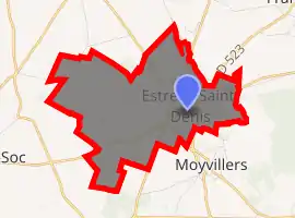
| |
 Estrées-Saint-Denis  Estrées-Saint-Denis | |
| Coordinates: 49°25′35″N 2°38′37″E | |
| Country | France |
| Region | Hauts-de-France |
| Department | Oise |
| Arrondissement | Compiègne |
| Canton | Estrées-Saint-Denis |
| Intercommunality | Plaine d'Estrées |
| Government | |
| • Mayor (2008–2014) | Charles Pouplin |
| Area 1 | 8.08 km2 (3.12 sq mi) |
| Population (2017-01-01)[1] | 3,752 |
| • Density | 460/km2 (1,200/sq mi) |
| Time zone | UTC+01:00 (CET) |
| • Summer (DST) | UTC+02:00 (CEST) |
| INSEE/Postal code | 60223 /60190 |
| Elevation | 69–118 m (226–387 ft) (avg. 70 m or 230 ft) |
| 1 French Land Register data, which excludes lakes, ponds, glaciers > 1 km2 (0.386 sq mi or 247 acres) and river estuaries. | |
It is one of many villages in the north of France bearing the name Estrées. The etymology of the name is from strata (cognate of English "street"), the word for the stone-layered Roman roads in the area (some of which turned into modern highways). Hence Estreti, "village on the road" which developed into "Estrées".
See also
References
- "Populations légales 2017". INSEE. Retrieved 6 January 2020.
| Wikimedia Commons has media related to Estrées-Saint-Denis. |
| Authority control |
|
|---|
This article is issued from Wikipedia. The text is licensed under Creative Commons - Attribution - Sharealike. Additional terms may apply for the media files.