Etroubles
Étroubles (Valdôtain: Étroble) is a town and comune in the Aosta Valley region of northwestern Italy.
Étroubles | |
|---|---|
| Comune di Étroubles Commune d'Étroubles | |
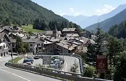 View of Étroubles | |
.svg.png.webp) Coat of arms | |
Location of Étroubles 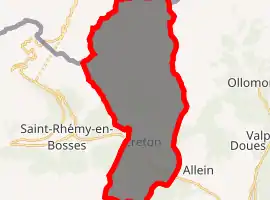
| |
 Étroubles Location of Étroubles in Italy 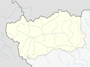 Étroubles Étroubles (Aosta Valley) | |
| Coordinates: 45°49′N 7°13′E | |
| Country | Italy |
| Region | Aosta Valley |
| Province | none |
| Frazioni | Bézet, Chez-les-Blancs, Cerisey, Échevennoz, Éternod, La Collère, Lavanche, Pallais, Prailles, Vachéry, Véyaz |
| Government | |
| • Mayor | Massimo Tamone |
| Area | |
| • Total | 39 km2 (15 sq mi) |
| Elevation | 1,280 m (4,200 ft) |
| Population (31 December 2010)[2] | |
| • Total | 491 |
| • Density | 13/km2 (33/sq mi) |
| Demonym(s) | Étroubleins |
| Time zone | UTC+1 (CET) |
| • Summer (DST) | UTC+2 (CEST) |
| Postal code | 11014 |
| Dialing code | 0165 |
| Website | Official website |
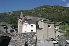
the Parish Church
Sights include a bell tower from a now disappeared 15th century Romanesque church and a medieval watchtower (built in the 12th century on a Roman foundation).
History
In Roman times, it was known as Restapolis and was the main center in the Grand-Saint-Bernard Valley. It perhaps housed the local garrison watching the main access from Gaul. In medieval times, it was a stage on the Via Francigena.
Napoleon Bonaparte stayed at Étroubles on 20 May 1800, during his march to Marengo and the eponymous battle.

| Authority control |
|
|---|
- "Superficie di Comuni Province e Regioni italiane al 9 ottobre 2011". Istat. Retrieved 16 March 2019.
- "Popolazione Residente al 1° Gennaio 2018". Istat. Retrieved 16 March 2019.
This article is issued from Wikipedia. The text is licensed under Creative Commons - Attribution - Sharealike. Additional terms may apply for the media files.
