Saint-Denis, Aosta Valley
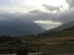
Saint-Denis (Valdôtain: Sen-Din-ì) is a town and comune in the Aosta Valley region of north-western Italy near the ruins of Cly castle.
Saint-Denis
Sen-Din-ì | |
|---|---|
| Comune di Saint-Denis Commune de Saint-Denis | |
 | |
Location of Saint-Denis 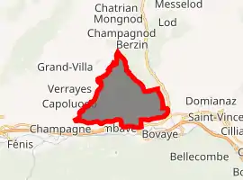
| |
 Saint-Denis Location of Saint-Denis in Italy 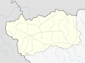 Saint-Denis Saint-Denis (Aosta Valley) | |
| Coordinates: 45°45′N 7°33′E | |
| Country | Italy |
| Region | Aosta Valley |
| Province | none |
| Frazioni | Barmaz, Bédeugaz, Blavesse, Celliers-Neufs, Champillon, Chouac, Cly, Cret de Gilles, Cuignon, Del, Etrobléyaz, Farys, Fosses, Goillaz-dessous, Goillaz-dessus, Gottroisaz, Grand Bruson, Petit Bruson, Grenellaz, Grosse-Golliane, Gubioche, Mesoncel, Moral, Orsières, Peccaz, Plantéry, Plau, Polalonge, Raffort, Roteus, Rovarey, Semon, Sessinaz, Vieille |
| Area | |
| • Total | 11 km2 (4 sq mi) |
| Elevation | 820 m (2,690 ft) |
| Population (1 January 2007)[2] | |
| • Total | 371 |
| • Density | 34/km2 (87/sq mi) |
| Demonym(s) | Saint-denisots |
| Time zone | UTC+1 (CET) |
| • Summer (DST) | UTC+2 (CEST) |
| Postal code | 11023 |
| Dialing code | 0166 |
| ISTAT code | 7059 |
| Patron saint | Saint Denis of Paris |
| Saint day | 9 October |
| Website | Official website |
References
- "Superficie di Comuni Province e Regioni italiane al 9 ottobre 2011". Istat. Retrieved 16 March 2019.
- All demographics and other statistics from the Italian statistical institute (Istat)

This article is issued from Wikipedia. The text is licensed under Creative Commons - Attribution - Sharealike. Additional terms may apply for the media files.