Falls View, West Virginia
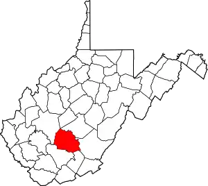
Falls View is a census-designated place (CDP) in Fayette County, West Virginia, United States. Falls View is located 4 miles (6.4 km) southwest of Gauley Bridge, on the north bank of the Kanawha River. As of the 2010 census, its population was 238.[2] Falls View was established in the early 20th century as a residential village for managers from the Electro Metallurgical Co., part of the Union Carbide and Carbon Corporation.[4] Electro Metallurgical operated four ferroalloy plants in the area, powered by hydroelectricity generated at the dam on Kanawha Falls.[4]
Falls View, West Virginia | |
|---|---|
Census-designated place (CDP) | |
 Falls View  Falls View | |
| Coordinates: 38°07′34″N 81°14′46″W | |
| Country | United States |
| State | West Virginia |
| County | Fayette |
| Area | |
| • Total | 0.405 sq mi (1.05 km2) |
| • Land | 0.330 sq mi (0.85 km2) |
| • Water | 0.075 sq mi (0.19 km2) |
| Elevation | 663 ft (202 m) |
| Population | |
| • Total | 238 |
| • Density | 590/sq mi (230/km2) |
| Time zone | UTC-5 (Eastern (EST)) |
| • Summer (DST) | UTC-4 (EDT) |
| Area code(s) | 304 & 681 |
| GNIS feature ID | 1554440[3] |
See also
References
- "US Gazetteer files: 2010, 2000, and 1990". census.gov. United States Census Bureau. February 12, 2011. Retrieved April 23, 2011.
- "2010 Demographic Profile Data". American FactFinder. United States Census Bureau. 2010. Archived from the original on February 13, 2020. Retrieved March 24, 2017.
- "Falls View". Geographic Names Information System. United States Geological Survey. June 27, 1980. Retrieved March 24, 2017.
- Federal Writers' Project (1941). The WPA Guide to West Virginia: The Mountain State. San Antonio, TX: Trinity University Press. pp. 439–440.
This article is issued from Wikipedia. The text is licensed under Creative Commons - Attribution - Sharealike. Additional terms may apply for the media files.