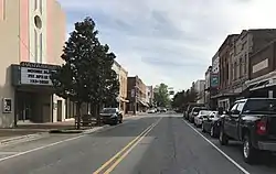
Farmville, North Carolina
Farmville is a town in Pitt County, North Carolina, United States, eight miles to the west of Greenville. At the 2010 Census, the population was 4,654. Farmville is a part of the Greenville Metropolitan Area located in North Carolina's Inner Banks region. Farmville has been a Tree City USA community through the Arbor Day Foundation for 36 years, proving its commitment to managing and expanding its public trees. The Town government, in cooperation with other non-profit groups that work for the advancement of the town, sponsor annual events such as the Farmville Dogwood Festival, the Christmas Parade, Hometown Halloween, A Taste of Farmville, and the Holiday Open House, among others.
Farmville, North Carolina | |
|---|---|
 | |
| Motto(s): "Honoring Our Past, Shaping Our Future" | |
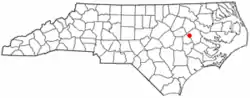 Location of Farmville, North Carolina | |
| Coordinates: 35°35′39″N 77°35′14″W | |
| Country | United States |
| State | North Carolina |
| County | Pitt |
| Government | |
| • Type | Mayor-Board of Commissioners |
| Area | |
| • Total | 3.37 sq mi (8.73 km2) |
| • Land | 3.37 sq mi (8.73 km2) |
| • Water | 0.00 sq mi (0.00 km2) |
| Elevation | 82 ft (25 m) |
| Population (2010) | |
| • Total | 4,654 |
| • Estimate (2019)[2] | 4,764 |
| • Density | 1,413.23/sq mi (545.65/km2) |
| Time zone | UTC-5 (Eastern (EST)) |
| • Summer (DST) | UTC-4 (EDT) |
| ZIP code | 27828 |
| Area code(s) | 252 |
| FIPS code | 37-22820[3] |
| GNIS feature ID | 1020222[4] |
| Website | http://www.farmvillenc.gov |

History
Established in February 1872, the town was named Farmville because all of its undertakings and activities were farm related. Among the influential founding fathers of Farmville, James Williams May and William Gray Lang made exceptional contributions to the towns development. Mr. James Williams May was a commissioner named in the original town charter. He donated sites for churches and was a business leader willing to invest his services and resources towards the success of the town. He was the grandson of Major Benjamin May. William Gray Lang served as a commissioner on the town board for more than 10 years. He also serviced on the executive committee appointed to establish the Tobacco Market in Farmville. The town grew slowly, with the 1880 census showing 111 in Farmville and 79 in Marlborough, a nearby unincorporated settlement along the wooden Historic Plank Road. The Marlborough settlement is now inside the town limits of Farmville. The cultivation of Tobacco in Pitt County and the Farmville area began in the 1890's, which helped bring the East Carolina Railway to Farmville in 1900. Most of buildings in downtown Farmville were built shortly after due to the economic boom the railroad helped begin. The Farmville Historic District and Benjamin May-Lewis House are listed on the National Register of Historic Places.[5]
Geography
Farmville is located at 35°35′39″N 77°35′14″W (35.594246, −77.587128).[6]
According to the United States Census Bureau, the town has a total area of 3.1 square miles (8.0 km2), all of it land.
Little Contentnea Creek, a tributary to Contentnea Creek, passes to the north Farmville.
Demographics
| Historical population | |||
|---|---|---|---|
| Census | Pop. | %± | |
| 1880 | 111 | — | |
| 1890 | 140 | 26.1% | |
| 1900 | 262 | 87.1% | |
| 1910 | 816 | 211.5% | |
| 1920 | 1,780 | 118.1% | |
| 1930 | 2,056 | 15.5% | |
| 1940 | 2,980 | 44.9% | |
| 1950 | 2,942 | −1.3% | |
| 1960 | 3,997 | 35.9% | |
| 1970 | 4,424 | 10.7% | |
| 1980 | 4,707 | 6.4% | |
| 1990 | 4,392 | −6.7% | |
| 2000 | 4,302 | −2.0% | |
| 2010 | 4,654 | 8.2% | |
| 2019 (est.) | 4,764 | [2] | 2.4% |
| U.S. Decennial Census[7] | |||
As of the census[3] of 2014, there were 5,012 people, 2,394 households, and 1,992 families residing in the town. The population density was 1,387.4 people per square mile (535.8/km2). There were 2,010 housing units at an average density of 648.2 per square mile (250.3/km2). The racial makeup of the town was 47.37% White, 50.09% African American, 0.07% Native American, 0.23% Asian, 1.19% from other races, and 1.05% from two or more races. Hispanic or Latino of any race were 2.12% of the population.
There were 1,839 households, out of which 26.6% had children under the age of 18 living with them, 38.8% were married couples living together, 22.5% had a female householder with no husband present, and 34.6% were non-families. 32.1% of all households were made up of individuals, and 16.9% had someone living alone who was 65 years of age or older. The average household size was 2.33 and the average family size was 2.93.
In the town, the population was spread out, with 23.9% under the age of 18, 7.4% from 18 to 24, 23.4% from 25 to 44, 26.3% from 45 to 64, and 18.9% who were 65 years of age or older. The median age was 42 years. For every 100 females, there were 77.7 males. For every 100 females age 18 and over, there were 71.6 males.
The median income for a household in the town was $29,229, and the median income for a family was $38,918. Males had a median income of $31,543 versus $21,968 for females. The per capita income for the town was $20,582. About 14.6% of families and 20.6% of the population were below the poverty line, including 32.8% of those under age 18 and 23.8% of those age 65 or over.
Education
Farmville is served by the Pitt County Schools district.[8] Local public schools include:
- H. B. Sugg Elementary School (Previously K through 12) (Now Pre-K – 2nd)
- Sam D. Bundy Elementary School (3rd −5th)
- Farmville Middle School (6th – 8th)
- Farmville Central High School (9th −12th)
- Pitt Community College, Farmville Center-This satellite campus serves as the hub for educational, workforce, and business services in southwest Pitt County, and surrounding counties. Classes are credits are offered to high school and college students, as well as individuals wanting to improve their skills and knowledge in a specific field.
- The GlasStation-Glass Blowing art studio, classroom, and workshop for East Carolina University's School of Art and Design
Notable people
- Sam D. Bundy – Member, North Carolina General Assembly
- Joseph Dixon (North Carolina politician) – United States Congressman (1870–1871)
- Roberta Flack – American singer, taught music in Farmville
- Blenda Gay – Former NFL player, murdered in 1976
- Walter B. Jones Sr. – United States Congressman (1967–1992)
- Walter B. Jones Jr. – United States Congressman (1993–2019)
- Mike Sutton – Head Basketball Coach, Tennessee Technological University
- Allen H. Turnage – General, United States Marine Corps
- Edith D. Warren – Member, North Carolina General Assembly
References
- "2019 U.S. Gazetteer Files". United States Census Bureau. Retrieved July 27, 2020.
- "Population and Housing Unit Estimates". United States Census Bureau. May 24, 2020. Retrieved May 27, 2020.
- "U.S. Census website". United States Census Bureau. Retrieved 2008-01-31.
- "US Board on Geographic Names". United States Geological Survey. 2007-10-25. Retrieved 2008-01-31.
- "National Register Information System". National Register of Historic Places. National Park Service. July 9, 2010.
- "US Gazetteer files: 2010, 2000, and 1990". United States Census Bureau. 2011-02-12. Retrieved 2011-04-23.
- "Census of Population and Housing". Census.gov. Retrieved June 4, 2015.
- "Map of Schools". www.pitt.k12.nc.us. Pitt County Schools. Retrieved 17 March 2019.
External links
Municipalities and communities of Pitt County, North Carolina, United States | ||
|---|---|---|
| City | 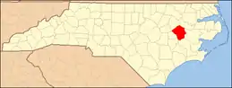 | |
| Towns | ||
| Townships |
| |
| CDPs | ||
| Unincorporated communities | ||
| Footnotes | ‡This populated place also has portions in an adjacent county or counties | |
| ||