Fayston, Vermont
Fayston /ˈfeɪstən/ is a town in Washington County, Vermont, United States. The population was 1,353 at the 2010 census.[3]
Fayston, Vermont | |
|---|---|
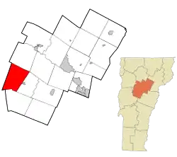 Location in Washington County and the state of Vermont | |
 Fayston, Vermont Location in the United States | |
| Coordinates: 44°12′44″N 72°51′47″W | |
| Country | United States |
| State | Vermont |
| County | Washington |
| Area | |
| • Total | 36.5 sq mi (94.5 km2) |
| • Land | 36.5 sq mi (94.5 km2) |
| • Water | 0.0 sq mi (0.0 km2) |
| Elevation | 1,755 ft (535 m) |
| Population (2010) | |
| • Total | 1,353 |
| • Density | 37/sq mi (14/km2) |
| Time zone | UTC-5 (Eastern (EST)) |
| • Summer (DST) | UTC-4 (EDT) |
| ZIP code | 05660, 05673 |
| Area code(s) | 802 |
| FIPS code | 50-25825[1] |
| GNIS feature ID | 1462096[2] |
| Website | www |
History
The town was chartered in 1788 and sold to a speculator. The town was organized in 1805.[4] The Mad River Glen ski area, located in Fayston on Stark Mountain, was founded in 1947. The town was home to a small one room school house as well as several family farmers and maple producers, which contributed to the town's economic growth and stability.
Geography
According to the United States Census Bureau, the town has a total area of 36.5 square miles (94.5 km2), all land. The town is located in the Mad River valley and is south of Camel's Hump State Park. Fayston is located on Vermont Route 17. Burnt Rock Mountain is located in Fayston.[5]
Demographics
| Historical population | |||
|---|---|---|---|
| Census | Pop. | %± | |
| 1800 | 18 | — | |
| 1810 | 149 | 727.8% | |
| 1820 | 263 | 76.5% | |
| 1830 | 458 | 74.1% | |
| 1840 | 635 | 38.6% | |
| 1850 | 684 | 7.7% | |
| 1860 | 800 | 17.0% | |
| 1870 | 694 | −13.2% | |
| 1880 | 638 | −8.1% | |
| 1890 | 533 | −16.5% | |
| 1900 | 466 | −12.6% | |
| 1910 | 452 | −3.0% | |
| 1920 | 424 | −6.2% | |
| 1930 | 318 | −25.0% | |
| 1940 | 284 | −10.7% | |
| 1950 | 172 | −39.4% | |
| 1960 | 158 | −8.1% | |
| 1970 | 292 | 84.8% | |
| 1980 | 657 | 125.0% | |
| 1990 | 846 | 28.8% | |
| 2000 | 1,141 | 34.9% | |
| 2010 | 1,353 | 18.6% | |
| 2014 (est.) | 1,347 | [6] | −0.4% |
| U.S. Decennial Census[7][8] | |||
As of the census[1] of 2000, there were 1,141 people, 484 households, and 312 families residing in the town. The population density was 31.3 people per square mile (12.1/km2). There were 900 housing units at an average density of 24.7 per square mile (9.5/km2). The racial makeup of the town was 98.25% White, 0.53% African American, 0.18% Native American, 0.09% Asian, and 0.96% from two or more races. Hispanic or Latino of any race were 0.96% of the population.
There were 484 households, out of which 30.4% had children under the age of 18 living with them, 56.4% were married couples living together, 6.4% had a female householder with no husband present, and 35.5% were non-families. 25.0% of all households were made up of individuals, and 5.6% had someone living alone who was 65 years of age or older. The average household size was 2.36 and the average family size was 2.85.
In the town, the population was spread out, with 22.8% under the age of 18, 5.7% from 18 to 24, 33.2% from 25 to 44, 28.7% from 45 to 64, and 9.6% who were 65 years of age or older. The median age was 39 years. For every 100 females, there were 103.0 males. For every 100 females age 18 and over, there were 101.6 males.
The median income for a household in the town was $53,472, and the median income for a family was $60,938. Males had a median income of $35,139 versus $26,852 for females. The per capita income for the town was $28,196. About 2.9% of families and 5.5% of the population were below the poverty line, including 4.3% of those under age 18 and 5.6% of those age 65 or over.
References
- "U.S. Census website". United States Census Bureau. Retrieved 2008-01-31.
- "US Board on Geographic Names". United States Geological Survey. 2007-10-25. Retrieved 2008-01-31.
- "Profile of General Population and Housing Characteristics: 2010 Demographic Profile Data (DP-1): Fayston town, Washington County, Vermont". United States Census Bureau. Retrieved September 18, 2012.
- http://www.cvedc.org/towns/history/HstFays.htm%5B%5D
- "Archived copy". Archived from the original on 2010-09-19. Retrieved 2010-07-20.CS1 maint: archived copy as title (link)
- "Annual Estimates of the Resident Population for Incorporated Places: April 1, 2010 to July 1, 2014". Archived from the original on May 23, 2015. Retrieved June 4, 2015.
- "Census of Population and Housing". Census.gov. Retrieved June 4, 2015.
- "Vermont History Explorer". Retrieved August 7, 2015.
External links
Municipalities and communities of Washington County, Vermont, United States | ||
|---|---|---|
| Cities | 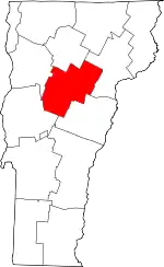 Map of Vermont highlighting Washington County | |
| Towns | ||
| Villages | ||
| CDPs | ||
| Other communities | ||
| ||
- www.madriverweb.com. "Fayston History | Fayston VT". Retrieved 2019-10-04.