Flinders Ranges Council
Flinders Ranges Council is a local government area (LGA) located in the Flinders Ranges of South Australia.
| Flinders Ranges Council South Australia | |||||||||||||||
|---|---|---|---|---|---|---|---|---|---|---|---|---|---|---|---|
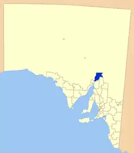 Location of The Flinders Ranges Council | |||||||||||||||
| Population | 1,643 (2016 census)[1] | ||||||||||||||
| • Density | 0.39138/km2 (1.0137/sq mi) | ||||||||||||||
| Established | 1 January 1997[2] | ||||||||||||||
| Area | 4,198 km2 (1,620.9 sq mi) | ||||||||||||||
| Mayor | Peter Slattery [3] | ||||||||||||||
| Council seat | Quorn | ||||||||||||||
| Region | Far North[4] | ||||||||||||||
| State electorate(s) | Electoral district of Giles | ||||||||||||||
| Federal Division(s) | Division of Grey | ||||||||||||||
| Website | Flinders Ranges Council | ||||||||||||||
| |||||||||||||||
The LGA is approximately 100 km from north to south, and 45 km from east to west, with a total area of 4,198 square kilometres.
The main towns within the council are Hawker and Quorn; it also includes the localities of Barndioota, Kanyaka and Stephenston, and part of Bruce, Cradock, Flinders Ranges, Moockra, Saltia, Shaggy Ridge, Wilmington and Yarrah.[5]
It was created on 1 January 1997 following the merger of the District Council of Kanyaka-Quorn and the District Council of Hawker.[2]
The LGA adjoins the following to the south - City of Port Augusta, District Council of Mount Remarkable and District Council of Orroroo Carrieton, while the remainder of the adjoining land is within the unincorporated area of South Australia where municipal services are provided by the Outback Communities Authority.[5][6]
Flinders Ranges Council is entirely in the state electorate of Giles and the federal Division of Grey.[7]
Council
| Ward | Councillor | Notes | |
|---|---|---|---|
| Mayor [3] | Peter Slattery | ||
| Unsubdivided [3] | Ken Anderson | ||
| Ronald Daniel | |||
| Nicole Downing | |||
| Greg Flint | |||
| Julian Hipwell | |||
| Scott Reubenicht | |||
| Clinton Ryks-Jones | |||
| Garry Thompson | |||
The Flinders Ranges Council has a directly-elected mayor.[8]
References
- Australian Bureau of Statistics (27 June 2017). "Flinders Ranges (DC)". 2016 Census QuickStats. Retrieved 10 April 2018.

- Ashenden, E.S. (12 December 1996). "LOCAL GOVERNMENT ACT 1934 SECTIONS 7 AND 14: AMALGAMATION OF THE DISTRICT COUNCIL OF HAWKER AND THE DISTRICT COUNCIL OF KANYAKA-QUORN" (PDF). The South Australian Government Gazette. Government of South Australia. pp. 1850–1852. Retrieved 31 December 2018.
- "Elected Members". Flinders Ranges Council. Retrieved 15 February 2015.
- "Far North SA Government Region" (PDF). Department of Planning, Transport and Infrastructure. Retrieved 10 October 2014.
- "Location SA Map Viewer". Government of South Australia. Retrieved 15 February 2016.
- "Communities". Outback Communities Authority. Archived from the original on 2 March 2016. Retrieved 15 February 2016.
- "2014 Suburbs, Districts, and Postcodes List". Electoral Commission of South Australia. Retrieved 15 February 2016.
- "Election Results 2014" (PDF). Local Government Association of South Australia. Retrieved 14 February 2016.