Yalata, South Australia
Yalata is an Aboriginal community located 200 kilometres (120 mi) west of Ceduna on the Great Australian Bight in South Australia. At the 2016 census, Yalata and the surrounding area had a population of 248.[2]
| Yalata South Australia | |||||||||||||||
|---|---|---|---|---|---|---|---|---|---|---|---|---|---|---|---|
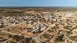 Yalata, looking north-east | |||||||||||||||
 Yalata | |||||||||||||||
| Coordinates | 31°23′03″S 131°37′14″E[1] | ||||||||||||||
| Population | 248 (2016 census)[2] | ||||||||||||||
| • Density | 0.05435/km2 (0.14077/sq mi) | ||||||||||||||
| Established | 1994 23 October 2003 (locality)[3] | ||||||||||||||
| Postcode(s) | 5690[4] | ||||||||||||||
| Elevation | 90 m (295 ft) | ||||||||||||||
| Area | 4,563 km2 (1,761.8 sq mi) | ||||||||||||||
| Time zone | ACST (UTC+9:30) | ||||||||||||||
| • Summer (DST) | ACDT (UTC+10:30) | ||||||||||||||
| Location | |||||||||||||||
| LGA(s) | Aboriginal Council of Yalata | ||||||||||||||
| Region | Eyre Western[1] | ||||||||||||||
| County | Hopetoun (part)[1] | ||||||||||||||
| State electorate(s) | Flinders[5] | ||||||||||||||
| Federal Division(s) | Grey[6] | ||||||||||||||
| |||||||||||||||
| |||||||||||||||
| Footnotes | Adjoining localities[1] | ||||||||||||||
History
The community consists mainly of Anangu who lived in the spinifex country far to the north around Ooldea prior to their forced removal to Yalata in 1952. In the 1950s areas around Maralinga and Emu were used for Atomic Testing by the British Government of the day. Around this time the Australian Government resumed much Anangu land to be used for the Woomera Rocket testing Range. As a result, Anangu were moved to Ooldea in the first instance then later moved to the Yalata site. The Maralinga Tjarutja native title land was handed back to the Anangu under legislation passed by both houses of the South Australian Parliament in December 1984 and proclaimed in January 1985. The Yalata Aboriginal lands cover 4,580 km2 and span approximately 150 km of the Eyre Highway. Inland Anangu resettled on the land in 1995 and forming a community at Oak Valley. Regular movement of Anangu between Yalata and Oak Valley occurs.
Environment
The Atlas of South Australia describes the Yalata area as:
sandy plain with deep sand and parabolic dunes. The vegetative cover is open mallee scrub with a mixed understory of chenopod shrubs and grasses and low open woodland with a chenopod shrub understory.
Demography
Anangu regard themselves as a Southern Anangu people and speak a Southern dialect of the Pitjantjatjara language.[8]
At the 2016 census, Pitjantjatjara was spoken as the primary language in 50.4% of homes in the Yalata area. The main religion of residents was as follows, Lutheran: 37.3%, no religion 15.4%, Australian Aboriginal Traditional Religions: 10.8% and not stated: 33.6%.[2]
Facilities
Yalata Roadhouse, 200 km west of Ceduna, was operated by Yalata Aboriginal Community Incorporated. There is also a caravan park to assist tourists passing through or visiting the Great Australian Bight for fishing or whale watching.[9] The roadhouse was closed in February 2006.[10]
The lands of the Yalata bear their own name. A portion of these lands in South Australia's remote west, comprises Yalata, one of the four local government areas of South Australia classified as an Aboriginal Council (AC).
On 21 August 2007, the Adelaide Advertiser reported that fire had overnight destroyed the shed-structure police station and associated home, with damage costing approximately A$500,000.[11]
Governance
Yalata is governed at the local level by the Aboriginal Council of Yalata, one of the five local government bodies in South Australia classified as Aboriginal Councils (AC). At the state and federal levels, Yalata lies in the electoral district of Flinders and at the division of Grey, respectively.
See also
References
- "Search results for 'Yalata, LOCB' with the following datasets selected - 'Suburbs and localities', 'Counties', 'Local Government Areas', 'SA Government Regions' and 'Gazetteer'". Location SA Map Viewer. South Australian Government. Retrieved 13 August 2019.
- Australian Bureau of Statistics (27 June 2017). "Yalata (state suburb)". 2016 Census QuickStats. Retrieved 22 March 2019.

- Weatherill, Jay (23 October 2003). "GEOGRAPHICAL NAMES ACT 1991 Notice to Assign Names and Boundaries to Places" (PDF). The South Australian Government Gazette. Government of South AustralIA. p. 3859. Retrieved 14 April 2019.
Assign the names YUNTA, BLINMAN, BOOKABIE, GLENDAMBO, YALATA, KINGOONYA, OLARY, INNAMINCKA, and MANNA HILL, to those areas Out of Councils and shown numbered 1 to 9 on Rack Plan 857 (Sheet 3)
- "Postcode for Yalata, South Australia". Postcodes Australia. Retrieved 13 August 2019.
- "District of Flinders Background Profile". Electoral Commission SA. Retrieved 13 August 2019.
- "Profile of the electoral division of Grey (SA)". Australian Electoral Commission. Retrieved 13 August 2019.
- "Monthly climate statistics: Summary statistics Nullarbor (nearest weather station)". Retrieved 13 August 2019.
- "Yalata Land Management". Retrieved 18 May 2006.
- "Yalata". Nullarbor Net. Retrieved 21 May 2006.
- "Lease issues close roadhouse". Australian Broadcasting Corporation. Retrieved 28 April 2007.
- Fire destroys police station, Adelaide Advertiser, 21 August 2007 Retrieved on 21 August 2007
Further reading
- "How the Aboriginal community displaced from Maralinga won their fight for tough laws on alcohol". ABC News. Australian Broadcasting Corporation. 28 May 2020.