Flowers Hills
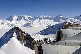
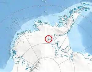
The Flowers Hills (78°24′S 84°10′W) are a triangular shaped group of hills, 34.6 kilometres (21.5 mi) long and 11.5 kilometres (7.1 mi) wide, with peaks of 1,240 metres (4,070 ft) (Gubesh Peak) and 1,504 metres (4,934 ft) (Dickey Peak), extending along the eastern edge of the Sentinel Range, Ellsworth Mountains, Antarctica. The hills are bounded by Hansen Glacier and Dater Glacier to the west and north, Rutford Ice Stream to the east and Sikera Valley to the southwest, and separated from Doyran Heights to the west-southwest by Kostinbrod Pass. Their interior is drained by Lardeya Ice Piedmont and Valoga Glacier.
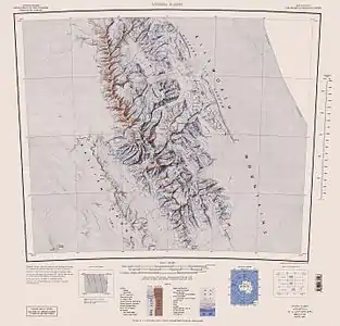
The hills were first mapped by the United States Geological Survey from surveys and U.S. Navy air photos, 1957–59, and were named by the Advisory Committee on Antarctic Names for Edwin C. Flowers, a meteorologist at the South Pole Station in 1957.[1]
Maps
- Vinson Massif. Scale 1:250 000 topographic map. Reston, Virginia: US Geological Survey, 1988.
- Antarctic Digital Database (ADD). Scale 1:250000 topographic map of Antarctica. Scientific Committee on Antarctic Research (SCAR). Since 1993, regularly updated.
Features
Geographical features include:
References
- "Flowers Hills". Geographic Names Information System. United States Geological Survey. Retrieved 2012-03-28.
External links
- Flowers Hills. Adjusted Copernix satellite image
![]() This article incorporates public domain material from the United States Geological Survey document: "Flowers Hills". (content from the Geographic Names Information System)
This article incorporates public domain material from the United States Geological Survey document: "Flowers Hills". (content from the Geographic Names Information System)
| General |
| .svg.png.webp) |
|---|---|---|
| Regions | ||
| Waterways | ||
| Famous explorers | ||