Formosa do Rio Preto
Formosa do Rio Preto is the westernmost and largest (by area) city in the Brazilian state of Bahia. It is also the largest in all Northeastern Brazil.
Formosa do Rio Preto | |
|---|---|
Municipality | |
| The Municipality of Formosa do Rio Preto | |
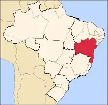
 Localization of the city | |
| Coordinates: 11°02′52″S 45°11′34″W | |
| Country | Brazil |
| Region | Northeast |
| State | Bahia |
| Founded | December 22, 1961 |
| Government | |
| • Mayor | Manoel Afonso de Araujo (PMN) |
| Area | |
| • Total | 16,185.171 km2 (6,249.129 sq mi) |
| Population (2020 [1]) | |
| • Total | 25,857 |
| • Density | 1.3/km2 (3/sq mi) |
| [2] | |
| Time zone | UTC-3 (UTC-3) |
| • Summer (DST) | UTC11° 02' 52" S 45° 11' 34" O |
| HDI (2000) | 0.646 – medium[3] |
The municipality contains part of the 707,079 hectares (1,747,230 acres) Serra Geral do Tocantins Ecological Station, a strictly protected conservation unit created in 2001 to preserve an area of cerrado.[4] It also contains part of the 724,324 hectares (1,789,840 acres) Nascentes do Rio Parnaíba National Park, created in 2002.[5]
References
- IBGE 2020
- IBGE 2008 statistics
- "Archived copy". Archived from the original on 2009-10-03. Retrieved 2009-12-17.CS1 maint: archived copy as title (link) UNDP
- Unidade de Conservação: Estação Ecológica Serra Geral do Tocantins (in Portuguese), MMA: Ministério do Meio Ambiente, retrieved 2016-05-28
- Unidade de Conservação: Parque Nacional das Nascentes do Rio Parnaíba (in Portuguese), MMA: Ministério do Meio Ambiente, retrieved 2016-05-01
This article is issued from Wikipedia. The text is licensed under Creative Commons - Attribution - Sharealike. Additional terms may apply for the media files.