Fort Valley, Georgia
Fort Valley is a city in and the county seat of Peach County, Georgia, United States.[7] As of the 2010 census, the city had a population of 9,815.[8]
Fort Valley, Georgia | |
|---|---|
 Fort Valley City Hall | |
| Nickname(s): "Peach Capital of Georgia"[1] | |
| Motto(s): "Where Caring Is A Way Of Life"[2] | |
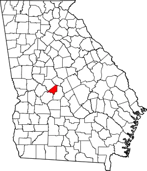
 Location in Peach County and the state of Georgia | |
| Coordinates: 32°33′N 83°53′W | |
| Country | United States |
| State | Georgia |
| County | Peach |
| Area | |
| • Total | 7.55 sq mi (19.56 km2) |
| • Land | 7.54 sq mi (19.52 km2) |
| • Water | 0.01 sq mi (0.04 km2) |
| Elevation | 518 ft (158 m) |
| Population (2010) | |
| • Total | 9,815 |
| • Estimate (2019)[4] | 8,962 |
| • Density | 1,188.91/sq mi (459.05/km2) |
| Time zone | UTC-5 (Eastern (EST)) |
| • Summer (DST) | UTC-4 (EDT) |
| ZIP code | 31030 |
| Area code(s) | 478 |
| FIPS code | 13-31096[5] |
| GNIS feature ID | 0355881[6] |
| Website | Fort Valley website |
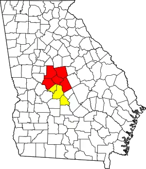
The city is in the Warner Robins metropolitan area and the Macon–Warner Robins combined statistical area.
History
The town's name is a mystery, as it has never had a fort. Historians believe that the name was mistakenly changed in a transcription error when the post office was named; the area was originally thought to have been called Fox Valley.[1]
Founded in 1836, Fort Valley was incorporated as a town in 1854 and as a city in 1907. In 1924 it was the designated seat of the newly formed Peach County.[9]
Fort Valley was the backdrop for a Life feature story in the March 22, 1943 edition. The World War II-era story focused on the town's sponsoring of the "Ham and Egg Show," a contest held by African-American farmers to highlight ham and poultry production in Peach County, Georgia.[10]
Geography

Fort Valley is located at 32°33′N 83°53′W (32.55, -83.89).[11]
The city is located in the central part of the state along U.S. Route 341, which is the main route through the city. Via U.S. 341, Roberta is 15 mi (24 km) northwest, and Perry is 12 mi (19 km) southeast. Georgia State Routes 49, 96, and 540 (Fall Line Freeway) also run through the city. GA-49 leads northeast 11 mi (18 km) to Byron and southwest 8 mi (13 km) to Marshallville. GA-96 leads east 16 mi (26 km) to Warner Robins and west 13 mi (21 km) to Reynolds. The Fall Line Freeway runs north of the city as a four-lane divided highway, leading northeast to Byron with GA-49 and west to Reynolds with GA-96.
According to the United States Census Bureau, the city has a total area of 5.3 square miles (14 km2), all land.
Demographics
| Historical population | |||
|---|---|---|---|
| Census | Pop. | %± | |
| 1870 | 1,333 | — | |
| 1880 | 1,277 | −4.2% | |
| 1890 | 1,752 | 37.2% | |
| 1900 | 2,022 | 15.4% | |
| 1910 | 2,697 | 33.4% | |
| 1920 | 3,223 | 19.5% | |
| 1930 | 4,560 | 41.5% | |
| 1940 | 4,953 | 8.6% | |
| 1950 | 6,820 | 37.7% | |
| 1960 | 8,310 | 21.8% | |
| 1970 | 9,251 | 11.3% | |
| 1980 | 9,000 | −2.7% | |
| 1990 | 8,198 | −8.9% | |
| 2000 | 8,005 | −2.4% | |
| 2010 | 9,815 | 22.6% | |
| 2019 (est.) | 8,962 | [4] | −8.7% |
| U.S. Decennial Census[12] | |||
As of the census[5] of 2000, there were 8,005 people, 3,050 households, and 1,878 families residing in the city. The population density was 1,519.5 people per square mile (586.5/km2). There were 3,303 housing units at an average density of 627.0 per square mile (242.0/km2). The racial makeup of the city was 22.10% White, 74.65% African American, 0.37% Native American, 0.25% Asian, 0.05% Pacific Islander, 1.85% from other races, and 0.72% from two or more races. Hispanic or Latino people of any race were 4.37% of the population.
There were 3,050 households, out of which 30.6% had children under the age of 18 living with them, 25.9% were married couples living together, 30.9% had a female householder with no husband present, and 38.4% were non-families. 29.1% of all households were made up of individuals, and 10.4% had someone living alone who was 65 years of age or older. The average household size was 2.57 and the average family size was 3.20.
In the city, the population was spread out, with 27.3% under the age of 18, 16.9% from 18 to 24, 26.0% from 25 to 44, 18.3% from 45 to 64, and 11.4% who were 65 years of age or older. The median age was 28 years. For every 100 females, there were 86.1 males. For every 100 females age 18 and over, there were 81.8 males.
The median income for a household in the city was $19,646, and the median income for a family was $24,206. Males had a median income of $27,016 versus $20,110 for females. The per capita income for the city was $10,815. About 31.8% of families and 37.7% of the population were below the poverty line, including 44.3% of those under the age of 18 and 17.3% of those 65 and older.
Economy
Fort Valley is the corporate headquarters of the Blue Bird Corporation, a large manufacturer of activity buses and school buses, which opened its first Fort Valley facility in 1935.
Athletics
Football
Despite being a city of less than 10,000 people, Fort Valley boasts one of the best football teams in the state. The Peach County High Trojans have played in eight state title games since 1990, and have made the playoffs every year since.
- 1992 AAA State Runners-Up
- 1998 AAA State Runners-Up
- 2003 AAA State Runners-Up
- 2005 AAA State Champions
- 2006 AAA State Champions
- 2009 AAA State Champions
- 2011 AAA State Runners-Up
- 2017 AAA State Runners-Up
Track and field
- 1993 AAA 4x100 Relay State Champions (Greg Streeter, Jacquez Green, Marcus Robinson, Melvin Oats)
Arts and culture
Points of interest
- Massee Lane Gardens
- Blue Bird Corporation's headquarters, currently their only Georgia plant
Education
Public schools
The Peach County School District holds grades pre-school to grade twelve, and consists of three elementary schools, two middle schools, and a high school.[13] The district has 270 full-time teachers and over 3,927 students.[14]
- Byron Elementary School
- Hunt Elementary School
- Kay Road Elementary School
- Byron Middle School
- Fort Valley Middle School
- Peach County High School
Colleges and universities
The city is home to Fort Valley State University, a historically-black college.[15]
Infrastructure
Transportation
Highways
U.S. Route:
State Routes:
Health care
- The Medical Center of Peach County
Notable people
- Louie Crew, emeritus professor at Rutgers University, poet and activist, taught at Fort Valley State from 1973–1979
- Antone Davis, former National Football League offensive lineman, born in Fort Valley[16]
- Jacquez Green, former National Football League wide receiver and punt returner, born in Fort Valley[17]
- Harold Houser, United States Navy Rear admiral, and the 35th Governor of American Samoa, born in Fort Valley[18]
- Edward H. Hurst, Brigadier general in the Marine Corps and recipient of Navy Cross, born in Fort Valley
- Louis Ivory, former college football running back, 2000 Walter Payton Award winner, born in Fort Valley[19]
- Benny Johnson, NFL player
- Pete Johnson, former NFL player
- Greg Lloyd, Sr., former NFL player, attended Fort Valley State 1983-86
- Dannie Lockett, former NFL player
- Randy McMichael, former NFL player for the San Diego Chargers, Miami Dolphins, and the St.Louis Rams
- Marcus Robinson, former National Football League wide receiver, born in Fort Valley[20]
- Tim Watson, former American football safety in the National Football League, born in Fort Valley[21]
References
- "Profile for Fort Valley, Georgia, GA". ePodunk. Retrieved September 2, 2012.
- "Fort Valley, Georgia". Fort Valley, Georgia. Retrieved September 2, 2012.
- "2019 U.S. Gazetteer Files". United States Census Bureau. Retrieved July 9, 2020.
- "Population and Housing Unit Estimates". United States Census Bureau. May 24, 2020. Retrieved May 27, 2020.
- "U.S. Census website". United States Census Bureau. Retrieved 2008-01-31.
- "US Board on Geographic Names". United States Geological Survey. 2007-10-25. Retrieved 2008-01-31.
- "Find a County". National Association of Counties. Archived from the original on 2011-05-31. Retrieved 2011-06-07.
- "Archived copy". Archived from the original on 2012-05-05. Retrieved 2012-05-05.CS1 maint: archived copy as title (link)
- Hellmann, Paul T. (May 13, 2013). Historical Gazetteer of the United States. Routledge. p. 230. ISBN 978-1135948597. Retrieved 30 November 2013.
- LIFE Magazine (22 March 1943). Ham and Egg Show: Negro farmers vie for prizes, learn how to produce more food.
- "US Gazetteer files: 2010, 2000, and 1990". United States Census Bureau. 2011-02-12. Retrieved 2011-04-23.
- "Census of Population and Housing". Census.gov. Retrieved June 4, 2015.
- Georgia Board of Education, Retrieved June 25, 2010.
- School Stats, Retrieved June 25, 2010.
- Fort Valley State University, Retrieved June 25, 2010.
- Didinger, Ray (April 23, 1991). "Blocking Out Negatives Once Unmotivated, Davis Now Serious Student And Prospect". Philadelphia Daily News. Retrieved 2011-09-30.
- "Jacquez Green". Pro-Football-Reference.Com. Retrieved September 2, 2012.
- "RADM Harold A. Houser '16: Governor of American Samoa". MMI Foundation. Retrieved September 2, 2012.
- "Little Giants". Time Inc. Retrieved September 2, 2012.
- "Marcus Robinson". Pro-Football-Reference.Com. Retrieved September 2, 2012.
- "Tim Watson". NFL Enterprises LLC. Retrieved September 2, 2012.
External links
| Wikimedia Commons has media related to Fort Valley, Georgia. |
- Fort Valley Georgia portal style website, government, business, library, recreation and more
- City-Data.com - comprehensive statistical data and more about Fort Valley
- Football
- Info

