Peach County, Georgia
Peach County is a county located in the central portion of the U.S. state of Georgia. As of the 2010 census, the population was 27,695.[1] Its county seat is Fort Valley.[2] Founded in 1924, it is the state's newest county, taken from Houston and Macon counties on July 8 of that year.[3] Its namesake is the peach, on account of it being located in a peach-growing district.[4]
Peach County | |
|---|---|
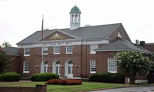 Peach County Courthouse in Fort Valley | |
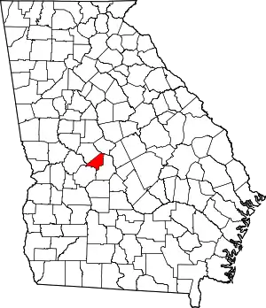 Location within the U.S. state of Georgia | |
 Georgia's location within the U.S. | |
| Coordinates: 32°34′N 83°50′W | |
| Country | |
| State | |
| Founded | July 8, 1924 |
| Named for | Peach fruit |
| Seat | Fort Valley |
| Largest city | Fort Valley |
| Area | |
| • Total | 151 sq mi (390 km2) |
| • Land | 150 sq mi (400 km2) |
| • Water | 1.0 sq mi (3 km2) 0.7%% |
| Population | |
| • Estimate (2018) | 27,297 |
| • Density | 184/sq mi (71/km2) |
| Time zone | UTC−5 (Eastern) |
| • Summer (DST) | UTC−4 (EDT) |
| Congressional district | 2nd |
| Website | www |
Peach County is included in the Warner Robins, GA Metropolitan Statistical Area, which is included in the Macon-Warner Robins, GA Combined Statistical Area.
Geography
According to the U.S. Census Bureau, the county has a total area of 151 square miles (390 km2), of which 150 square miles (390 km2) is land and 1.0 square mile (2.6 km2) (0.7%) is water.[5] It is the fifth-smallest county in Georgia by area.
The majority of Peach County is located in the Lower Ocmulgee River sub-basin of the Altamaha River basin. A small portion of the northern edge of the county, north of Byron, is located in the Upper Ocmulgee River sub-basin of the Altamaha River basin. The very western tip of Peach County is located in the Upper Flint River sub-basin of the ACF River Basin (Apalachicola-Chattahoochee-Flint River Basin).[6]
Major highways
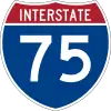 Interstate 75
 U.S. Route 41
 U.S. Route 341
 State Route 7
 State Route 7 Connector
 State Route 11
 Georgia State Route 42
 Georgia State Route 49
 State Route 49 Connector
 Georgia State Route 96
 State Route 127
 State Route 247 Connector
 State Route 401 (unsigned designation for I-75)
 State Route 540 (Fall Line Freeway)
Adjacent counties
- Bibb County - north
- Houston County - east
- Crawford County - northwest
- Taylor County - west
- Macon County - southwest
Demographics
| Historical population | |||
|---|---|---|---|
| Census | Pop. | %± | |
| 1930 | 10,268 | — | |
| 1940 | 10,378 | 1.1% | |
| 1950 | 11,705 | 12.8% | |
| 1960 | 13,846 | 18.3% | |
| 1970 | 15,990 | 15.5% | |
| 1980 | 19,151 | 19.8% | |
| 1990 | 21,189 | 10.6% | |
| 2000 | 23,668 | 11.7% | |
| 2010 | 27,695 | 17.0% | |
| 2018 (est.) | 27,297 | [7] | −1.4% |
| U.S. Decennial Census[8] 1790-1960[9] 1900-1990[10] 1990-2000[11] 2010-2013[1] | |||
2000 census
At the 2000 census there were 23,668 people, 8,436 households, and 5,997 families living in the county. The population density was 60/km2 (157/mi2). There were 9,093 housing units at an average density of 23/km2 (60/mi2). The racial makeup of the county was 51.27% White, 45.37% Black or African American, 0.33% Native American, 0.33% Asian, 0.03% Pacific Islander, 1.83% from other races, and 0.84% from two or more races. 4.22% of the population were Hispanic or Latino of any race.[12]
Of the 8,436 households 33.60% had children under the age of 18 living with them, 47.00% were married couples living together, 19.60% had a female householder with no husband present, and 28.90% were non-families. 22.60% of households were one person and 7.80% were one person aged 65 or older. The average household size was 2.68 and the average family size was 3.14.
The age distribution was 26.00% under the age of 18, 14.90% from 18 to 24, 27.50% from 25 to 44, 21.70% from 45 to 64, and 9.80% 65 or older. The median age was 32 years. For every 100 females, there were 93.60 males. For every 100 females age 18 and over, there were 89.80 males.
The median household income was $34,453 and the median family income was $41,570. Males had a median income of $33,357 versus $24,440 for females. The per capita income for the county was $16,031. About 15.20% of families and 20.20% of the population were below the poverty line, including 24.50% of those under age 18 and 13.50% of those age 65 or over.
2010 census
At the 2010 census, there were 27,695 people, 9,958 households, and 6,934 families living in the county.[13] The population density was 184.3 inhabitants per square mile (71.2/km2). There were 11,050 housing units at an average density of 73.5 per square mile (28.4/km2).[14] The racial makeup of the county was 48.3% white, 45.9% black or African American, 0.8% Asian, 0.2% American Indian, 3.2% from other races, and 1.5% from two or more races. Those of Hispanic or Latino origin made up 6.8% of the population.[13] In terms of ancestry, 11.0% were American, 7.1% were English, and 5.8% were Irish.[15]
Of the 9,958 households, 34.6% had children under the age of 18 living with them, 45.1% were married couples living together, 19.2% had a female householder with no husband present, 30.4% were non-families, and 24.8% of households were made up of individuals. The average household size was 2.58 and the average family size was 3.07. The median age was 33.3 years.[13]
The median household income was $41,014 and the median family income was $53,708. Males had a median income of $40,919 versus $29,328 for females. The per capita income for the county was $18,681. About 19.1% of families and 25.4% of the population were below the poverty line, including 44.6% of those under age 18 and 14.0% of those age 65 or over.[16]
Education
Communities
- Byron (partly)
- Fort Valley
- Warner Robins (partly)
- Perry (partly)
Politics
The county is considered a bellwether polity.[17]
| Year | Republican | Democratic | Third parties |
|---|---|---|---|
| 2020 | 51.8% 6,502 | 47.2% 5,920 | 1.0% 123 |
| 2016 | 50.3% 5,413 | 47.4% 5,100 | 2.2% 239 |
| 2012 | 45.8% 5,287 | 53.3% 6,148 | 0.9% 102 |
| 2008 | 46.2% 5,173 | 52.9% 5,927 | 0.9% 96 |
| 2004 | 53.2% 4,554 | 46.3% 3,961 | 0.5% 39 |
| 2000 | 49.4% 3,525 | 49.6% 3,540 | 1.0% 72 |
| 1996 | 39.6% 2,676 | 53.1% 3,582 | 7.3% 494 |
| 1992 | 33.4% 2,327 | 52.7% 3,677 | 13.9% 969 |
| 1988 | 48.0% 2,782 | 51.3% 2,972 | 0.7% 42 |
| 1984 | 44.1% 2,652 | 56.0% 3,369 | |
| 1980 | 31.8% 1,642 | 66.1% 3,415 | 2.2% 113 |
| 1976 | 22.6% 1,163 | 77.4% 3,989 | |
| 1972 | 60.8% 3,747 | 39.2% 2,413 | |
| 1968 | 23.2% 904 | 34.9% 1362 | 42.0% 1,638 |
| 1964 | 55.4% 1,970 | 44.6% 1,585 | 0.0% 1 |
| 1960 | 30.5% 628 | 69.5% 1,433 | |
| 1956 | 23.0% 461 | 77.0% 1,541 | |
| 1952 | 19.7% 374 | 80.2% 1,523 | 0.1% 1 |
| 1948 | 13.9% 166 | 53.8% 642 | 32.3% 385 |
| 1944 | 20.4% 236 | 79.6% 919 | |
| 1940 | 17.2% 155 | 82.1% 738 | 0.7% 6 |
| 1936 | 5.9% 49 | 92.5% 767 | 1.6% 13 |
| 1932 | 8.5% 56 | 90.7% 595 | 0.8% 5 |
| 1928 | 26.7% 208 | 73.3% 572 |
References
- "State & County QuickFacts". United States Census Bureau. Archived from the original on June 15, 2011. Retrieved February 18, 2014.
- "Find a County". National Association of Counties. Archived from the original on May 31, 2011. Retrieved June 7, 2011.
- "Peach County". georgia.gov. Archived from the original on December 2, 2008. Retrieved May 7, 2015.
- Krakow, Kenneth K. (1975). Georgia Place-Names: Their History and Origins (PDF). Macon, GA: Winship Press. p. 172. ISBN 0-915430-00-2.
- "US Gazetteer files: 2010, 2000, and 1990". United States Census Bureau. February 12, 2011. Retrieved April 23, 2011.
- "Georgia Soil and Water Conservation Commission Interactive Mapping Experience". Georgia Soil and Water Conservation Commission. Retrieved November 22, 2015.
- "Population and Housing Unit Estimates". Retrieved July 31, 2019.
- "U.S. Decennial Census". United States Census Bureau. Retrieved June 25, 2014.
- "Historical Census Browser". University of Virginia Library. Retrieved June 25, 2014.
- "Population of Counties by Decennial Census: 1900 to 1990". United States Census Bureau. Retrieved June 25, 2014.
- "Census 2000 PHC-T-4. Ranking Tables for Counties: 1990 and 2000" (PDF). United States Census Bureau. Retrieved June 25, 2014.
- "U.S. Census website". United States Census Bureau. Retrieved January 31, 2008.
- "DP-1 Profile of General Population and Housing Characteristics: 2010 Demographic Profile Data". United States Census Bureau. Archived from the original on February 13, 2020. Retrieved December 30, 2015.
- "Population, Housing Units, Area, and Density: 2010 - County". United States Census Bureau. Archived from the original on February 13, 2020. Retrieved December 30, 2015.
- "DP02 SELECTED SOCIAL CHARACTERISTICS IN THE UNITED STATES – 2006-2010 American Community Survey 5-Year Estimates". United States Census Bureau. Archived from the original on February 13, 2020. Retrieved December 30, 2015.
- "DP03 SELECTED ECONOMIC CHARACTERISTICS – 2006-2010 American Community Survey 5-Year Estimates". United States Census Bureau. Archived from the original on February 13, 2020. Retrieved December 30, 2015.
- David Wasserman (October 6, 2020), "The 10 Bellwether Counties That Show How Trump Is in Serious Trouble", Nytimes.com
- Leip, David. "Dave Leip's Atlas of U.S. Presidential Elections". uselectionatlas.org. Retrieved March 22, 2018.
External links
Places adjacent to Peach County, Georgia | ||||||||||
|---|---|---|---|---|---|---|---|---|---|---|
| ||||||||||
Municipalities and communities of Peach County, Georgia, United States | ||
|---|---|---|
| Cities | Map of Georgia highlighting Peach County | |
| Unincorporated communities | ||
| Footnotes | ‡This populated place also has portions in an adjacent county or counties | |
| ||
| Principal cities |  | |
|---|---|---|
| Municipalities | ||
| Other communities | ||
| Counties | ||
| CSA components | ||

| Authority control |
|---|