Fritch, Texas
Fritch is a city in Hutchinson and Moore Counties in the U.S. state of Texas. The population was 2,117 at the 2010 census.[5] Fritch and the surrounding area are served by ZIP code 79036. The current mayor is Dwight Kirksey.[6]
Fritch, Texas | |
|---|---|
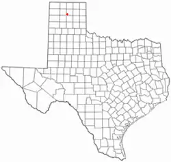 Location of Fritch, Texas | |
 | |
| Coordinates: 35°38′23″N 101°36′3″W | |
| Country | United States |
| State | Texas |
| Counties | Hutchinson, Moore |
| Area | |
| • Total | 1.62 sq mi (4.20 km2) |
| • Land | 1.62 sq mi (4.20 km2) |
| • Water | 0.00 sq mi (0.00 km2) |
| Elevation | 3,196 ft (974 m) |
| Population (2010) | |
| • Total | 2,117 |
| • Estimate (2019)[2] | 1,952 |
| • Density | 1,203.45/sq mi (464.58/km2) |
| Time zone | UTC-6 (Central (CST)) |
| • Summer (DST) | UTC-5 (CDT) |
| ZIP code | 79036 |
| Area code(s) | 806 |
| FIPS code | 48-27696[3] |
| GNIS feature ID | 1357770[4] |
| Website | www |
1992 Tornado
On June 27, 1992, a multivortex EF4 tornado struck the Fritch area, resulting in major damage to the city and the loss of 200 homes, but no loss of life.
2014 wildfire
On May 11, 2014, a fast-moving wildfire in the area began, causing much destruction and loss of homes in the Fritch area, which was evacuated by authorities. Media reported 100 structures destroyed with numerous people in local shelters.[7] [8]
Geography
Fritch is located in the southwest corner of Hutchinson County at 35°38′23″N 101°36′3″W (35.639639, -101.600921)[9] at the geographic center of the Texas Panhandle region. It is 35 miles (56 km) north-northeast of Amarillo and 13 miles (21 km) west of Borger. Fritch sits in an area where the typically flat High Plains are broken up into canyons and draws by the Canadian River. The city itself sits on a flat piece of land surrounded by undulating terrain due to this phenomenon.
According to the United States Census Bureau, the city has a total area of 1.6 square miles (4.2 km2), all of it land.[5] Lake Meredith on the Canadian River lies 2 miles (3 km) northwest of the city and is a main source of water for surrounding communities, though Fritch itself actually uses well water drawn from the Ogallala Aquifer for its municipal water supply.
Demographics
| Historical population | |||
|---|---|---|---|
| Census | Pop. | %± | |
| 1960 | 1,617 | — | |
| 1970 | 1,778 | 10.0% | |
| 1980 | 2,299 | 29.3% | |
| 1990 | 2,335 | 1.6% | |
| 2000 | 2,235 | −4.3% | |
| 2010 | 2,117 | −5.3% | |
| 2019 (est.) | 1,952 | [2] | −7.8% |
| U.S. Decennial Census[10] | |||
As of the census[3] of 2000, 2,235 people, 886 households, and 679 families resided in the city. The population density was 1,840.9 people per square mile (713.2/km2). The 961 housing units averaged 791.5 per square mile (306.6/km2). The racial makeup of the city was 95.53% White, 0.09% African American, 1.66% Native American, 0.13% Asian, 1.30% from other races, and 1.30% from two or more races. Hispanics or Latinos of any race were 4.30% of the population.
Of the 886 households, 34.7% had children under the age of 18 living with them, 66.3% were married couples living together, 8.1% had a female householder with no husband present, and 23.3% were not families. About 21.6% of all households were made up of individuals, and 11.7% had someone living alone who was 65 years of age or older. The average household size was 2.52 and the average family size was 2.93.
In the city, the population was distributed as 26.4% under the age of 18, 7.5% from 18 to 24, 25.8% from 25 to 44, 24.0% from 45 to 64, and 16.4% who were 65 years of age or older. The median age was 39 years. For every 100 females, there were 98.1 males. For every 100 females age 18 and over, there were 93.6 males.
The median income for a household in the city was $42,098, and a family was $46,600. Males had a median income of $41,134 versus $21,860 for females. The per capita income for the city was $17,745. None of the population were below the poverty line.
Fritch is primarily a bedroom community, with the majority of citizens commuting to nearby Borger and Amarillo for work. Major employers in the area include Pantex, ConocoPhillips, and Agrium, all located within a short distance of Fritch. Due to its nature as a commuting town, Fritch differs from most small towns in the region, which rely more on agriculture as their economic base. Though several large ranches are adjacent to the town, little to no farming occurs due to the uneven topography, and the town has few agriculture-related services.
Recreation
Fritch is located adjacent to the Lake Meredith National Recreation Area, which offers residents and visitors ample opportunities for outdoor activities including boating, fishing, camping, hiking, and seasonal hunting. Alibates Flint Quarries National Monument is 10 miles (16 km) southwest of Fritch along Lake Meredith. The city is home to the Lake Meredith Historical Museum.
Notable people
- Ron White, comedian
Education
Fritch is served by the Sanford-Fritch Independent School District.
Images
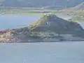 Rattlesnake Island in Lake Meredith
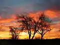 Sunrise near Fritch, TX
 Fritch Fortress boat ramp on Lake Meredith
 Canadian River wetlands near Fritch, TX
References
- "2019 U.S. Gazetteer Files". United States Census Bureau. Retrieved August 7, 2020.
- "Population and Housing Unit Estimates". United States Census Bureau. May 24, 2020. Retrieved May 27, 2020.
- "U.S. Census website". United States Census Bureau. Retrieved 2008-01-31.
- "US Board on Geographic Names". United States Geological Survey. 2007-10-25. Retrieved 2008-01-31.
- "Geographic Identifiers: 2010 Census Summary File 1 (G001): Fritch city, Texas". American Factfinder. U.S. Census Bureau. Archived from the original on February 13, 2020. Retrieved March 20, 2018.
- "The City of Fritch Directory".
- "UPDATE Fire has destroyed roughly 100 homes". Archived from the original on May 12, 2014. Retrieved May 12, 2014.
- "Hutchinson County LEPC Facebook updates". Retrieved May 12, 2014.
- "US Gazetteer files: 2010, 2000, and 1990". United States Census Bureau. 2011-02-12. Retrieved 2011-04-23.
- "Census of Population and Housing". Census.gov. Retrieved June 4, 2015.
External links
Municipalities and communities of Hutchinson County, Texas, United States | ||
|---|---|---|
| Cities | 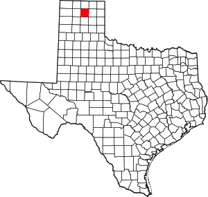 Hutchinson County map | |
| Town | ||
| CDP | ||
| Other unincorporated community | ||
| Ghost towns | ||
| Footnotes | ‡This populated place also has portions in an adjacent county or counties | |
| ||
Municipalities and communities of Moore County, Texas, United States | ||
|---|---|---|
| Cities | 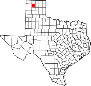 Moore County map | |
| Unincorporated communities | ||
| Footnotes | ‡This populated place also has portions in an adjacent county or counties | |
| ||
