Sanford, Texas
Sanford is a town in Hutchinson County, Texas, United States. The population was 164 at the 2010 census,[5] down from 203 at the 2000 census.
Sanford, Texas | |
|---|---|
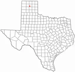 Location of Sanford, Texas | |
 | |
| Coordinates: 35°42′9″N 101°31′54″W | |
| Country | United States |
| State | Texas |
| County | Hutchinson |
| Area | |
| • Total | 0.13 sq mi (0.35 km2) |
| • Land | 0.13 sq mi (0.35 km2) |
| • Water | 0.00 sq mi (0.00 km2) |
| Elevation | 3,035 ft (925 m) |
| Population (2010) | |
| • Total | 164 |
| • Estimate (2019)[2] | 156 |
| • Density | 1,164.18/sq mi (450.75/km2) |
| Time zone | UTC-6 (Central (CST)) |
| • Summer (DST) | UTC-5 (CDT) |
| ZIP code | 79078 |
| Area code(s) | 806 |
| FIPS code | 48-65384[3] |
| GNIS feature ID | 1367731[4] |
On December 28, 1974, Hee Haw Season 6, Episode 16, Red Steagall saluted his hometown of Sanford, population 181.
History
Sanford was established in 1927 following discovery of natural gas in what became known as the Panhandle Gas Field. The town was named for pioneer rancher James McEuin Sanford (1864–1933).[6]
Geography
Sanford is located in southwestern Hutchinson County at 35°42′9″N 101°31′54″W (35.702626, -101.531773),[7] at the intersection of Ranch Roads 687 and 1319. It is 1 mile (1.6 km) southeast of the Sanford Dam on the Canadian River, forming Lake Meredith, and it is 11 miles (18 km) northwest of Borger, the county seat.
According to the United States Census Bureau, the town of Sanford has a total area of 0.14 square miles (0.35 km2), all of it land.[5]
Demographics
| Historical population | |||
|---|---|---|---|
| Census | Pop. | %± | |
| 1970 | 181 | — | |
| 1980 | 249 | 37.6% | |
| 1990 | 218 | −12.4% | |
| 2000 | 203 | −6.9% | |
| 2010 | 164 | −19.2% | |
| 2019 (est.) | 156 | [2] | −4.9% |
| U.S. Decennial Census[8] | |||
As of the census[3] of 2000, there were 203 people, 82 households, and 59 families residing in the town. The population density was 1,517.1 people per square mile (602.9/km2). There were 113 housing units at an average density of 844.5 per square mile (335.6/km2). The racial makeup of the town was 95.57% White, 1.48% Native American, 0.49% from other races, and 2.46% from two or more races. Hispanic or Latino of any race were 5.42% of the population.
There were 82 households, out of which 28.0% had children under the age of 18 living with them, 57.3% were married couples living together, 11.0% had a female householder with no husband present, and 28.0% were non-families. 26.8% of all households were made up of individuals, and 9.8% had someone living alone who was 65 years of age or older. The average household size was 2.48 and the average family size was 3.02.
In the town, the population was spread out, with 25.6% under the age of 18, 8.9% from 18 to 24, 25.6% from 25 to 44, 23.2% from 45 to 64, and 16.7% who were 65 years of age or older. The median age was 40 years. For every 100 females, there were 109.3 males. For every 100 females age 18 and over, there were 112.7 males.
The median income for a household in the town was $28,672, and the median income for a family was $29,375. Males had a median income of $27,750 versus $16,250 for females. The per capita income for the town was $12,208. About 24.2% of families and 27.6% of the population were below the poverty line, including 45.9% of those under the age of eighteen and 7.4% of those 65 or over.
Education
The town is served by the Sanford-Fritch Independent School District.
References
- "2019 U.S. Gazetteer Files". United States Census Bureau. Retrieved August 7, 2020.
- "Population and Housing Unit Estimates". United States Census Bureau. May 24, 2020. Retrieved May 27, 2020.
- "U.S. Census website". United States Census Bureau. Retrieved 2008-01-31.
- "US Board on Geographic Names". United States Geological Survey. 2007-10-25. Retrieved 2008-01-31.
- "Geographic Identifiers: 2010 Census Summary File 1 (G001): Sanford town, Texas". American Factfinder. U.S. Census Bureau. Archived from the original on February 13, 2020. Retrieved March 20, 2018.
- Anderson, H. Allen. "Sanford, TX". tshaonline.org. Texas State Historical Association. Retrieved 2020-11-09.
- "US Gazetteer files: 2010, 2000, and 1990". United States Census Bureau. 2011-02-12. Retrieved 2011-04-23.
- "Census of Population and Housing". Census.gov. Retrieved June 4, 2015.
Municipalities and communities of Hutchinson County, Texas, United States | ||
|---|---|---|
| Cities |  Hutchinson County map | |
| Town | ||
| CDP | ||
| Other unincorporated community | ||
| Ghost towns | ||
| Footnotes | ‡This populated place also has portions in an adjacent county or counties | |
| ||