Fruitdale, South Dakota
Fruitdale is a town in Butte County, South Dakota, United States. The population was 64 at the 2010 census.
Fruitdale, South Dakota | |
|---|---|
Town | |
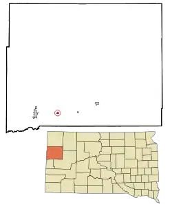 Location in Butte County and the state of South Dakota | |
| Coordinates: 44°40′5″N 103°41′47″W | |
| Country | United States |
| State | South Dakota |
| County | Butte |
| Founded | 1910[1] |
| Area | |
| • Total | 0.27 sq mi (0.71 km2) |
| • Land | 0.27 sq mi (0.71 km2) |
| • Water | 0.00 sq mi (0.00 km2) |
| Elevation | 2,949 ft (899 m) |
| Population | |
| • Total | 64 |
| • Estimate (2019)[4] | 68 |
| • Density | 248.18/sq mi (95.66/km2) |
| Time zone | UTC-7 (Mountain (MST)) |
| • Summer (DST) | UTC-6 (MDT) |
| ZIP code | 57717 |
| Area code(s) | 605 |
| FIPS code | 46-23140[5] |
| GNIS feature ID | 1255175[6] |
Fruitdale was laid out in 1911, and named for a fruit orchard near the original town site.[7]
Geography
Fruitdale is located at 44°40′5″N 103°41′47″W (44.668168, -103.696389).[8]
According to the United States Census Bureau, the town has a total area of 0.27 square miles (0.70 km2), all land.[9]
Fruitdale has been assigned the ZIP code 57742 and the FIPS place code 23140.
Demographics
| Historical population | |||
|---|---|---|---|
| Census | Pop. | %± | |
| 1920 | 40 | — | |
| 1930 | 113 | 182.5% | |
| 1940 | 89 | −21.2% | |
| 1950 | 70 | −21.3% | |
| 1960 | 79 | 12.9% | |
| 1970 | 74 | −6.3% | |
| 1980 | 88 | 18.9% | |
| 1990 | 43 | −51.1% | |
| 2000 | 62 | 44.2% | |
| 2010 | 64 | 3.2% | |
| 2019 (est.) | 68 | [4] | 6.3% |
| U.S. Decennial Census[10] | |||
2010 census
As of the census[3] of 2010, there were 64 people, 29 households, and 18 families residing in the town. The population density was 237.0 inhabitants per square mile (91.5/km2). There were 32 housing units at an average density of 118.5 per square mile (45.8/km2). The racial makeup of the town was 98.4% White and 1.6% from two or more races. Hispanic or Latino of any race were 4.7% of the population.
There were 29 households, of which 17.2% had children under the age of 18 living with them, 58.6% were married couples living together, 3.4% had a male householder with no wife present, and 37.9% were non-families. 31.0% of all households were made up of individuals, and 10.3% had someone living alone who was 65 years of age or older. The average household size was 2.21 and the average family size was 2.78.
The median age in the town was 45.8 years. 15.6% of residents were under the age of 18; 7.9% were between the ages of 18 and 24; 21.9% were from 25 to 44; 39% were from 45 to 64; and 15.6% were 65 years of age or older. The gender makeup of the town was 48.4% male and 51.6% female.
2000 census
As of the census[5] of 2000, there were 62 people, 23 households, and 18 families residing in the town. The population density was 195.2 people per square mile (74.8/km2). There were 29 housing units at an average density of 91.3 per square mile (35.0/km2). The racial makeup of the town was 93.55% White, and 6.45% from two or more races.
There were 23 households, out of which 47.8% had children under the age of 18 living with them, 65.2% were married couples living together, 8.7% had a female householder with no husband present, and 21.7% were non-families. 17.4% of all households were made up of individuals, and 4.3% had someone living alone who was 65 years of age or older. The average household size was 2.70 and the average family size was 3.11.
In the town, the population was spread out, with 29.0% under the age of 18, 4.8% from 18 to 24, 33.9% from 25 to 44, 25.8% from 45 to 64, and 6.5% who were 65 years of age or older. The median age was 39 years. For every 100 females, there were 113.8 males. For every 100 females age 18 and over, there were 100.0 males.
The median income for a household in the town was $26,250, and the median income for a family was $28,125. Males had a median income of $33,750 versus $14,500 for females. The per capita income for the town was $10,932. None of the families and about 2.8% of the population were below the poverty line.
References
- "SD Towns" (PDF). South Dakota State Historical Society. Archived from the original (PDF) on 2010-02-10. Retrieved 2010-02-12.
- "2019 U.S. Gazetteer Files". United States Census Bureau. Retrieved July 30, 2020.
- "U.S. Census website". United States Census Bureau. Retrieved 2012-06-21.
- "Population and Housing Unit Estimates". United States Census Bureau. May 24, 2020. Retrieved May 27, 2020.
- "U.S. Census website". United States Census Bureau. Retrieved 2008-01-31.
- "US Board on Geographic Names". United States Geological Survey. 2007-10-25. Retrieved 2008-01-31.
- Federal Writers' Project (1940). South Dakota place-names, v.1-3. University of South Dakota. p. 38.
- "US Gazetteer files: 2010, 2000, and 1990". United States Census Bureau. 2011-02-12. Retrieved 2011-04-23.
- "US Gazetteer files 2010". United States Census Bureau. Archived from the original on 2012-07-14. Retrieved 2012-06-21.
- "Census of Population and Housing". Census.gov. Retrieved June 4, 2015.
Municipalities and communities of Butte County, South Dakota, United States | ||
|---|---|---|
| Cities | 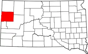 | |
| Towns | ||
| Townships | ||
| Unorganized territories |
| |
| CDP | ||
| Other unincorporated communities | ||
| Ghost town | ||
| ||