Funkley, Minnesota
Funkley is a city in Beltrami County, Minnesota, United States. The population was five at the 2010 census,[6] making the city the least populous incorporated place in Minnesota.[7] It shared that distinction with Tenney until the latter dissolved in 2011.[8]
Funkley | |
|---|---|
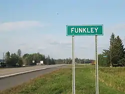 Funkley, MN Road Sign and Bar | |
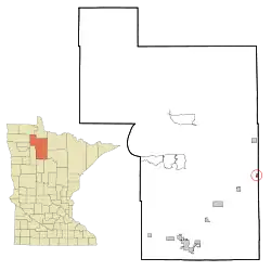 Location of Funkley, Minnesota | |
| Coordinates: 47°47′15″N 94°25′58″W | |
| Country | United States |
| State | Minnesota |
| County | Beltrami |
| Government | |
| • Mayor | Emil Erickson |
| Area | |
| • Total | 0.77 sq mi (1.99 km2) |
| • Land | 0.77 sq mi (1.99 km2) |
| • Water | 0.00 sq mi (0.00 km2) |
| Elevation | 1,391 ft (424 m) |
| Population | |
| • Total | 5 |
| • Estimate (2019)[3] | 8 |
| • Density | 10.42/sq mi (4.02/km2) |
| Time zone | UTC-6 (Central (CST)) |
| • Summer (DST) | UTC-5 (CDT) |
| ZIP code | 56630 |
| Area code(s) | 218 |
| FIPS code | 27-22976[4] |
| GNIS feature ID | 0656344[5] |
Funkley was incorporated in 1904 at the site of a junction along the Minnesota and International Railway.[9] The name comes from Henry Funkley, a county attorney.[10]
Geography
According to the United States Census Bureau, the city has a total area of 0.60 square miles (1.55 km2), all land.[11]
Demographics
| Historical population | |||
|---|---|---|---|
| Census | Pop. | %± | |
| 1910 | 59 | — | |
| 1920 | 56 | −5.1% | |
| 1930 | 60 | 7.1% | |
| 1940 | 26 | −56.7% | |
| 1950 | 28 | 7.7% | |
| 1960 | 28 | 0.0% | |
| 1970 | 19 | −32.1% | |
| 1980 | 18 | −5.3% | |
| 1990 | 15 | −16.7% | |
| 2000 | 15 | 0.0% | |
| 2010 | 5 | −66.7% | |
| 2019 (est.) | 8 | [3] | 60.0% |
| U.S. Decennial Census[12] 2013 Estimate[13] | |||
2010 census
As of the census[2] of 2010, there were 5 people, 5 households, and 0 families living in the city. The population density was 8.3 inhabitants per square mile (3.2/km2). There were 12 housing units at an average density of 20.0 per square mile (7.7/km2). The racial makeup of the city was 80.0% White and 20.0% from two or more races.
There were 5 households, of which 100.0% were non-families. 100.0% of all households were made up of individuals. The average household size was 1.00 and the average family size was 0.00.
The median age in the city was 46.8 years. 0.0% of residents were under the age of 18; 0.0% were between the ages of 18 and 24; 20% were from 25 to 44; 80% were from 45 to 64; and 0.0% were 65 years of age or older. The gender makeup of the city was 20.0% male and 80.0% female.
2000 census
As of the census[4] of 2000, there were 15 people, 6 households, and 4 families living in the city. The population density was 38.9 people per square mile (14.9/km2). There were 12 housing units at an average density of 31.1 per square mile (11.9/km2). The racial makeup of the city was 100.00% White.
There were 6 households, of which 33.3% had children under the age of 18 living with them, 66.7% were married couples living together, 16.7% had a female householder with no husband present, and 16.7% were non-families. 16.7% of all households were made up of individuals, and none had someone living alone who was 65 years of age or older. The average household size was 2.50 and the average family size was 2.60.
In the city, the population was spread out, with 26.7% under the age of 18, 26.7% from 25 to 44, 13.3% from 45 to 64, and 33.3% who were 65 years of age or older. The median age was 38 years. For every 100 females, there were 150.0 males. For every 100 females age 18 and over, there were 120.0 males.
The median income for a household in the city was $26,250, and the median income for a family was $25,625. Males had a median income of $29,167 versus $17,083 for females. The per capita income for the city was $15,521. None of the population and none of the families were below the poverty line.
References
- "2019 U.S. Gazetteer Files". United States Census Bureau. Retrieved July 26, 2020.
- "U.S. Census website". United States Census Bureau. Retrieved 2012-11-13.
- "Population and Housing Unit Estimates". United States Census Bureau. May 24, 2020. Retrieved May 27, 2020.
- "U.S. Census website". United States Census Bureau. Retrieved 2008-01-31.
- "US Board on Geographic Names". United States Geological Survey. 2007-10-25. Retrieved 2008-01-31.
- "2010 Census Redistricting Data (Public Law 94-171) Summary File". American FactFinder. U.S. Census Bureau, 2010 Census. Retrieved 23 April 2011.
- Rivero, Nicolas (25 August 2017). "The Smallest Town in Each of the 50 States". Mental Floss. Retrieved 25 June 2018.
- Smith, Mary Lynn (June 22, 2011). "Teeny Tenney says ta-ta; residents vote 2-1 to dissolve town". Star Tribune. Retrieved November 9, 2014.
- "Minnesota Place Names - Township and Village Information". Minnesota Place Names. Minnesota Historical Society. Retrieved 21 May 2011.
- Upham, Warren (1920). Minnesota Geographic Names: Their Origin and Historic Significance. Minnesota Historical Society. p. 37.
- "US Gazetteer files 2010". United States Census Bureau. Archived from the original on 2012-07-02. Retrieved 2012-11-13.
- United States Census Bureau. "Census of Population and Housing". Retrieved October 28, 2014.
- "Population Estimates". United States Census Bureau. Archived from the original on 2014-05-22. Retrieved 2014-10-28.
Municipalities and communities of Beltrami County, Minnesota, United States | ||
|---|---|---|
| Cities | 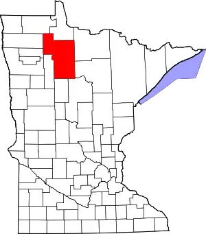 Map of Minnesota highlighting Beltrami County | |
| Townships |
| |
| CDPs | ||
| Unorganized territories | ||
| Unincorporated communities | ||
| Indian reservations | ||
| Footnotes | ‡This populated place also has portions in an adjacent county or counties | |
| ||
| Authority control |
|
|---|