Galena, Maryland
Galena is a town in Kent County, Maryland, United States. The population was 612 at the 2010 census.
Galena, Maryland | |
|---|---|
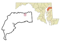 Location of Galena, Maryland | |
| Coordinates: 39°20′30″N 75°52′42″W | |
| Country | |
| State | |
| County | |
| Incorporated | 1858[1] |
| Government | |
| • Mayor | John Carroll[1] |
| Area | |
| • Total | 0.36 sq mi (0.93 km2) |
| • Land | 0.36 sq mi (0.93 km2) |
| • Water | 0.00 sq mi (0.00 km2) |
| Elevation | 69 ft (21 m) |
| Population | |
| • Total | 612 |
| • Estimate (2019)[4] | 582 |
| • Density | 1,612.19/sq mi (623.07/km2) |
| Time zone | UTC-5 (Eastern (EST)) |
| • Summer (DST) | UTC-4 (EDT) |
| ZIP code | 21635 |
| Area code(s) | 410 |
| FIPS code | 24-31225 |
| GNIS feature ID | 0590270 |
| Website | www |
Geography
Galena is located at 39°20′30″N 75°52′42″W (39.341680, -75.878444).[5]
According to the United States Census Bureau, the town has a total area of 0.36 square miles (0.93 km2), all land.[6]
History
Galena was founded in 1763 under the name Down's Cross Roads, after William Downs, a local tavern owner.[7] The name was later changed to Georgetown Cross Roads sometime before 1813, and finally to Galena in 1858.[8] The name comes from a supposed silver mine in the vicinity of the town, which extracted the metal from the lead ore known as galena. There is, however, no geological evidence for galena deposits on Maryland's eastern shore, and the story is likely apocryphal.[8]
Businesses
Galena is home to a variety of small businesses for its size. Along with many antique shops, there is a diner, confectionery shop, convenience store and deli, organic and healthfoods market, pizza parlor, and recording studio, and wedding videography studio.
Demographics
| Historical population | |||
|---|---|---|---|
| Census | Pop. | %± | |
| 1880 | 347 | — | |
| 1890 | 266 | −23.3% | |
| 1900 | 251 | −5.6% | |
| 1910 | 262 | 4.4% | |
| 1920 | 298 | 13.7% | |
| 1930 | 265 | −11.1% | |
| 1940 | 250 | −5.7% | |
| 1950 | 259 | 3.6% | |
| 1960 | 299 | 15.4% | |
| 1970 | 361 | 20.7% | |
| 1980 | 374 | 3.6% | |
| 1990 | 324 | −13.4% | |
| 2000 | 428 | 32.1% | |
| 2010 | 612 | 43.0% | |
| 2019 (est.) | 582 | [4] | −4.9% |
| U.S. Decennial Census[9] | |||
2010 census
As of the census[3] of 2010, there were 612 people, 271 households, and 169 families living in the town. The population density was 1,700.0 inhabitants per square mile (656.4/km2). There were 284 housing units at an average density of 788.9 per square mile (304.6/km2). The racial makeup of the town was 91.3% White, 2.3% African American, 0.2% Native American, 0.3% Asian, 3.9% from other races, and 2.0% from two or more races. Hispanic or Latino of any race were 6.0% of the population.
There were 271 households, of which 26.2% had children under the age of 18 living with them, 52.0% were married couples living together, 7.0% had a female householder with no husband present, 3.3% had a male householder with no wife present, and 37.6% were non-families. 32.8% of all households were made up of individuals, and 14.8% had someone living alone who was 65 years of age or older. The average household size was 2.26 and the average family size was 2.88.
The median age in the town was 45.1 years. 20.1% of residents were under the age of 18; 6.5% were between the ages of 18 and 24; 23.2% were from 25 to 44; 29.4% were from 45 to 64; and 20.8% were 65 years of age or older. The gender makeup of the town was 47.5% male and 52.5% female.
2000 census
As of the census[10] of 2000, there were 428 people, 190 households, and 121 families living in the town. The population density was 1,208.2 people per square mile (472.1/km2). There were 202 housing units at an average density of 570.2 per square mile (222.8/km2). The racial makeup of the town was 95.79% White, 3.50% African American, and 0.70% from two or more races. Hispanic or Latino of any race were 0.70% of the population.
There were 190 households, out of which 27.9% had children under the age of 18 living with them, 54.7% were married couples living together, 7.4% had a female householder with no husband present, and 35.8% were non-families. 33.2% of all households were made up of individuals, and 23.7% had someone living alone who was 65 years of age or older. The average household size was 2.23 and the average family size was 2.85.
In the town, the population was spread out, with 23.6% under the age of 18, 1.9% from 18 to 24, 27.6% from 25 to 44, 24.5% from 45 to 64, and 22.4% who were 65 years of age or older. The median age was 43 years. For every 100 females, there were 83.7 males. For every 100 females age 18 and over, there were 78.7 males.
The median income for a household in the town was $47,813, and the median income for a family was $53,068. Males had a median income of $35,096 versus $22,500 for females. The per capita income for the town was $18,858. About 1.6% of families and 4.7% of the population were below the poverty line, including none of those under age 18 and 6.5% of those age 65 or over.
References
- "Galena". Maryland Manual. Retrieved 26 June 2017.
- "2019 U.S. Gazetteer Files". United States Census Bureau. Retrieved July 25, 2020.
- "U.S. Census website". United States Census Bureau. Retrieved 2013-01-25.
- "Population and Housing Unit Estimates". United States Census Bureau. May 24, 2020. Retrieved May 27, 2020.
- "US Gazetteer files: 2010, 2000, and 1990". United States Census Bureau. 2011-02-12. Retrieved 2011-04-23.
- "US Gazetteer files 2010". United States Census Bureau. Archived from the original on 2012-07-02. Retrieved 2013-01-25.
- "The Town of Galena on the Easter Shore of Maryland". www.kentcounty.com. Retrieved 2017-10-13.
- "Then & Now Was there silver in that thar hill? June 2". MyEasternShoreMD. Retrieved 2017-10-13.
- "Census of Population and Housing". Census.gov. Retrieved June 4, 2015.
- "U.S. Census website". United States Census Bureau. Retrieved 2008-01-31.
External links
- Map of Galena, from the Historical Society of Kent County collection
Municipalities and communities of Kent County, Maryland, United States | ||
|---|---|---|
| Towns | 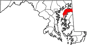 | |
| CDPs | ||
| Unincorporated communities | ||
| Footnotes | ‡This populated place also has portions in an adjacent county or counties | |
| ||
| Authority control |
|---|