Georgetown (CDP), Maryland
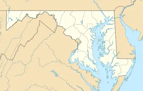
Georgetown is an unincorporated community and census-designated place in western Kent County, Maryland, United States.[2] Its population was 143 as of the 2010 census.[1] It should not be confused with the community of the same name 22 miles (35 km) to the northeast on the Kent/Cecil County border.
Georgetown, Maryland | |
|---|---|
 Georgetown  Georgetown | |
| Coordinates: 39°13′16″N 76°11′47″W | |
| Country | |
| State | |
| County | |
| Area | |
| • Total | 1.47 sq mi (3.82 km2) |
| • Land | 1.47 sq mi (3.81 km2) |
| • Water | 0.004 sq mi (0.01 km2) |
| Elevation | 43 ft (13 m) |
| Population | |
| • Total | 143 |
| • Density | 97/sq mi (37.6/km2) |
| Time zone | UTC-5 (Eastern (EST)) |
| • Summer (DST) | UTC-4 (EDT) |
| Area code(s) | 410 & 443 |
| FIPS code | 24-31875 |
| GNIS feature ID | 2583629[2] |
Geography
The Georgetown CDP is 7 miles (11 km) west of Chestertown, the Kent county seat. It is bordered to the east by the community of Fairlee, and Tolchester Beach on the shore of Chesapeake Bay is 2 miles (3 km) to the west.
According to the U.S. Census Bureau, the Georgetown CDP has a total area of 1.5 square miles (3.8 km2), of which 0.004 square miles (0.01 km2), or 0.38%, are water.[1]
References
- "Geographic Identifiers: 2010 Census Summary File 1 (G001), Georgetown CDP, Maryland". American FactFinder. U.S. Census Bureau. Archived from the original on February 13, 2020. Retrieved March 14, 2019.
- "Georgetown Census Designated Place". Geographic Names Information System. United States Geological Survey.
Municipalities and communities of Kent County, Maryland, United States | ||
|---|---|---|
| Towns | 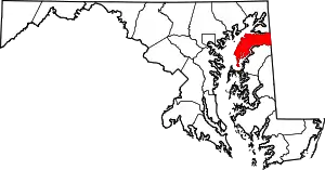 | |
| CDPs | ||
| Unincorporated communities | ||
| Footnotes | ‡This populated place also has portions in an adjacent county or counties | |
| ||
This article is issued from Wikipedia. The text is licensed under Creative Commons - Attribution - Sharealike. Additional terms may apply for the media files.
