Gary, South Dakota
Gary is a city in Deuel County, South Dakota, United States. The population was 227 at the 2010 census. South Dakota Highway 101 serves as the main route of the community.
Gary, South Dakota | |
|---|---|
| Motto(s): "Gate City To The Dakotas" | |
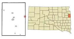 Location in Deuel County and the state of South Dakota | |
| Coordinates: 44°47′35″N 96°27′27″W | |
| Country | United States |
| State | South Dakota |
| County | Deuel |
| Incorporated | 1917[1] |
| Area | |
| • Total | 0.75 sq mi (1.94 km2) |
| • Land | 0.75 sq mi (1.94 km2) |
| • Water | 0.00 sq mi (0.00 km2) |
| Elevation | 1,467 ft (447 m) |
| Population | |
| • Total | 227 |
| • Estimate (2019)[4] | 229 |
| • Density | 306.15/sq mi (118.21/km2) |
| Time zone | UTC-6 (Central (CST)) |
| • Summer (DST) | UTC-5 (CDT) |
| ZIP code | 57237 |
| Area code(s) | 605 |
| FIPS code | 46-23860[5] |
| GNIS feature ID | 1265643[6] |
History
A post office called Gary was established in 1874.[7] Gary was platted by the railroad in 1877.[8] It was named for H. B. Gary, a postal official.[8] An early variant name was State Line.[9]
Geography
Gary is located at 44°47′35″N 96°27′27″W (44.793178, -96.457569).[10]
According to the United States Census Bureau, the city has a total area of 0.69 square miles (1.79 km2), all land.[11] The West Branch of the Lac qui Parle River flows through the city as a spring fed stream near its headwaters.[12]
Gary has been assigned the ZIP code 57237 and the FIPS place code 23860.
Demographics
| Historical population | |||
|---|---|---|---|
| Census | Pop. | %± | |
| 1890 | 277 | — | |
| 1900 | 345 | 24.5% | |
| 1910 | 477 | 38.3% | |
| 1920 | 588 | 23.3% | |
| 1930 | 543 | −7.7% | |
| 1940 | 566 | 4.2% | |
| 1950 | 558 | −1.4% | |
| 1960 | 471 | −15.6% | |
| 1970 | 366 | −22.3% | |
| 1980 | 354 | −3.3% | |
| 1990 | 274 | −22.6% | |
| 2000 | 231 | −15.7% | |
| 2010 | 227 | −1.7% | |
| 2019 (est.) | 229 | [4] | 0.9% |
| U.S. Decennial Census[13] | |||
2010 census
As of the census[3] of 2010, there were 227 people, 120 households, and 61 families residing in the city. The population density was 329.0 inhabitants per square mile (127.0/km2). There were 153 housing units at an average density of 221.7 per square mile (85.6/km2). The racial makeup of the city was 96.9% White, 0.9% African American, 1.8% Native American, and 0.4% from two or more races. Hispanic or Latino of any race were 1.3% of the population.
There were 120 households, of which 17.5% had children under the age of 18 living with them, 42.5% were married couples living together, 6.7% had a female householder with no husband present, 1.7% had a male householder with no wife present, and 49.2% were non-families. 47.5% of all households were made up of individuals, and 23.3% had someone living alone who was 65 years of age or older. The average household size was 1.89 and the average family size was 2.67.
The median age in the city was 51.6 years. 18.1% of residents were under the age of 18; 5.3% were between the ages of 18 and 24; 17.9% were from 25 to 44; 32.6% were from 45 to 64; and 26% were 65 years of age or older. The gender makeup of the city was 51.5% male and 48.5% female.
2000 census
As of the census[5] of 2000, there were 231 people, 128 households, and 62 families residing in the city. The population density was 334.5 people per square mile (129.3/km2). There were 148 housing units at an average density of 214.3 per square mile (82.8/km2). The racial makeup of the city was 99.57% White and 0.43% Native American.
There were 128 households, out of which 16.4% had children under the age of 18 living with them, 43.0% were married couples living together, 4.7% had a female householder with no husband present, and 50.8% were non-families. 50.0% of all households were made up of individuals, and 31.3% had someone living alone who was 65 years of age or older. The average household size was 1.80 and the average family size was 2.62.
In the city, the population was spread out, with 16.5% under the age of 18, 3.5% from 18 to 24, 21.6% from 25 to 44, 26.0% from 45 to 64, and 32.5% who were 65 years of age or older. The median age was 52 years. For every 100 females, there were 90.9 males. For every 100 females age 18 and over, there were 89.2 males.
The median income for a household in the city was $20,962, and the median income for a family was $31,250. Males had a median income of $19,500 versus $16,563 for females. The per capita income for the city was $13,480. About 12.9% of families and 13.9% of the population were below the poverty line, including 14.6% of those under the age of eighteen and 24.3% of those 65 or over.
References
- "SD Towns" (PDF). South Dakota State Historical Society. Archived from the original (PDF) on 2010-02-10. Retrieved 2010-02-12.
- "2019 U.S. Gazetteer Files". United States Census Bureau. Retrieved July 30, 2020.
- "U.S. Census website". United States Census Bureau. Retrieved 2012-06-21.
- "Population and Housing Unit Estimates". United States Census Bureau. May 24, 2020. Retrieved May 27, 2020.
- "U.S. Census website". United States Census Bureau. Retrieved 2008-01-31.
- "US Board on Geographic Names". United States Geological Survey. 2007-10-25. Retrieved 2008-01-31.
- "Deuel County". Jim Forte Postal History. Archived from the original on 3 April 2015. Retrieved 18 March 2015.
- Chicago and North Western Railway Company (1908). A History of the Origin of the Place Names Connected with the Chicago & North Western and Chicago, St. Paul, Minneapolis & Omaha Railways. p. 75.
- Federal Writers' Project (1940). South Dakota place-names, v.1-3. University of South Dakota. p. 38.
- "US Gazetteer files: 2010, 2000, and 1990". United States Census Bureau. 2011-02-12. Retrieved 2011-04-23.
- "US Gazetteer files 2010". United States Census Bureau. Archived from the original on 2012-07-02. Retrieved 2012-06-21.
- South Dakota Atlas & Gazetteer. Yarmouth, Me.: DeLorme. 2001. p. 35. ISBN 0-89933-330-3.
- "Census of Population and Housing". Census.gov. Retrieved June 4, 2015.
Municipalities and communities of Deuel County, South Dakota, United States | ||
|---|---|---|
| Cities | 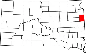 | |
| Towns | ||
| Unincorporated communities | ||
| ||
| Authority control |
|---|