Gbako
Gbako is a Local Government Area in Niger State, Nigeria. Its headquarters are in the town of Lemu in the north of the area at9°24′00″N 6°02′00″E. The Kaduna River forms its western boundary.
Gbako | |
|---|---|
LGA | |
 Gbako Location in Nigeria | |
| Coordinates: 9°16′N 5°59′E | |
| Country | |
| State | Niger State |
| Government | |
| • Local Government Chairman and the Head of the Local Government Council | Hussaini Lemu |
| Area | |
| • Total | 1,753 km2 (677 sq mi) |
| Population (2006 census) | |
| • Total | 127,466 |
| Time zone | UTC+1 (WAT) |
| 3-digit postal code prefix | 912 |
| ISO 3166 code | NG.NI.GB |
It has an area of 1,753 km2 and a population of 127,466 at the 2006 census.
The postal code of the area is 912.[1]
References
- "Post Offices- with map of LGA". NIPOST. Archived from the original on November 26, 2012. Retrieved 2009-10-20.
State capital: Minna | ||
| Local Government Areas | 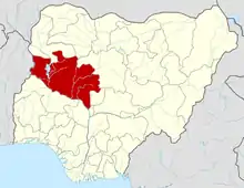 | |
This article is issued from Wikipedia. The text is licensed under Creative Commons - Attribution - Sharealike. Additional terms may apply for the media files.
