Gezawa
Gezawa is a Local Government Area in Kano State, Nigeria. Its headquarters are in the town of Gezawa.
Gezawa | |
|---|---|
LGA and town | |
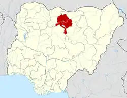
 Gezawa Location in Nigeria | |
| Coordinates: 12°06′N 8°44′E | |
| Country | |
| State | Kano State |
| Area | |
| • Total | 340 km2 (130 sq mi) |
| Population (2006 census) | |
| • Total | 282,069 |
| Time zone | UTC+1 (WAT) |
| 3-digit postal code prefix | 702 |
| ISO 3166 code | NG.KN.GE |

Traditional mudbrick making in Gezawa village.
It has an area of 340 km2 and a population of 282,069 at the 2006 census.
The postal code of the area is 702.[1]
References
- "Post Offices- with map of LGA". NIPOST. Archived from the original on 2012-11-26. Retrieved 2009-10-20.
State capital: Kano | ||
| Local government areas |
|  |
This article is issued from Wikipedia. The text is licensed under Creative Commons - Attribution - Sharealike. Additional terms may apply for the media files.