Rogo
Rogo is a Local Government Area in Kano State, Nigeria. Its headquarters are in the town of Rogo.
Rogo
Rogo | |
|---|---|
LGA and town | |
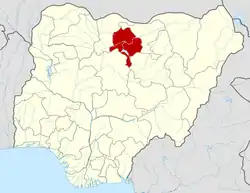
 Rogo Location in Nigeria | |
| Coordinates: 11°34′N 7°50′E | |
| Country | |
| State | Kano State |
| Area | |
| • Total | 802 km2 (310 sq mi) |
| Population (2020 Estimated) | |
| • Total | 350,000 |
| Time zone | UTC+1 (WAT) |
| 3-digit postal code prefix | 704 |
| ISO 3166 code | NG.KN.RO |
It has an area of 802 km2 and a population of 227,742 at the 2006 census. and it's bordering with makarfi local government kaduna state from the south and bordering with kafur and danja local government katsina state from the West an from North KARAYE l.g east kiru local government Kano state. ROGO Local Govt. has a 10 political Wards, Which Included: Beli ward Falgore ward Fulatan Ward Gwangwan ward Jajaye ward Rogo Ruma Rogo Sabon Gari Ruwan Bago ward Zarewa ward Zoza Ward. The postal code of the area is 704.[1]
References
- "Post Offices- with map of LGA". NIPOST. Archived from the original on 2009-10-07. Retrieved 2009-10-20.
State capital: Kano | ||
| Local government areas |
|  |
This article is issued from Wikipedia. The text is licensed under Creative Commons - Attribution - Sharealike. Additional terms may apply for the media files.