Granisle
Granisle is a village on Babine Lake in the Northern Interior of British Columbia, Canada, to the north of Topley between Burns Lake and Houston.
Granisle | |
|---|---|
| Village of Granisle[1] | |
 | |
 Location of Granisle in British Columbia | |
| Coordinates: 54°53′13″N 126°12′25″W | |
| Country | |
| Province | |
| Region | BC Interior |
| Regional district | Regional District of Buckley-Nechako |
| Incorporated | 1971 |
| Government | |
| • Governing body | Granisle Village Council |
| Area | |
| • Total | 41.86 km2 (16.16 sq mi) |
| Elevation | 740 m (2,430 ft) |
| Population (2016) | |
| • Total | 303 |
| • Density | 7.2/km2 (19/sq mi) |
| Time zone | UTC-8 (PST) |
| Waterways | Babine Lake |
| Website | www |
History
| Year | Pop. | ±% |
|---|---|---|
| 1971 | 515 | — |
| 1976 | 1,210 | +135.0% |
| 1981 | 1,430 | +18.2% |
| 1986 | 646 | −54.8% |
| 1991 | 803 | +24.3% |
| 1996 | 446 | −44.5% |
| 2001 | 353 | −20.9% |
| 2006 | 364 | +3.1% |
| 2011 | 303 | −16.8% |
| 2016 | 303 | +0.0% |
| Source: Statistics Canada [2][3][4][5][6][7] | ||
The early inhabitants of the area were Carrier Indians, called "Babine" by the early explorers, referring to the distended ornamented lower lips of the native women.
The village of Granisle was founded in the late 1960s and early 1970s on the shores of Babine Lake as a home for the families of the miners working in the nearby copper mines. Granisle was incorporated as a village in 1971. At the height of its population, Granisle boasted approximately 3,000 people.
After the last mine shut down in 1992, the community transformed into a retirement destination. Tourism in the area also began to grow and is now the area's main industry.
In 1971 workmen excavating in an open-pit copper mine at Babine Lake discovered the partly articulated skeleton of a Columbian Mammoth. The bones were taken from silty pond deposits overlain by very thick boulder-clay deposited by the last glacier that covered the area. Radiocarbon dates indicate that the animal sank in sticky pond deposits about 34,000 years ago. A replica of some of the Mammoth's Bones can be seen at the Granisle Museum.
Village
Granisle had an ice hockey team in the now non-existent Pacific Northwest Hockey League.
References
- "British Columbia Regional Districts, Municipalities, Corporate Name, Date of Incorporation and Postal Address" (XLS). British Columbia Ministry of Communities, Sport and Cultural Development. Archived from the original on July 13, 2014. Retrieved November 2, 2014.
- "Table 3: Population for census divisions and subdivisions, 1971 and 1976". 1976 Census of Canada. Census Divisions and Subdivisions, Western Provinces and the Territories. Population: Geographic Distributions. Ottawa: Statistics Canada. 1977.
- "Table 2: Census Subdivisions in Alphabetical Order, Showing Population Rank, Canada, 1981". 1981 Census of Canada. Census subdivisions in decreasing population order. Ottawa: Statistics Canada. 1982. ISBN 0-660-51563-6.
- "Table 2: Population and Dwelling Counts, for Census Divisions and Census Subdivisions, 1986 and 1991 – 100% Data". 91 Census. Population and Dwelling Counts – Census Divisions and Census Subdivisions. Ottawa: Statistics Canada. 1992. pp. 100–108. ISBN 0-660-57115-3.
- "Population and Dwelling Counts, for Canada, Provinces and Territories, and Census Divisions, 2001 and 1996 Censuses – 100% Data (British Columbia)". Statistics Canada. Retrieved 2019-05-28.
- "Population and dwelling counts, for Canada, provinces and territories, and census subdivisions (municipalities), 2006 and 2001 censuses – 100% data (British Columbia)". Statistics Canada. January 6, 2010. Retrieved 2019-05-28.
- "Census Profile, 2016 Census". Statistics Canada. February 8, 2017. Retrieved 2020-02-04.
External links
| Subdivisions | 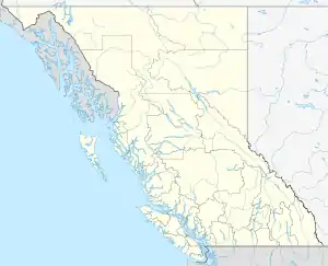 | |
|---|---|---|
| Communities | ||
| Metro areas and agglomerations | ||
| Villages |
| |
| ||