List of cities in British Columbia
A city is a classification of municipalities used in the Canadian province of British Columbia. British Columbia's Lieutenant Governor in Council may incorporate a community as a city by letters patent, under the recommendation of the Minister of Communities, Sport and Cultural Development, if its population is greater than 5,000 and the outcome of a vote involving affected residents was that greater than 50% voted in favour of the proposed incorporation.[1]
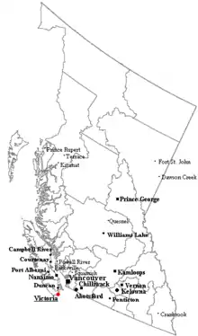
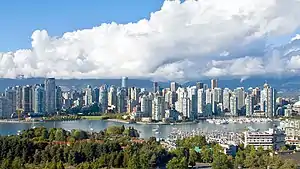
British Columbia has 52 cities[2][3][4] that had a cumulative population of 3,327,824 and an average population of 63,997 in the 2016 Census.[5] British Columbia's largest and smallest cities are Vancouver and Greenwood with populations of 631,486 and 665 respectively.[5] The largest city by land area is Abbotsford, which spans 375.55 km2 (145.00 sq mi), while the smallest is Duncan, at 2.07 km2 (0.80 sq mi).[5]
The first community to incorporate as a city was New Westminster on July 16, 1860,[2] while the province's newest city is Delta, which was redesignated from a district municipality to a city on September 22, 2017.[4]
List
| Name | Corporate name[2] | Regional district[2] | Incorporation date[2] | Population (2016)[5] | Population (2011)[5] | Change (%)[5] | Area (km2)[5] | Population density[5] |
|---|---|---|---|---|---|---|---|---|
| Duncan | Duncan, The Corporation of the City of | Cowichan Valley | March 4, 1912 | 4,944 | 4,932 | 0.2 | 2.07 | 2,387.1 |
| Enderby | Enderby, The Corporation of the City of | North Okanagan | March 1, 1905 | 2,964 | 2,932 | 1.1 | 4.26 | 695.3 |
| Fernie | Fernie, The Corporation of the City of | East Kootenay | July 28, 1904 | 5,249 | 4,448 | 18.0 | 13.50 | 388.7 |
| Fort St. John | Fort St. John, City of | Peace River | December 31, 1947 | 20,155 | 18,609 | 8.3 | 26.27 | 767.3 |
| Grand Forks | Grand Forks, The Corporation of the City of | Kootenay Boundary | April 15, 1897 | 4,049 | 3,985 | 1.6 | 10.43 | 388.1 |
| Greenwood | Greenwood, The Corporation of the City of | Kootenay Boundary | July 12, 1897 | 665 | 708 | −6.1 | 2.42 | 274.9 |
| Kamloops | Kamloops, City of | Thompson-Nicola | October 17, 1967 | 90,280 | 85,678 | 5.4 | 299.25 | 301.7 |
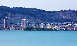
| Kelowna | Kelowna, City of | Central Okanagan | May 4, 1905 | 127,380 | 117,312 | 8.6 | 211.85 | 601.3 |
| Kimberley | Kimberley, City of | East Kootenay | March 29, 1944 | 7,425 | 6,652 | 11.6 | 60.62 | 122.5 |
| Langford | Langford, City of | Capital | December 8, 1992 | 35,342 | 29,228 | 20.9 | 39.94 | 885.0 |
| Langley | Langley, City of | Metro Vancouver|Metro Vancouver | March 15, 1955 | 25,888 | 25,081 | 3.2 | 10.22 | 2,533.6 |
| Maple Ridge | Maple Ridge, City of | Metro Vancouver|Metro Vancouver | September 12, 2014[6] | 82,256 | 76,052 | 8.2 | 266.78 | 308.3 |
| Merritt | Merritt, City of | Thompson-Nicola | April 1, 1911 | 7,139 | 7,113 | 0.4 | 26.07 | 273.9 |
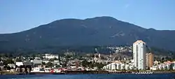
| Nanaimo | Nanaimo, City of | Nanaimo | December 24, 1874 | 90,504 | 83,810 | 8.0 | 90.76 | 997.2 |
| Nelson | Nelson, The Corporation of the City of | Central Kootenay | March 18, 1897 | 10,572 | 10,230 | 3.3 | 11.95 | 884.3 |
| New Westminster | New Westminster, The Corporation of the City of | Metro Vancouver|Metro Vancouver | July 16, 1860 | 70,996 | 65,976 | 7.6 | 15.63 | 4,543.4 |
| North Vancouver | North Vancouver, The Corporation of the City of | Metro Vancouver|Metro Vancouver | August 10, 1891 | 52,898 | 48,196 | 1.8 | 11.85 | 4,465.1 |
| Parksville | Parksville, City of | Nanaimo | June 19, 1945 | 12,514 | 11,977 | 4.5 | 14.56 | 859.6 |
| Penticton | Penticton, The Corporation of the City of | Okanagan-Similkameen | January 1, 1909 | 33,761 | 32,877 | 2.7 | 42.10 | 801.8 |
| Pitt Meadows | Pitt Meadows, City of | Metro Vancouver|Metro Vancouver | April 25, 1914 | 18,573 | 17,736 | 4.7 | 86.51 | 214.7 |
| Port Alberni | Port Alberni, City of | Alberni-Clayoquot | October 28, 1967 | 17,678 | 17,743 | −0.4 | 19.76 | 894.7 |
| Port Coquitlam | Port Coquitlam, The Corporation of the City of | Metro Vancouver|Metro Vancouver | March 7, 1913 | 58,612 | 55,958 | 4.7 | 29.17 | 2,009.4 |
| Port Moody | Port Moody, City of | Metro Vancouver|Metro Vancouver | March 11, 1913 | 33,551 | 33,011 | 1.6 | 25.89 | 1,295.9 |
| Powell River | Powell River, The Corporation of the City of | Powell River | October 15, 1955 | 13,157 | 13,165 | −0.1 | 28.91 | 455.1 |
| Prince George | Prince George, City of | Fraser-Fort George | March 6, 1915 | 74,003 | 71,974 | 2.8 | 318.26 | 232.5 |
| Prince Rupert | Prince Rupert, City of | North Coast | March 10, 1910 | 12,220 | 12,508 | −2.3 | 66.28 | 184.4 |
| Quesnel | Quesnel, City of | Cariboo | March 21, 1928 | 9,879 | 10,007 | −1.3 | 35.39 | 279.2 |
| Revelstoke | Revelstoke, City of | Columbia Shuswap | March 1, 1899 | 7,547 | 7,139 | 5.7 | 41.13 | 183.5 |
| Richmond | Richmond, City of | Metro Vancouver|Metro Vancouver | November 10, 1879 | 198,309 | 190,473 | 4.1 | 129.27 | 1,534.1 |
| Rossland | Rossland, The Corporation of the City of | Kootenay Boundary | March 18, 1897 | 3,729 | 3,556 | 4.9 | 59.79 | 62.4 |
| Salmon Arm | Salmon Arm, City of | Columbia Shuswap | May 15, 1905 | 17,706 | 17,464 | 1.4 | 155.28 | 114.0 |
| Surrey | Surrey, City of | Metro Vancouver|Metro Vancouver | November 10, 1879 | 517,887 | 468,251 | 10.6 | 316.41 | 1,636.8 |
| Terrace | Terrace, City of | Kitimat-Stikine | December 31, 1927 | 11,643 | 11,486 | 1.4 | 57.36 | 203.0 |
| Trail | Trail, City of | Kootenay Boundary | June 14, 1901 | 7,709 | 7,681 | 0.4 | 34.93 | 220.7 |
| Vancouver[lower-alpha 1] | Vancouver, City of | Metro Vancouver|Metro Vancouver | April 6, 1886 | 631,486 | 603,502 | 4.6 | 114.97 | 5,492.6 |
| Vernon | Vernon, The Corporation of the City of | North Okanagan | December 30, 1892 | 40,116 | 38,180 | 5.1 | 96.05 | 417.7 |
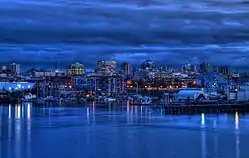
| Victoria[lower-alpha 2] | Victoria, The Corporation of the City of | Capital | August 2, 1862 | 85,792 | 80,017 | 7.2 | 19.47 | 4,305.8 |
| West Kelowna | West Kelowna, City of | Central Okanagan | June 26, 2015[3] | 32,655 | 30,902 | 5.7 | 123.53 | 264.4 |
| White Rock | White Rock, The Corporation of the City of | Metro Vancouver|Metro Vancouver | April 15, 1957 | 19,952 | 19,339 | 3.2 | 5.12 | 3,893.1 |
| Williams Lake | Williams Lake, City of | Cariboo | March 15, 1929 | 10,753 | 10,832 | −0.7 | 33.13 | 324.6 |
| Total cities | — | — | — | 3,327,824 | 3,133,081 | 4.5 | 4,263.15 | 1,081.81 |
Notes:
- Vancouver is Canada's eighth-largest city and British Columbia's largest city by population. The Vancouver CMA includes the cities of Burnaby, Coquitlam, Delta, Langley, Maple Ridge, New Westminster, North Vancouver, Pitt Meadows, Port Coquitlam, Port Moody, Richmond, Surrey, Vancouver and White Rock.
- Victoria is British Columbia's capital. The Victoria CMA includes the cities of Colwood, Langford and Victoria.
Former cities
Sandon held city status between 1898 and 1920.[7] Phoenix held city status between 1900 and 1919.[8]
City status eligibility
As of the 2016 Census, eight towns – Comox, Creston, Ladysmith, Osoyoos, Qualicum Beach, Sidney, Smithers and View Royal – meet the requirement of having populations greater than 5,000 to incorporate as a city. Also, 19 district municipalities meet the minimum population requirements to incorporate as a city.
Gallery
See also
References
- "Local Government Act: Part 2 — Incorporation of Municipalities". Government of British Columbia Queen's Printer. November 12, 2012. Retrieved December 8, 2012.
- "British Columbia Regional Districts, Municipalities, Corporate Name, Date of Incorporation and Postal Address" (XLS). British Columbia Ministry of Communities, Sport and Cultural Development. Archived from the original on July 13, 2014. Retrieved December 8, 2012.
- "Order in Council No. 357". Province of British Columbia. June 26, 2015. Retrieved July 1, 2015.
- "Order in Council No. 362". Province of British Columbia. September 22, 2017. Retrieved January 10, 2018.
- "Population and dwelling counts, for Canada, provinces and territories, and census subdivisions (municipalities), 2016 and 2011 censuses (British Columbia)". Statistics Canada. February 20, 2019. Retrieved October 17, 2019.
- "Order of the Lieutenant Governor in Council: Order in Council No. 513" (PDF). Province of British Columbia. September 9, 2014. Retrieved September 14, 2014.
- "From Boom to Bust in 20 Years: Sandon's History as an Incorporated City". Sandon Museum. Retrieved June 26, 2013.
- "Name Details: Phoenix (Abandoned Locality)". GeoBC. Retrieved June 27, 2013.
