Grant, Oklahoma
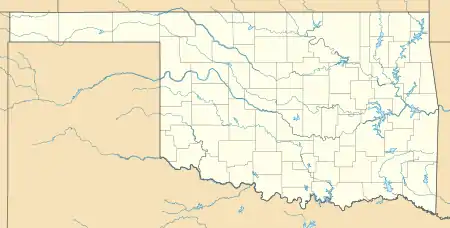
Grant is an unincorporated community in Choctaw County, Oklahoma, United States.[1] It is located along U.S. Route 271, south of Hugo.[2] As of the 2010 census it had a population of 289.[3]
Grant, Oklahoma | |
|---|---|
 Grant Location within the state of Oklahoma | |
| Coordinates: 33°56′35″N 95°30′49″W | |
| Country | United States |
| State | Oklahoma |
| County | Choctaw |
| Area | |
| • Total | 1.91 sq mi (4.95 km2) |
| • Land | 1.88 sq mi (4.86 km2) |
| • Water | 0.03 sq mi (0.08 km2) |
| Elevation | 465 ft (142 m) |
| Population (2010) | |
| • Total | 289 |
| • Density | 154/sq mi (59.4/km2) |
| Time zone | UTC-6 (Central (CST)) |
| • Summer (DST) | UTC-5 (CDT) |
| ZIP codes | 74738 |
| FIPS code | 40-31000 |
| GNIS feature ID | 1093317 |
History
The community was founded as a station stop on the St. Louis and San Francisco Railroad, which opened through the Indian Territory in June 1887. A post office opened at Grant, Indian Territory on January 31, 1889. It was named for President Ulysses S. Grant.[4]
At the time of its founding, Grant was located in Kiamitia County, a part of the Apukshunnubbee District of the Choctaw Nation.[5]
Demographics
As of the 2010 Census, there were 289 people, 120 households, and 82 families residing in the community.[3] The racial composition of the city was 55.0% White, 23.9% African American, 9.3% Native American, 2.4% from other races, and 9.3% from two or more races. Hispanic or Latino of any race were 3.8% of the population.[3]
Of the 120 households, 30.8% had children under the age of 18 living with them, 45.0% were married couples living together, 18.3% had a female householder with no husband present, and 31.7% were non-families.[3] 29.2% of all households were made up of individuals, and 13.4% had someone living alone who was 65 years of age or older.[3] The average household size was 2.41 and the average family size was 2.85.[3]
In the city the population was spread out, with 21.8% under the age of 18, 10.0% from 18 to 24, 20.8% from 25 to 44, 29.4% from 45 to 64, and 18.0% who were 65 years of age or older.[6] The median age was 42.8 years.[6] For every 100 females, there were 88.9 males. For every 100 females age 18 and over, there were 85.2 males.[6]
According to the 2013 American Community Survey, the median income for a household in the city was $33,750 and the median income for a family was $43,942.[7] The per capita income for the city was $18,293.[7] About 6.9% of the population and 3.5% of families were below the poverty line, including 5.6% of those under age 18 and 25.0% of those age 65 or over.[7]
Notable person
- Mark Dinning, pop music singer
References
- U.S. Geological Survey Geographic Names Information System: Grant, Oklahoma
- Knight, Janie."Grant," Encyclopedia of Oklahoma History and Culture, Oklahoma Historical Society, Accessed May 24, 2015.
- "DP-1: Profile of General Population and Housing Characteristics: 2010 - 2010 Demographic Profile Data: Grant CDP, Oklahoma" Archived 2020-02-13 at Archive.today American Fact Finder, United States Census Bureau, Accessed May 24, 2015.
- Shirk, George H. Oklahoma Place Names (Norman: University of Oklahoma Press, 1965), p. 92.
- Morris, John W. Historical Atlas of Oklahoma (Norman: University of Oklahoma Press, 1986), plate 38.
- "QT-PI: Age Groups and Sex: 2010 - 2010 Census Summary File 1: Grant CDP, Oklahoma Archived 2020-02-13 at Archive.today, American Fact Finder, United States Census Bureau, Accessed May 24, 2015.
- "DP03: Selected Economic Characteristics - 2009-2013 American Community Survey 5-Year Estimates: Grant CDP, Oklahoma," Archived 2020-02-13 at Archive.today American Fact Finder, United States Census Bureau, Accessed May 24, 2015.
Further reading
- Shirk, George H. Oklahoma Place Names. Norman: University of Oklahoma Press, 1987. ISBN 0-8061-2028-2 .
External links
Municipalities and communities of Choctaw County, Oklahoma, United States | ||
|---|---|---|
| City | 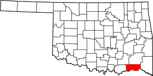 Choctaw County map | |
| Towns | ||
| CDPs | ||
| Other unincorporated communities | ||
| Indian reservation | ||
| Footnotes | ‡This populated place also has portions in another county or counties | |
| ||
