Messer, Oklahoma
Messer is an unincorporated community located on State Highway 93 in Choctaw County, Oklahoma, United States.[1][2]
Messer, Oklahoma | |
|---|---|
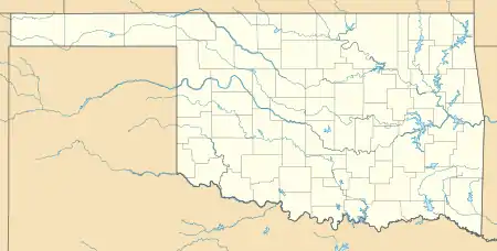 Messer Location within the state of Oklahoma  Messer Messer (the United States) | |
| Coordinates: 34°05′14″N 95°28′10″W | |
| Country | United States |
| State | Oklahoma |
| County | Choctaw |
| Time zone | UTC-6 (Central (CST)) |
| • Summer (DST) | UTC-5 (CDT) |
| GNIS feature ID | 1100629 |
A post office was established at Messer, Indian Territory on January 4, 1907. It closed on February 29, 1916.[3] At the time of its founding, Messer was located in Kiamitia County, a part of the Apukshunnubbee District of the Choctaw Nation.[4]
References
- Official State Highway Map (Map) (2005-2006 ed.). Oklahoma Department of Transportation. § O7.
- U.S. Geological Survey Geographic Names Information System: Messer, Oklahoma
- Shirk, George H. Oklahoma Place Names (Norman: University of Oklahoma, 1965), p. 139.
- Morris, John W. Historical Atlas of Oklahoma (Norman: University of Oklahoma, 1986), plate 38.
Municipalities and communities of Choctaw County, Oklahoma, United States | ||
|---|---|---|
| City | 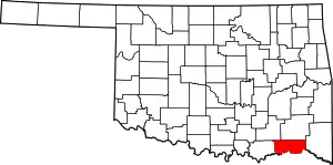 Choctaw County map | |
| Towns | ||
| CDPs | ||
| Other unincorporated communities | ||
| Indian reservation | ||
| Footnotes | ‡This populated place also has portions in another county or counties | |
| ||
This article is issued from Wikipedia. The text is licensed under Creative Commons - Attribution - Sharealike. Additional terms may apply for the media files.
