Gregoire Lake
Gregoire Lake is a lake in Alberta, Canada. It is part of the Athabasca River basin.
| Gregoire Lake | |
|---|---|
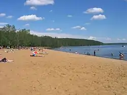 A beach at Gregoire Lake Provincial Park | |
 Gregoire Lake | |
| Location | Wood Buffalo, Alberta |
| Coordinates | 56°27′06″N 111°07′38″W |
| Type | eutrophic |
| Primary outflows | Gregoire River |
| Catchment area | 232 km2 (90 sq mi)[1] |
| Basin countries | Canada |
| Max. length | 9.3 km (5.8 mi) |
| Max. width | 4.6 km (2.9 mi) |
| Surface area | 25.8 km2 (10.0 sq mi)[1] |
| Average depth | 3.9 m (13 ft) |
| Max. depth | 7.2 m (24 ft) |
| Surface elevation | 480 m (1,570 ft) |
It is located in the wetlands of northern Alberta, adjacent to Highway 881, between Fort McMurray and Lac La Biche. It was known as "Willow Lake" until 1940 when the name was changed to "Gregoire Lake".[2]
The lake has a total area of 25.8 km2 (10.0 sq mi) and lies at an elevation of 480 m (1,570 ft). It has a maximum depth of 7.2 m (24 ft) and an average depth of 3.9 m (13 ft).[1]
Gregoire Lake Provincial Park is established on the northern shore of the lake, which is a traditional territory of Woodland Cree and Chipewyan First Nations.[2]
See also
- List of lakes in Alberta
References
- University of Alberta (2005). "Atlas of Alberta Lakes - Gregoire Lake". Archived from the original on 2011-07-19. Retrieved 2007-10-30.
- "Gregoire Lake". albertalakes.ualberta.ca. Retrieved 2019-12-28.
| Rivers | 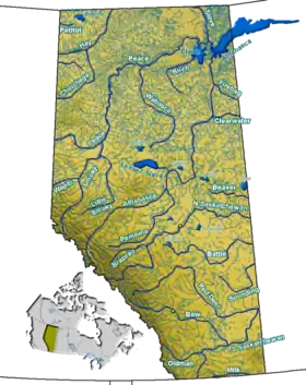 Rivers and lakes in Alberta | |
|---|---|---|
| Waterfalls | ||
| Lakes | ||
| Reservoirs | ||
| Glaciers | ||
| Other | ||
| Authority control |
|---|
This article is issued from Wikipedia. The text is licensed under Creative Commons - Attribution - Sharealike. Additional terms may apply for the media files.