Großrinderfeld
Großrinderfeld is a country town in southwestern Germany, in the state of Baden-Württemberg. It is located between Tauberbischofsheim and Würzburg.
Großrinderfeld | |
|---|---|
 Coat of arms | |
Location of Großrinderfeld within Main-Tauber-Kreis district 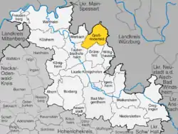 | |
 Großrinderfeld  Großrinderfeld | |
| Coordinates: 49°39′53″N 09°44′05″E | |
| Country | Germany |
| State | Baden-Württemberg |
| Admin. region | Stuttgart |
| District | Main-Tauber-Kreis |
| Government | |
| • Mayor | Anette Schmidt |
| Area | |
| • Total | 56.28 km2 (21.73 sq mi) |
| Elevation | 311 m (1,020 ft) |
| Population (2019-12-31)[1] | |
| • Total | 4,031 |
| • Density | 72/km2 (190/sq mi) |
| Time zone | UTC+01:00 (CET) |
| • Summer (DST) | UTC+02:00 (CEST) |
| Postal codes | 97950 |
| Dialling codes | 09349 / 09344 |
| Vehicle registration | TBB, MGH |
| Website | www.grossrinderfeld.de |
Großrinderfeld consists of the four villages of Großrinderfeld, Gerchsheim, Schönfeld and Ilmspan.
History
- Until 1803, Großrinderfeld belonged to the "Kurfürstentum Mainz", then it became part of the Grand Duchy of Baden
- On 25 July 1866 the area of Großrinderfeld and the village Gerchsheim were the place of one of the last combats of the Austro-Prussian War. The Prussians there defeated troops of the South-German allies of Austria during the Campaign of the Main.[2]
- In 1975 the three villages of Gerchsheim, Schönfeld und Ilmspan have been merged with Großrinderfeld to form greater Großrinderfeld
References
- "Bevölkerung nach Nationalität und Geschlecht am 31. Dezember 2019". Statistisches Landesamt Baden-Württemberg (in German). September 2020.
- Theodor Fontane: Der deutsche Krieg von 1866. Der Feldzug in West- und Mitteldeutschland. Berlin 1871. p. 222-227 digitalised
This article is issued from Wikipedia. The text is licensed under Creative Commons - Attribution - Sharealike. Additional terms may apply for the media files.