Gurrundah
Gurrundah is a locality in the Upper Lachlan Shire, New South Wales, Australia.[2] It lies on the eastern side of the Crookwell–Gunning road about 22 south of Crookwell and 26 km north of Gunning. At the 2016 census, it had a population of 55.[1]
| Gurrundah New South Wales | |||||||||||||||
|---|---|---|---|---|---|---|---|---|---|---|---|---|---|---|---|
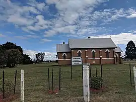 Church in Gurrundah | |||||||||||||||
Gurrundah Location in New South Wales | |||||||||||||||
| Coordinates | 34°39′42″S 149°24′22″E | ||||||||||||||
| Population | 55 (2016 census)[1] | ||||||||||||||
| Postcode(s) | 2581 | ||||||||||||||
| Location | |||||||||||||||
| LGA(s) | Upper Lachlan Shire | ||||||||||||||
| Region | Southern Tablelands | ||||||||||||||
| County | King | ||||||||||||||
| Parish | Lampton | ||||||||||||||
| State electorate(s) | Goulburn | ||||||||||||||
| Federal Division(s) | Hume | ||||||||||||||
| |||||||||||||||
References
- Australian Bureau of Statistics (27 June 2017). "Gurrundah". 2016 Census QuickStats. Retrieved 6 August 2017.

- "Gurrundah". Geographical Names Register (GNR) of NSW. Geographical Names Board of New South Wales. Retrieved 6 August 2017.
| Towns | |
|---|---|
| Localities and rural places |
|
Main Article: Local government areas of New South Wales | |
This article is issued from Wikipedia. The text is licensed under Creative Commons - Attribution - Sharealike. Additional terms may apply for the media files.
