Upper Lachlan Shire
Upper Lachlan Shire is a local government area in the Southern Tablelands region of New South Wales, Australia. The Shire was formed in February 2004 from Crookwell Shire and parts of Mulwaree, Gunning and Yass Shires.
| Upper Lachlan New South Wales | |||||||||||||||
|---|---|---|---|---|---|---|---|---|---|---|---|---|---|---|---|
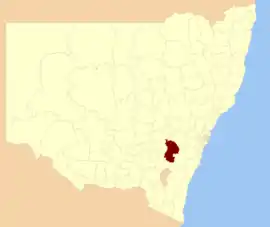 Location in New South Wales | |||||||||||||||
| Coordinates | 34°27′S 149°28′E | ||||||||||||||
| Population |
| ||||||||||||||
| • Density | 1.08350/km2 (2.8062/sq mi) | ||||||||||||||
| Established | 2004 | ||||||||||||||
| Area | 7,102 km2 (2,742.1 sq mi) | ||||||||||||||
| Mayor | John Stafford (Independent) | ||||||||||||||
| Council seat | Crookwell[3] | ||||||||||||||
| Region | Southern Tablelands | ||||||||||||||
| State electorate(s) | Goulburn | ||||||||||||||
| Federal Division(s) | Hume | ||||||||||||||
| Website | Upper Lachlan | ||||||||||||||
| |||||||||||||||
The Mayor of Upper Lachlan Shire Council is Cr. John Stafford, an unaligned politician.
Towns and localities
The shire includes the towns and bigger localities of:
and the smaller localities of:
- Bannaby
- Bannister
- Bellmount Forest (part)
- Bevendale
- Biala
- Big Hill
- Blakney Creek
- Brayton (part)
- Breadalbane
- Broadway
- Chatsbury
- Crooked Corner
- Cullerin
- Curraweela
- Currawang (part)
- Fullerton
- Golspie
- Greenwich Park (part)
- Gurrundah
- Jerrawa
- Lade Vale (part)
- Lerida (part)
- Limerick
- Lost River
- Merrill
- Myrtleville
- Middle Arm (part)
- Narrawa
- Oolong
- Peelwood
- Pejar
- Pomeroy
- Richlands
- Roslyn
- Stonequarry
- Tarlo (part)
- Tuena
- Wayo (part)
- Wheeo
- Wiarborough (part)
- Wollogorang (part)
- Wombeyan Caves (part)
- Woodhouselee (part)
- Yalbraith
Heritage listings
The Upper Lachlan Shire has a number of heritage-listed sites, including:
- Collector, 24 Church Street (Federal Highway): Bushranger Hotel[4]
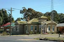
- Crookwell, Goulburn-Crookwell railway: Crookwell railway station [5]
- Gunning, Main Southern railway: Gunning railway station [6]
- Taralga, Macarthur Street: Catholic Church of Christ the King[7]
Council
Current composition and election method
Upper Lachlan Shire Council is composed of nine Councillors elected proportionally as one entire ward. All Councillors are elected for a fixed four-year term of office. The Mayor is elected by the Councillors at the first meeting of the Council. The most recent election was held on 10 September 2016, and the makeup of the Council is as follows:[8]
| Party | Councillors | |
|---|---|---|
| Independents and Unaligned | 9 | |
| Total | 9 | |
The current Council, elected in 2016, in order of election, is:[8]
| Councillor | Party | Notes | |
|---|---|---|---|
| Brian McCormack | Independent | ||
| Pam Kensit | Independent | ||
| John Searl | Independent | Deputy Mayor[9] | |
| Ron Cummins | Independent | ||
| Richard Opie | Independent | ||
| James Wheelwright | Unaligned | ||
| Darren O'Brien | Independent | ||
| John Stafford | Independent | Mayor[9] | |
| Paul Culhane | Independent | ||
References
- Australian Bureau of Statistics (27 June 2017). "Upper Lachlan Shire (A)". 2016 Census QuickStats. Retrieved 7 July 2017.

- "3218.0 – Regional Population Growth, Australia, 2017-18". Australian Bureau of Statistics. 27 March 2019. Retrieved 27 March 2019. Estimated resident population (ERP) at 30 June 2018.
- "Upper Lachlan Shire Council". Department of Local Government. Retrieved 28 November 2006.
- "The Ben Hall Sites - Bushranger Hotel". New South Wales State Heritage Register. Office of Environment and Heritage. H01827. Retrieved 18 May 2018.
- "Crookwell Railway Station and yard group". New South Wales State Heritage Register. Office of Environment and Heritage. H01124. Retrieved 18 May 2018.
- "Gunning Railway Station and yard group". New South Wales State Heritage Register. Office of Environment and Heritage. H01162. Retrieved 18 May 2018.
- "Catholic Church of Christ the King". New South Wales State Heritage Register. Office of Environment and Heritage. H01696. Retrieved 18 May 2018.
- "Upper Lachlan Shire Council: Summary of First Preference Votes for each Candidate". Local Government Elections 2016. Electoral Commission of New South Wales. 17 September 2016. Retrieved 19 October 2016.
- "Upper Lachlan Shire Council: New mayor and deputy mayor selected". Crookwell Gazette. 20 September 2018. Retrieved 18 February 2020.
| Towns | |
|---|---|
| Localities and rural places |
|
Main Article: Local government areas of New South Wales | |