Brayton, New South Wales
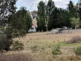
Brayton is a locality in the Southern Tablelands of New South Wales, Australia, in the Upper Lachlan Shire.[2][3] At the 2016 census, it had a population of 173.[1]
| Brayton New South Wales | |||||||||||||||
|---|---|---|---|---|---|---|---|---|---|---|---|---|---|---|---|
 | |||||||||||||||
Brayton Location in New South Wales | |||||||||||||||
| Coordinates | 34°38′57″S 149°58′02″E | ||||||||||||||
| Population | 173 (2016 census)[1] | ||||||||||||||
| Postcode(s) | 2579 | ||||||||||||||
| Location | |||||||||||||||
| LGA(s) | Upper Lachlan Shire | ||||||||||||||
| Region | Southern Tablelands | ||||||||||||||
| County | Argyle | ||||||||||||||
| Parish | Billyrambija | ||||||||||||||
| State electorate(s) | Goulburn | ||||||||||||||
| Federal Division(s) | Hume | ||||||||||||||
| |||||||||||||||
It was formerly known as Longreach, the name of a property granted to Peter Stuckey in the mid-1820s. The house he built with convict labour is made of sandstone from the area. Further information is in Early Colonial Houses of New South Wales by Rachel Roxburgh. Its name was changed to avoid confusion with the Queensland town of Longreach and apparently named after Lily Brayton, an English actress and singer.[2] It had a public school from 1859 to 1953. This includes periods when it was closed or operated as a "half-time" school.[4]
References
- Australian Bureau of Statistics (27 June 2017). "Brayton". 2016 Census QuickStats. Retrieved 9 August 2017.

- "Brayton". Geographical Names Register (GNR) of NSW. Geographical Names Board of New South Wales. Retrieved 10 August 2017.
- "Brayton". OpenStreetMap. Retrieved 10 August 2017.
- "Brayton Public School in the School history database search". New South Wales Department of Education. Retrieved 28 December 2017.
| Towns | |
|---|---|
| Localities and rural places |
|
Main Article: Local government areas of New South Wales | |
This article is issued from Wikipedia. The text is licensed under Creative Commons - Attribution - Sharealike. Additional terms may apply for the media files.