Halma, Minnesota
Halma is a city in Kittson County, Minnesota, United States. The population was 61 at the 2010 census.[6]
Halma | |
|---|---|
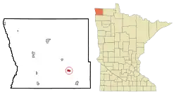 Location of Halma, Minnesota | |
| Coordinates: 48°39′35″N 96°35′55″W | |
| Country | United States |
| State | Minnesota |
| County | Kittson |
| Area | |
| • Total | 0.95 sq mi (2.45 km2) |
| • Land | 0.94 sq mi (2.43 km2) |
| • Water | 0.01 sq mi (0.02 km2) |
| Elevation | 997 ft (304 m) |
| Population | |
| • Total | 61 |
| • Estimate (2019)[3] | 61 |
| • Density | 65.10/sq mi (25.14/km2) |
| Time zone | UTC-6 (Central (CST)) |
| • Summer (DST) | UTC-5 (CDT) |
| ZIP code | 56729 |
| Area code(s) | 218 |
| FIPS code | 27-26612[4] |
| GNIS feature ID | 0644586[5] |
History
A post office called Halma began operation in 1904 and was closed in 2009.[7] According to the Federal Writers' Project, the name may be derived from the surname Holm.[8]
Geography
According to the United States Census Bureau, the city has a total area of 0.91 square miles (2.36 km2), of which 0.90 square miles (2.33 km2) is land and 0.01 square miles (0.03 km2) is water.[9]
Halma is located along U.S. Highway 59, near Kittson County Roads 7 and 20.
Demographics
| Historical population | |||
|---|---|---|---|
| Census | Pop. | %± | |
| 1930 | 129 | — | |
| 1940 | 158 | 22.5% | |
| 1950 | 177 | 12.0% | |
| 1960 | 115 | −35.0% | |
| 1970 | 96 | −16.5% | |
| 1980 | 97 | 1.0% | |
| 1990 | 73 | −24.7% | |
| 2000 | 78 | 6.8% | |
| 2010 | 61 | −21.8% | |
| 2019 (est.) | 61 | [3] | 0.0% |
| U.S. Decennial Census 2011 estimate | |||
2010 census
As of the census[2] of 2010, there were 61 people, 26 households, and 17 families living in the city. The population density was 67.8 inhabitants per square mile (26.2/km2). There were 34 housing units at an average density of 37.8 per square mile (14.6/km2). The racial makeup of the city was 95.1% White and 4.9% from two or more races.
There were 26 households, of which 42.3% had children under the age of 18 living with them, 42.3% were married couples living together, 7.7% had a female householder with no husband present, 15.4% had a male householder with no wife present, and 34.6% were non-families. 34.6% of all households were made up of individuals, and 7.6% had someone living alone who was 65 years of age or older. The average household size was 2.35 and the average family size was 2.88.
The median age in the city was 35.8 years. 29.5% of residents were under the age of 18; 6.6% were between the ages of 18 and 24; 27.9% were from 25 to 44; 29.6% were from 45 to 64; and 6.6% were 65 years of age or older. The gender makeup of the city was 50.8% male and 49.2% female.
2000 census
As of the census[4] of 2000, there were 78 people, 32 households, and 23 families living in the city. The population density was 83.9 people per square mile (32.4/km2). There were 38 housing units at an average density of 40.9 per square mile (15.8/km2). The racial makeup of the city was 100.00% White. Hispanic or Latino of any race were 1.28% of the population.
There were 32 households, out of which 31.3% had children under the age of 18 living with them, 62.5% were married couples living together, 3.1% had a female householder with no husband present, and 28.1% were non-families. 25.0% of all households were made up of individuals, and none had someone living alone who was 65 years of age or older. The average household size was 2.44 and the average family size was 2.78.
In the city, the population was spread out, with 28.2% under the age of 18, 6.4% from 18 to 24, 29.5% from 25 to 44, 24.4% from 45 to 64, and 11.5% who were 65 years of age or older. The median age was 33 years. For every 100 females, there were 122.9 males. For every 100 females age 18 and over, there were 133.3 males.
The median income for a household in the city was $27,917, and the median income for a family was $28,750. Males had a median income of $25,000 versus $21,000 for females. The per capita income for the city was $13,541. There were no families and 5.7% of the population living below the poverty line, including no under eighteens and none of those over 64.
References
- "2019 U.S. Gazetteer Files". United States Census Bureau. Retrieved July 26, 2020.
- "U.S. Census website". United States Census Bureau. Retrieved 2012-11-13.
- "Population and Housing Unit Estimates". United States Census Bureau. May 24, 2020. Retrieved May 27, 2020.
- "U.S. Census website". United States Census Bureau. Retrieved 2008-01-31.
- "US Board on Geographic Names". United States Geological Survey. 2007-10-25. Retrieved 2008-01-31.
- "2010 Census Redistricting Data (Public Law 94-171) Summary File". American FactFinder. U.S. Census Bureau, 2010 Census. Retrieved 23 April 2011.
- "Post offices in Halma, Minn., and Pisek, N.D., head for closure". Grand Forks Herald. Retrieved 1 November 2019.
- Federal Writers' Project (31 October 2013). The WPA Guide to Minnesota: The North Star State. WPA. p. 423. ISBN 978-1-59534-221-8.
- "US Gazetteer files 2010". United States Census Bureau. Retrieved 2012-11-13.
Municipalities and communities of Kittson County, Minnesota, United States | ||
|---|---|---|
| Cities | 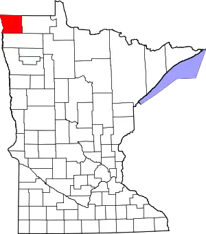 Map of Minnesota highlighting Kittson County | |
| Townships | ||
| Unorganized territories | ||
| Unincorporated communities | ||
| Ghost town | ||
| ||