Handeni District
Handeni District is one of the 10 districts of Tanga Region in Tanzania. It is bordered to the west by the Kilindi District and the Handeni Urban District, to the north by the Korogwe District, to the east by the Pangani District, and to the south by the Pwani Region. It split in 2002 form the Kilindi District. The administrative capital of the district is Handeni town.
Handeni District
Wilaya ya Handeni (Swahili) | |
|---|---|
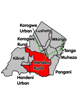 Location within Tanga Region (red) | |
| Country | Tanzania |
| Zone | Northern |
| Region | Tanga |
| Capital | Handeni |
| Government | |
| • District Commissioner | Godwin Gondwe |
| Area | |
| • Total | 7,366.41 km2 (2,844.19 sq mi) |
| Population (2012) | |
| • Total | 276,646 |
| • Density | 38/km2 (97/sq mi) |
| Time zone | UTC+3 (EAT) |
| Postcode | 218xx |
| Area code(s) | 027 |
| Website | www |
According to the 2002 Tanzania National Census, the population of the Handeni District was 248,633.[1]
According to the 2012 census, the population had increased to: 276,646. [2]
Administrative subdivisions
As of 2012, Handeni District Council was administratively divided into 20 wards.[2]
Wards
- Kabuku
- Kabuku ndani
- Kang'ata
- Kiva
- Komkonga
- Kwachaga
- Kwaluguru
- Kwamatuku
- Kwamgwe
- Kwamkonje
- Kwamsisi
- Kwasunga
- Kwedizinga
- Mazingara
- Mgambo
- Misima
- Mkata
- Ndolwa
- Segera
- Sindeni
Culture
The dramatic open area to the north of Handeni at the foot of the Maasai Steppe was the setting for Ernest Hemingway's classic hunting book, Green Hills of Africa.
References
- "Archived copy". Archived from the original on 9 August 2007. Retrieved 18 September 2007.CS1 maint: archived copy as title (link)
- "2012 Population and Housing Census" (PDF). Development Partners Group Tanzania. Retrieved 7 August 2019.