Korogwe District
Korogwe Rural District (or Korogwe District Council) is one of the ten districts of Tanga Region in Tanzania. It is bordered to the north by the Lushoto District, to the east by the Mkinga District and the Muheza District, to the South by the Handeni Rural District and the Korogwe Urban District, and to the West by the Kilimanjaro Region.
Korogwe District
Wilaya ya Korogwe (Swahili) | |
|---|---|
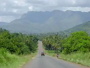 Trunk road heading towards Korogwe | |
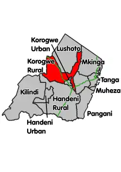 Location within Tanga Region (red) | |
| Country | Tanzania |
| Zone | Northern |
| Region | Tanga |
| Capital | Korogwe |
| Government | |
| • District Commissioner | Erasto Sima |
| Area | |
| • Total | 3,428.43 km2 (1,323.72 sq mi) |
| Population (2012) | |
| • Total | 242,038 |
| • Density | 71/km2 (180/sq mi) |
| Time zone | UTC+3 (EAT) |
| Postcode | 216xx |
| Area code(s) | 027 |
| Website | District website |
According to the 2012 Tanzania National Census, the population of Korogwe Rural District was 242,038.[1]
Administrative subdivisions
As of 2012, Korogwe Rural District was administratively divided into 20 wards.[1]
References
- "2012 Population and Housing Census" (PDF). Development Partners Group Tanzania. Retrieved 7 August 2019.
This article is issued from Wikipedia. The text is licensed under Creative Commons - Attribution - Sharealike. Additional terms may apply for the media files.