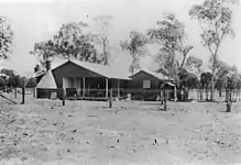
Hannaford, Queensland
Hannaford is a rural locality in the Western Downs Region, Queensland, Australia.[2] In the 2016 census Hannaford had a population of 118 people.[1]
| Hannaford Queensland | |||||||||||||||
|---|---|---|---|---|---|---|---|---|---|---|---|---|---|---|---|
 Hannaford | |||||||||||||||
| Coordinates | 27.4272°S 150.0033°E | ||||||||||||||
| Population | 118 (2016 census)[1] | ||||||||||||||
| • Density | 0.1040/km2 (0.2693/sq mi) | ||||||||||||||
| Postcode(s) | 4406 | ||||||||||||||
| Area | 1,134.8 km2 (438.1 sq mi) | ||||||||||||||
| Time zone | AEST (UTC+10:00) | ||||||||||||||
| LGA(s) | Western Downs Region | ||||||||||||||
| State electorate(s) | Warrego | ||||||||||||||
| Federal Division(s) | Maranoa | ||||||||||||||
| |||||||||||||||
Geography

Hannaford is flat land used for agriculture. The Surat Developmental Road passes through the locality from east to west. The Glenmorgan railway line also passes through the locality from east (The Gums) to west (Meandarra); Hannaford railway station (27.3264°S 150.0650°E) serves the locality.[3][4]
History
Hannaford railway station was named on 14 July 1924 by the Queensland Railways Department taking the name of the parish, which in turn was named after pastoralist Samuel Hannaford, who leased the North Inglestone pastoral run.[4]
Hannaford Provisional School opened on 4 March 1929 but closed on 29 August 1930. It reopened on 17 March 1947 and became Hannaford State School in 1948.[5]
Hannaford Post Office opened around 1934. It remains open as a community postal agent.[6][7]
In the 2016 census Hannaford had a population of 118 people.[1]
Education
Hannaford State School is a government primary (Prep-6) school for boys and girls at Hannaford Road (27.3404°S 150.0607°E).[8][9] In 2015, the school had an enrolment of 9 students with 2 teachers (1 full-time equivalent) and 4 non-teaching staff (2 full-time equivalent).[10] In 2018, the school had an enrolment of 23 students with 3 teachers (2 full-time equivalent) and 5 non-teaching staff (2 full-time equivalent).[11]
References
- Australian Bureau of Statistics (27 June 2017). "Hannaford (SSC)". 2016 Census QuickStats. Retrieved 20 October 2018.

- "Hannaford – locality in Western Downs Region (entry 47709)". Queensland Place Names. Queensland Government. Retrieved 29 December 2020.
- "Queensland Globe". State of Queensland. Retrieved 19 September 2017.
- "Hannaford – railway station in Western Downs Region (entry 15331)". Queensland Place Names. Queensland Government. Retrieved 6 June 2019.
- Queensland Family History Society (2010), Queensland schools past and present (Version 1.01 ed.), Queensland Family History Society, ISBN 978-1-921171-26-0
- Premier Postal History. "Post Office List". Premier Postal Auctions. Retrieved 19 September 2017.
- "Hannaford CPA". Australia Post. Retrieved 29 September 2017.
- "State and non-state school details". Queensland Government. 9 July 2018. Archived from the original on 21 November 2018. Retrieved 21 November 2018.
- "Hannaford State School". Retrieved 21 November 2018.
- "Annual Report 2016" (PDF). Hannaford State School. Archived (PDF) from the original on 19 September 2017. Retrieved 19 September 2017.
- "ACARA School Profile 2018". Australian Curriculum, Assessment and Reporting Authority. Retrieved 28 January 2020.