Hatta, United Arab Emirates
Hatta (Arabic: حتا) is the inland exclave of the emirate of Dubai in the United Arab Emirates.
Hatta
حتا | |
|---|---|
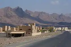 Hatta with Al Hajar Mountains in the background | |
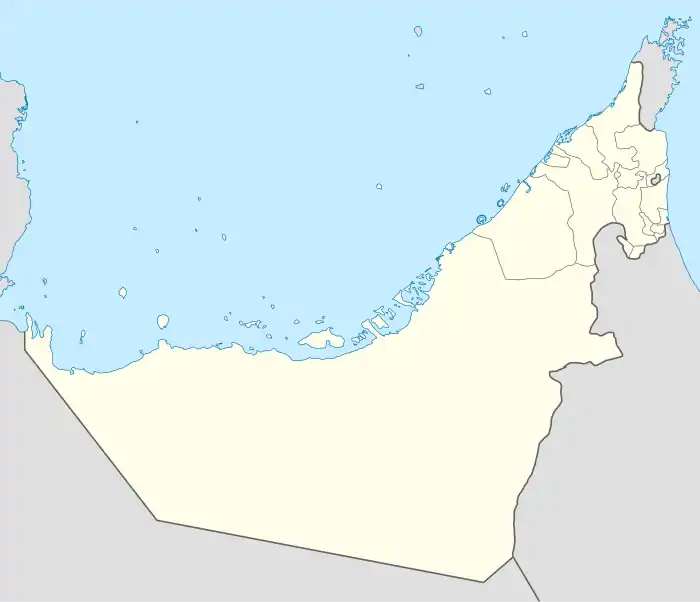 Hatta Location of Hatta within the UAE | |
| Coordinates: 24°47′48″N 56°07′03″E | |
| Country | |
| Emirate | |
| Area | |
| • Total | 140 km2 (50 sq mi) |
| Elevation | 330 m (1,082 ft) |
| Population (2016) | |
| • Total | 12,200 |
Geography
It lies to the south-east of Dubai's main territory and is about 134 km (83 mi) east of Dubai. It is located relatively high in the Hajar Mountains.[1] It borders Oman to the east and the south, the Ajman exclave of Masfout to the west, and Ras al-Khaimah to the north.
History
Previously known as Hajarain, Hatta became a dependency of Dubai during the reign of Hasher Bin Maktoum after the Omani Sultan Turki bin Said transferred the territory, finding himself unable to defend it against the Na'im of Buraimi, who had settled neighbouring Masfout (today a part of the emirate of Ajman).[2][3] The village was still called Hajarain as recently as 1906.[4]
The old village of Hatta includes two prominent military towers from the 1880s,[5] a fort from 1896[5] and the Juma mosque, which was built in 1780 and is the oldest building in Hatta. The traditional water supply was through the falaj system, which also has been restored.[5] Since it is located in the mountains, traditionally it was the summer habitation of Dubai-based families escaping the heat and humidity of the coast.
Since the early 1980s, Hatta has been a popular destination for adventuring western immigrants and local families alike 'wadi bashing' through the tracks between Hatta, Mahdah and Al Ain.[6]
Economy
Hatta's main economic factor is tourism and water. Historically the area was able to grow date palms; the fruits were used as a food source, while the tree was used for building material.[5] It has a popular heritage village, including a collection of reconstructed traditional mountain dwellings and is popular for weekend getaways with both people camping in the winter months or staying at the Hatta Fort Hotel,[5][7][8] which is located only 2.7 km (1.7 mi) from away from Hatta Dam.
Hatta Dam was built in 1990s to supply the area with electricity and water.[5] Hatta Kayak is a popular tourist destination and a favourite spot for kayaking in UAE.[9] Dubai Electricity and Water Authority (DEWA) plans a 250 MW pumped-storage hydroelectricity at Hatta using 880 million gallons of water 300 metres (980 ft) above a lower dam.[10]
Sports
It is home to football side Hatta Club.
Gallery
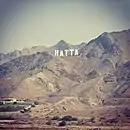 The sign in the rocks at Hatta
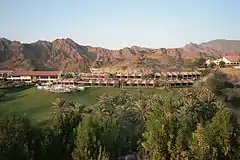 Hatta Fort Hotel
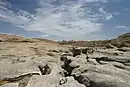 Hatta pools
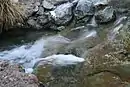 Spring water in Hatta
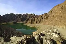 Hatta Dam
 Hatta Dam Kayaking
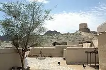 Hatta Heritage Village
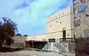 Hatta Fort
References
- "About Hatta in Dubai, UAE". usatoday.com. Retrieved 12 April 2017.
- Lorimer, John (1915). Gazetteer of the Persian Gulf. British Government, Bombay. p. 752.
- Heard-Bey, Frauke (2005). From Trucial States to United Arab Emirates : a society in transition. London: Motivate. p. 433. ISBN 1860631673. OCLC 64689681.
- Lorimer, John (1915). Gazetteer of the Persian Gulf Vol II. British Government, Bombay. p. 454.
- "Visit Hatta Heritage Village". visitdubai.com. Retrieved 9 June 2019.
- "Things to do in Hatta - UAE". visitdubai.com. Retrieved 12 April 2017.
- "Hatta Heritage Village". dubaiculture.gov.ae. Archived from the original on 12 March 2016. Retrieved 12 April 2017.
- "Dubai Mountain Resort - JA Hatta Fort Hotel". jaresortshotels.com. Retrieved 12 April 2017.
- "Hatta Dam". visitdubai.com. Retrieved 12 April 2017.
- "Dubai to build Persian Gulf's first hydroelectric plant, 880 million gallon 'battery'". Electrek. 23 December 2016. Retrieved 24 December 2016.
External links
![]() Media related to Hatta at Wikimedia Commons
Media related to Hatta at Wikimedia Commons
- Data Dubai: Hatta’s history at the Wayback Machine (archived August 22, 2007)
- Department of Tourism and Commerce Marketing, Government of Dubai: Historical Sites — Hatta Village at the Wayback Machine (archived February 16, 2008)
| Cities |  | |
|---|---|---|
| Towns | ||
| Townships | ||
| Settlements |
| |
| Exclaves | ||