Henderson, Minnesota
Henderson is a city in Sibley County, Minnesota, United States. The population in was 886 at the 2010 census.[6]
Henderson | |
|---|---|
 | |
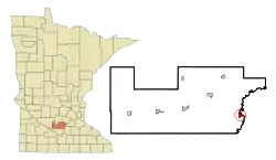 Location of Henderson within Sibley County, Minnesota | |
| Coordinates: 44°31′44″N 93°54′28″W | |
| Country | United States |
| State | Minnesota |
| County | Sibley |
| Government | |
| • Type | Mayor-council |
| • Mayor | Paul Menne |
| Area | |
| • Total | 1.10 sq mi (2.86 km2) |
| • Land | 1.07 sq mi (2.78 km2) |
| • Water | 0.03 sq mi (0.08 km2) |
| Elevation | 420 ft (69 m) |
| Population | |
| • Total | 886 |
| • Estimate (2019)[3] | 930 |
| • Density | 865.92/sq mi (334.23/km2) |
| Time zone | Central (CST) |
| ZIP code | 56044 |
| Area code(s) | 507 |
| FIPS code | 27-28394[4] |
| GNIS feature ID | 0644862[5] |
| Website | www |
History
Henderson was founded in August 1852 by Joseph R. Brown, and was named for his mother's maiden name.[7]
By 1855, Henderson had become a fast-growing city. It harbored more than 60 buildings, including a hotel, a warehouse, a steam sawmill, as well as Brown's house which functioned as a boarding house, a store and a residence for the Brown family.
In the following years, Henderson quickly became a major distribution center for the inland settlements surrounding the Minnesota River Valley.
By the mid-1860s, Henderson had two major brickyards, The Mattei and Schwartz Brickyard, who both contributed heavily to the early 1900s brick-style buildings still present in Henderson today.
The seat for Sibley County was originally established in Henderson, and an imposing courthouse was erected, being put into service in 1879. However, pressure from residents of Gaylord, from as far back as 1887, to gain the county seat precipitated a county-wide vote in 1915. That vote resulted in Gaylord gaining the seat; this caused around 200 residents to leave Henderson, a major decline in the city's population. Throughout the 50 years after this population loss, Henderson's economy became increasingly more centered on agriculture. Its success in transitioning to agriculture brought rise to the present Sauerkraut Days celebration.[8][9] The former courthouse, now designated 'Henderson Community Building', houses Henderson City offices.[10]
Museums & Library
Henderson has two museums and one public library.
- Sibley County Historical Museum: Operated by the Sibley County Historical Society
- J.R. Brown Minnesota River Center: Operated by the Joseph R. Brown Heritage Society
- Henderson Public Library: Henderson is member of the Traverse des Sioux Library Cooperative.
Area parks & wildlife refuges
Allanson's Park
In 1855, the town founder, J.R. Brown designated the land for future use as a public park. This land became Allanson's Park, which today has 15+ camping sites for tents, campers and RV's, a picnic shelter and playground.[10]
Bender Park
Bender Park is a city park that has a large multi-purpose shelter where the Henderson's Sauerkraut Days is held. It also has a two baseball fields and a concession stand. It is the home field to the Le Sueur-Henderson High School Girls Fast pitch team.[11]
Henderson Hummingbird Garden
The Henderson Hummingbird Garden was established as a part of the Henderson Hummingbird Hurrah and is located in Bender Park.
High Island Park
High Island Creek Park is 220 acres with over 6 miles of trails and camping opportunities.[12]
Rush River Park
Rush River Park is 285 acres with over 12 miles of trails with a picnic shelter and camping areas.[13] It is a popular horseback riding destination.
Ney Nature Center
The Ney Nature Center is 446 acres.[14] It provides year-round outdoor activities and indoor programing.
Minnesota Valley National Wildlife Refuge
The Minnesota Valley National Wildlife Refuge[15] is over 70 miles long, stretching from Bloomington, MN to Henderson, MN. The size of The Refuge is currently over 14,000 acres. The Refuge is managed by the US Fish and Wildlife Service. Approximately 50% of Henderson borders the Refuge.[16]
Notable people
- Joseph R. Brown – Minnesota and Wisconsin Territorial legislator & Town Founder
- Jerry Dempsey – Minnesota State Legislator (1993-2006)
- Terry Dempsey – Minnesota State Legislator (1978–1992); State District Court judge (1992–2002)
- Donald J.McGuire - Lakeville School District Superintendent (1960-1982); McGuire Middle School named in his honor; Director Dakota County Technical College (1982-1989); US Navy 1946-1947[17]
- Michael E. McGuire - Minnesota State Legislator (1955-1966); US Army wounded Normandy Campaign and Battle of the Bulge, Purple Heart Recipient [18]
- Michael P. McGuire - 5-term Mayor Montgomery, MN; Owner McGuire Landscaping; Board of Directors Ney Nature Center [19]
- Ray Oldenburg – Urban sociologist
- Matthias M. Simmer - Early photographer and jeweler in Henderson (b. 1857, d. 1908); Studio camera & work in collection of Sibley County Historical Society
- Edward T. Young - Minnesota Attorney General and state legislator
- Jeff Bertrang - Brigadier General (Retired), Minnesota Army National Guard
- Cora Koester - Mayor [20]
Schools & School District
The local school district is Independent School District 2397 and operates three facilities. It is the consolidated district of ISD 734 (Henderson) and ISD 393 (Le Sueur) which consolidated in 1992.
- Park Elementary: Park is located in Le Sueur with grades K-3
- Hilltop Elementary: Hilltop is located in Henderson and is a 4-5 STEM elementary school
- Le Sueur-Henderson High School: The middle school/high school is located in Le Sueur with grades 6-12.
Minnesota New County School: MNCS is a Minnesota Public Charter School, operating two sites and utilizes project-based learning. The MNCS Elementary, also known as the “1900 Building” site, teaches grades K-5. The MNCS High School is located on Main Street and teaches grades 6-12.
EdVisions Off-Campus High School: Also known as EOC, is a Minnesota Public Charter School was formed in Henderson. It is an online high school that utilizes project based learning with student enrollment from all over Minnesota.
Politics
Henderson is in Minnesota's 7th congressional district, represented by Colin Peterson (DFL). It is in Minnesota Senate district 18, represented by Scott Newman (R), and Minnesota House district 18B, represented by Glenn Gruenhagen (R).
Geography
According to the United States Census Bureau, the city has a total area of 1.09 square miles (2.82 km2); 1.06 square miles (2.75 km2) is land and 0.03 square miles (0.08 km2) is water.[21]
Minnesota State Highways 19 and 93 are two of the main routes in the community. U.S. Highway 169 is nearby.
Demographics
| Historical population | |||
|---|---|---|---|
| Census | Pop. | %± | |
| 1870 | 706 | — | |
| 1880 | 964 | 36.5% | |
| 1890 | 909 | −5.7% | |
| 1900 | 904 | −0.6% | |
| 1910 | 753 | −16.7% | |
| 1920 | 766 | 1.7% | |
| 1930 | 672 | −12.3% | |
| 1940 | 820 | 22.0% | |
| 1950 | 762 | −7.1% | |
| 1960 | 728 | −4.5% | |
| 1970 | 730 | 0.3% | |
| 1980 | 739 | 1.2% | |
| 1990 | 746 | 0.9% | |
| 2000 | 910 | 22.0% | |
| 2010 | 886 | −2.6% | |
| 2018 (est.) | 929 | [22] | 4.9% |
| US Decennial Census[23] | |||
As of 2000 the median income for a household in the city was $43,125, and the median income for a family was $49,091. Males had a median income of $31,736 versus $25,688 for females. The per capita income for the city was $17,544. About 4.7% of families and 6.6% of the population were below the poverty line, including 8.7% of those under age 18 and 9.7% of those age 65 or over.
2010 census
As of the 2010 United States Census,[2] there were 886 people, 377 households, and 236 families residing in the city. The population density was 835.8 inhabitants per square mile (322.7/km2). There were 405 housing units at an average density of 382.1 per square mile (147.5/km2). The racial makeup of the city was 97.5% White, 0.2% Asian, 1.4% from other races, and 0.9% from two or more races. Hispanic or Latino of any race were 2.5% of the population.
There were 377 households, of which 29.7% had children under the age of 18 living with them, 50.4% were married couples living together, 7.4% had a female householder with no husband present, 4.8% had a male householder with no wife present, and 37.4% were non-families. 30.5% of all households were made up of individuals, and 15.4% had someone living alone who was 65 years of age or older. The average household size was 2.35 and the average family size was 2.95.
The median age in the city was 39.5 years. 23.4% of residents were under the age of 18; 6.7% were between the ages of 18 and 24; 27.1% were from 25 to 44; 27.1% were from 45 to 64; and 15.6% were 65 years of age or older. The gender makeup of the city was 47.9% male and 52.1% female.
References
- "2019 U.S. Gazetteer Files". United States Census Bureau. Retrieved July 26, 2020.
- "U.S. Census website". US Census Bureau. Retrieved November 13, 2012.
- "Population and Housing Unit Estimates". United States Census Bureau. May 24, 2020. Retrieved May 27, 2020.
- "U.S. Census website". United States Census Bureau. Retrieved January 31, 2008.
- "US Board on Geographic Names". US Geological Survey. October 25, 2007. Retrieved January 31, 2008.
- "Our Estimates". MN State Demographic Center. Retrieved January 29, 2020.
- Upham, Warren (1920). Minnesota Geographic Names: Their Origin and Historic Significance. Minnesota Historical Society. p. 519.
- "Heritage Preservation Commission". henderson-mn.com. Retrieved December 7, 2016.
- "Henderson Sauerkraut Days June 24, 25, 26 2016". hendersonmn.com. Retrieved December 7, 2016.
- Visitors Page Henderson website (accessed December 6, 2018)
- "Visitors". Welcome to Henderson, MN. Retrieved January 31, 2020.
- "Welcome to Sibley County, Minnesota". www.co.sibley.mn.us. Retrieved January 31, 2020.
- "Welcome to Sibley County, Minnesota". www.co.sibley.mn.us. Retrieved January 31, 2020.
- "Welcome To Ney Nature Center". Ney Nature Center. Retrieved January 31, 2020.
- "About the Refuge and the Wetland Management District - Minnesota Valley - U.S. Fish and Wildlife Service". www.fws.gov. Retrieved January 31, 2020.
- "ArcGIS Web Application". sibleycounty.maps.arcgis.com. Retrieved January 31, 2020.
- https://www.startribune.com/don-mcguire-led-dakota-county-schools/98676194/
- https://www.leg.mn.gov/legdb/fulldetail?id=12251
- https://www.mankatofreepress.com/news/local_news/montgomery-mayor-to-run-for-district-25a-house-seat/article_9000ce3c-801e-5318-817d-3ffcdce7470e.html
- tkrohn@mankatofreepress.com, Tim Krohn. "New Ulm superintendent inducted into ROTC Hall of Fame". Mankato Free Press. Retrieved January 29, 2020.
- "US Gazetteer files 2010". US Census Bureau. Archived from the original on January 12, 2012. Retrieved November 13, 2012.
- "Population and Housing Unit Estimates". Retrieved February 25, 2020.
- "Census of Population and Housing". Census.gov. Retrieved June 4, 2015.
External links
Municipalities and communities of Sibley County, Minnesota, United States | ||
|---|---|---|
| Cities | 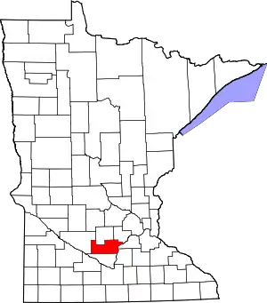 Map of Minnesota highlighting Sibley County | |
| Townships | ||
| Unincorporated communities | ||
| Footnotes | ‡This populated place also has portions in an adjacent county or counties | |
| ||
| Authority control |
|---|