Hillsview, South Dakota
Hillsview is a town in McPherson County, South Dakota, United States. The population was 3 at the 2010 census. Hillsview is the least-populated municipality in South Dakota.[6]
Hillsview, South Dakota | |
|---|---|
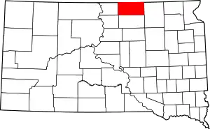
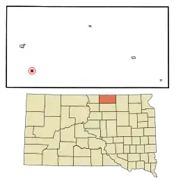 Location in McPherson County and the state of South Dakota | |
| Coordinates: 45°40′4″N 99°33′38″W | |
| Country | United States |
| State | South Dakota |
| County | McPherson |
| Founded | 1887[1] |
| Area | |
| • Total | 0.64 sq mi (1.67 km2) |
| • Land | 0.64 sq mi (1.65 km2) |
| • Water | 0.01 sq mi (0.02 km2) |
| Elevation | 1,850 ft (564 m) |
| Population | |
| • Total | 3 |
| • Estimate (2019)[4] | 3 |
| • Density | 4.71/sq mi (1.82/km2) |
| Time zone | UTC-6 (Central (CST)) |
| • Summer (DST) | UTC-5 (CDT) |
| ZIP code | 57437 |
| Area code(s) | 605 |
| FIPS code | 46-29340 |
| GNIS feature ID | 1261018[5] |
The town was so named on account of its lofty elevation.[7]
Geography
According to the United States Census Bureau, the town has a total area of 0.65 square miles (1.68 km2), of which 0.64 square miles (1.66 km2) is land and 0.01 square miles (0.03 km2) is water.[8]
Demographics
| Historical population | |||
|---|---|---|---|
| Census | Pop. | %± | |
| 1930 | 101 | — | |
| 1940 | 160 | 58.4% | |
| 1950 | 68 | −57.5% | |
| 1960 | 44 | −35.3% | |
| 1970 | 19 | −56.8% | |
| 1980 | 9 | −52.6% | |
| 1990 | 4 | −55.6% | |
| 2000 | 3 | −25.0% | |
| 2010 | 3 | 0.0% | |
| 2019 (est.) | 3 | [4] | 0.0% |
| U.S. Decennial Census[9] 2013 Estimate[10] | |||
2010 census
As of the census[3] of 2010, there were 3 people, 1 households, and 1 families residing in the town. The population density was 4.7 inhabitants per square mile (1.8/km2). There were 2 housing units at an average density of 3.1 per square mile (1.2/km2). The racial makeup of the town was 100.0% White.
There was 1 household of which 100.0% was married couples living together. 0.0% of all households were made up of individuals. The average household size was 3.00 and the average family size was 3.00.
The median age in the town was 53.5 years. 0.0% of residents were under the age of 18; 33.3% were between the ages of 18 and 24; 0.0% were from 25 to 44; 66.7% were from 45 to 64; and 0.0% were 65 years of age or older. The gender makeup of the town was 33.3% female and 66.7% male.
2000 census
As of the census of 2000, there were 3 people, 1 household, and 1 family residing in the town. The population density was 4.7 people per square mile (1.8/km2). There were 2 housing units at an average density of 3.1 per square mile (1.2/km2). The racial makeup of the town was 100% White.
There was 1 household, a married couple living together. The household size was 3 and the family size was 3.
In the town, the population was spread out, with 33.3% from 25 to 44, 33.3% from 45 to 64, and 33.3% who were 65 years of age or older. The median age was 64 years. There were 2 men and 1 woman.
References
- "SD Towns" (PDF). South Dakota State Historical Society. Archived from the original (PDF) on 2010-02-10. Retrieved 2010-02-13.
- "2019 U.S. Gazetteer Files". United States Census Bureau. Retrieved July 30, 2020.
- "U.S. Census website". United States Census Bureau. Retrieved 2012-06-21.
- "Population and Housing Unit Estimates". United States Census Bureau. May 24, 2020. Retrieved May 27, 2020.
- "US Board on Geographic Names". United States Geological Survey. 2007-10-25. Retrieved 2008-01-31.
- Rivero, Nicolas (25 August 2017). "The Smallest Town in Each of the 50 States". Mental Floss. Retrieved 25 June 2018.
- Federal Writers' Project (1940). South Dakota place-names, v.1-3. University of South Dakota. p. 43.
- "US Gazetteer files 2010". United States Census Bureau. Archived from the original on January 12, 2012. Retrieved 2012-06-21.
- United States Census Bureau. "Census of Population and Housing". Retrieved September 21, 2013.
- "Population Estimates". United States Census Bureau. Archived from the original on 2014-05-22. Retrieved 2014-07-20.