Honea Path, South Carolina
Honea Path is a town primarily in Anderson County, South Carolina and extending into Abbeville County in the northwest part of the state. The population was 3,597 at the 2010 census.[5]
Honea Path, South Carolina | |
|---|---|
| Nickname(s): "The land flowing with milk and honey" | |
| Motto(s): "Little town with a big heart." | |
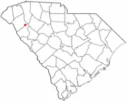 Location of Honea Path, South Carolina | |
| Coordinates: 34°26′51″N 82°23′35″W | |
| Country | United States |
| State | South Carolina |
| Counties | Abbeville, Anderson |
| Area | |
| • Total | 3.51 sq mi (9.10 km2) |
| • Land | 3.51 sq mi (9.10 km2) |
| • Water | 0.00 sq mi (0.00 km2) |
| Elevation | 791 ft (241 m) |
| Population (2010) | |
| • Total | 3,597 |
| • Estimate (2019)[2] | 3,826 |
| • Density | 1,088.79/sq mi (420.44/km2) |
| Time zone | UTC-5 (Eastern (EST)) |
| • Summer (DST) | UTC-4 (EDT) |
| ZIP code | 29654 |
| Area code(s) | 864 |
| FIPS code | 45-34810[3] |
| GNIS feature ID | 1246035[4] |
| Website | Town website |
Geography
Honea Path is located at 34°26′51″N 82°23′35″W (34.447400, -82.393044).[6]
According to the United States Census Bureau, the town has a total area of 3.6 square miles (9.4 km2), all land.
Honea Path has many lakes and creeks: towards Anderson on Highway 252 is Blue Barker Creek (aka, Blue Creek) and Barkers Creek, and towards Princeton on Highway 76 is Broad Mouth Creek.
Demographics
| Historical population | |||
|---|---|---|---|
| Census | Pop. | %± | |
| 1880 | 228 | — | |
| 1890 | 365 | 60.1% | |
| 1900 | 617 | 69.0% | |
| 1910 | 1,763 | 185.7% | |
| 1920 | 1,900 | 7.8% | |
| 1930 | 2,740 | 44.2% | |
| 1940 | 2,765 | 0.9% | |
| 1950 | 2,840 | 2.7% | |
| 1960 | 3,453 | 21.6% | |
| 1970 | 3,707 | 7.4% | |
| 1980 | 4,114 | 11.0% | |
| 1990 | 3,841 | −6.6% | |
| 2000 | 3,504 | −8.8% | |
| 2010 | 3,597 | 2.7% | |
| 2019 (est.) | 3,826 | [2] | 6.4% |
| U.S. Decennial Census[7] | |||
As of the census[3] of 2000, there were 3,504 people, 1,535 households, and 1,037 families residing in the town. The population density was 1,004.1 people per square mile (387.7/km2). There were 1,681 housing units at an average density of 481.7 per square mile (186.0/km2). The racial makeup of the town was 79.02% White, 19.55% African American, 0.17% Native American, 0.20% Asian, 0.06% Pacific Islander, 0.26% from other races, and 0.74% from two or more races. Hispanic or Latino of any race were 1.00% of the population.
There were 1,535 households, out of which 25.0% had children under the age of 18 living with them, 45.5% were married couples living together, 18.2% had a female householder with no husband present, and 32.4% were non-families. 30.2% of all households were made up of individuals, and 16.9% had someone living alone who was 65 years of age or older. The average household size was 2.25 and the average family size was 2.75.
In the town, the population was spread out, with 21.8% under the age of 18, 7.9% from 18 to 24, 23.5% from 25 to 44, 24.5% from 45 to 64, and 22.3% who were 65 years of age or older. The median age was 42 years. For every 100 females, there were 84.5 males. For every 100 females age 18 and over, there were 81.6 males.
The median income for a household in the town was $30,938, and the median income for a family was $38,980. Males had a median income of $28,635 versus $24,107 for females. The per capita income for the town was $17,643. About 10.9% of families and 14.9% of the population were below the poverty line, including 16.5% of those under age 18 and 21.4% of those age 65 or over.
History
In an area of textile mills developed in the early 20th century, Honea Path was the site of a violent confrontation between textile union workers and company management on September 6, 1934 during a larger textile strike and efforts at labor organizing. Textile factory guards killed six picketers and injured approximately twenty more in the altercation. The men were reported to have been shot fleeing the picket lines, and many were found with bullet wounds in their backs.[8] This event is featured in the Public Broadcasting Service (PBS) documentary on the POV series called "The Uprising of '34".[9] An historical photo essay entitled "Mill Town Murder" is online at Beacham Journal . Here: https://www.beachamjournal.com/journal/2014/08/its-the-80th-anniversary-of-the-chiquola-mill-massacre-in-honea-path-south-carolina.html
The Obediah Shirley House was listed on the National Register of Historic Places in 1999.[10]
Education
Public education in Honea Path is administered by Anderson School District Two. The district operates Honea Path Elementary School, Honea Path Middle School, and Belton-Honea Path High School.[11] Whispering Pines Mennonite School is a private institution.
Honea Path has a public library, a branch of the Anderson County Library System.[12]
References
- "2019 U.S. Gazetteer Files". United States Census Bureau. Retrieved July 29, 2020.
- "Population and Housing Unit Estimates". United States Census Bureau. May 24, 2020. Retrieved May 27, 2020.
- "U.S. Census website". United States Census Bureau. Retrieved 2008-01-31.
- "US Board on Geographic Names". United States Geological Survey. 2007-10-25. Retrieved 2008-01-31.
- "Geographic Identifiers: 2010 Demographic Profile Data (G001): Honea Path town, South Carolina". U.S. Census Bureau, American Factfinder. Archived from the original on February 10, 2020. Retrieved August 2, 2013.
- "US Gazetteer files: 2010, 2000, and 1990". United States Census Bureau. 2011-02-12. Retrieved 2011-04-23.
- "Census of Population and Housing". Census.gov. Retrieved June 4, 2015.
- George Stoney. "Filming 'The Uprising of '34'". Southern Changes: The Journal of the Southern Regional Council, 1978-2003. Archived from the original on February 26, 2013. Retrieved August 2, 2013.
- "The Uprising of '34". PBS. Retrieved August 2, 2013.
- "National Register Information System". National Register of Historic Places. National Park Service. July 9, 2010.
- "Schools". Anderson School District Two. Retrieved 7 June 2019.
- "South Carolina libraries and archives". SCIWAY. Retrieved 7 June 2019.
External links
Municipalities and communities of Abbeville County, South Carolina, United States | ||
|---|---|---|
| City | 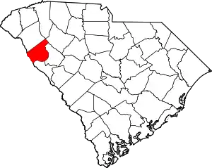 Map of South Carolina highlighting Abbeville County | |
| Towns | ||
| CDPs | ||
| Footnotes | ‡This populated place also has portions in an adjacent county or counties | |
| ||
Municipalities and communities of Anderson County, South Carolina, United States | ||
|---|---|---|
| Cities | 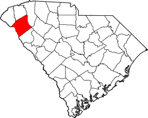 Map of South Carolina highlighting Anderson County | |
| Towns | ||
| CDPs | ||
| Unincorporated communities | ||
| Footnotes | ‡This populated place also has portions in an adjacent county or counties | |
| ||
| Authority control |
|---|