Hurricane, Utah
Hurricane (/ˈhɜːrɪkən/ HUR-i-kən) is a city in Washington County, Utah, United States and is a part of the Washington County, Utah.. Its population was 13,748 at the 2010 U.S. Census. Along with several other areas of southwestern Utah, the Hurricane area has undergone large population growth since the 1970s.
Hurricane, Utah | |
|---|---|
 Hurricane, Utah in July 2009 | |
 Location in Washington County and the state of Utah | |
| Coordinates: 37°10′27″N 113°19′34″W | |
| Country | United States |
| State | Utah |
| County | Washington |
| Area | |
| • Total | 53.63 sq mi (138.90 km2) |
| • Land | 52.76 sq mi (136.64 km2) |
| • Water | 0.88 sq mi (2.27 km2) |
| Elevation | 3,248 ft (990 m) |
| Population (2010) | |
| • Total | 13,748 |
| • Estimate (2019)[2] | 19,074 |
| • Density | 361.55/sq mi (139.60/km2) |
| Time zone | UTC-7 (Mountain (MST)) |
| • Summer (DST) | UTC-6 (MDT) |
| ZIP code | 84737 |
| Area code(s) | 435 |
| FIPS code | 49-37170[3] |
| GNIS feature ID | 1428951[4] |
| Website | www |
| [5] | |
History
Hurricane was first settled in 1896, and received its name after a whirlwind blew the top off a buggy in which Erastus Snow was riding. Snow exclaimed, "Well, that was a Hurricane. We'll name this 'Hurricane Hill'."[6]
Hurricane, which is pronounced "Her-ah-kun" by local residents (mimicking the accent of early Liverpudlian settlers), is in eastern Washington County.[7] The community was settled as part of LDS Church President Brigham Young's "Cotton Mission", intended to establish the southern end of Utah for agricultural purposes. The town once operated a large peach and apricot orchard for the LDS Church, and is historically known for growing peaches, pecans and pistachio nuts on small farms.
The 1992 St. George earthquake destroyed three houses as well as above- and below-ground utilities, causing about US$1 million in damage.[8][9]
Places of interest
The town boasts multiple parks, a new dog park, a city pool and large community center, several ranked golf courses, two reservoirs noted for bass fishing, boating and recreation (Sand Hollow and Quail Creek State Parks), as well as a small municipal airfield. The Hurricane Valley Heritage Park Museum is located on the corner of State Street and Main. There are several medical clinics in the area.
Hurricane Canal and Canal Trail
For approximately 80 years, the Hurricane Canal was the lifeblood of the Hurricane Valley. It was built over a period of 11 years (1893–1904), mostly by pick and shovel. Since 1985, the canal has lain empty. In 2000, special interest groups came together to preserve the canal, receiving grants and volunteering time to construct a trail to stand as a tribute to the early settlers put forth to make the canal a reality. A monument at the trailhead recounts the canal story in brief. Much of the trail, which only covers a small section of the canal, is the actual west bank of the canal, which “canal riders” rode every day when the canal was in operation to ensure there were no leaks or other problems since the bank was somewhat unstable. Two of the trail's unique aspects are walking in the canal itself – on a steel flume across a wash and through a tunnel immediately thereafter. The trail provides excellent views of the towns of Hurricane and La Verkin throughout. The trail ends before reaching the Virgin River Gorge, approximately five miles from the canal's former headwaters.
State Route 59 crash
On December 30, 2006, an Arizona driver on the Utah State Route 59 just outside Hurricane lost control and crashed through the guardrail at around 80 mph. The truck struck the culvert, flipped over, and rotated 180 degrees before landing on the opposite side of a ravine. Due to the rare nature of the event, photos of the crash were suspected to be a hoax, but the Hurricane City Police department confirmed the entire sequence of events.[10][11]
Geography
According to the United States Census Bureau, the city has a total area of 31.5 square miles (81.7 km2), of which 31.1 square miles (80.6 km2) is land and 0.4 square mile (1.1 km2) (1.39%) is water.[12]
Sand Hollow State Park
Sand Hollow is a very popular, very scenic state park in Hurricane, SW Utah. It offers a warm-water reservoir, sandy beaches and red rock; an access tunnel to Sand Mountain provides ATV trails through the sand dunes. Located in the city limits of Hurricane, Utah, approximately 297 miles south of Salt Lake City. It is a 45 minute drive from the park to Zion National Park and 20 minutes to St George. From I-15, take the Hurricane exit (Exit 16). Travel east on Hwy 9 for about four miles to Sand Hollow Road and then turn right. Travel south for 4 1/2 miles and turn left at the park entrance.
Interstate 15
U.S. Interstate 15 forms part of the northwest border of Hurricane. It has one exit, exit 16, that is located in Hurricane, and another exit, exit 27, that provides access to Hurricane from the north. I-15 is the main mean of transportation to the nearby St. George.
Utah State Route 9
Utah State Route 9 begins in Hurricane, at Harrisburg Junction. It travels east through Hurricane, forming State Street. SR-9 links Hurricane to the nearby Zion National Park and to U.S. Route 89.
Utah State Route 59
Utah State Route 59 ends in Hurricane, at the intersection of SR-9 and Main Street. It connects Hurricane with the nearby Hilldale, and indirectly connects Hurricane to Kanab through Arizona State Route 389.
Virgin River
The Virgin River forms nearly all of Hurricane's north border. It travels through the town's Confluence Park and crosses SR-9 at both the Hurricane-La Verkin border and near Quail Creek 3 miles from Harrisburg Junction. The river indirectly provides water to Hurricane, as well as to most of Washington County
Demographics
| Historical population | |||
|---|---|---|---|
| Census | Pop. | %± | |
| 1910 | 336 | — | |
| 1920 | 1,021 | 203.9% | |
| 1930 | 1,197 | 17.2% | |
| 1940 | 1,524 | 27.3% | |
| 1950 | 1,271 | −16.6% | |
| 1960 | 1,251 | −1.6% | |
| 1970 | 1,408 | 12.5% | |
| 1980 | 2,660 | 88.9% | |
| 1990 | 3,915 | 47.2% | |
| 2000 | 8,250 | 110.7% | |
| 2010 | 13,748 | 66.6% | |
| 2019 (est.) | 19,074 | [2] | 38.7% |
| U.S. Decennial Census[13] | |||
At the 2010 census,[14] there were 13,748 people, 4,609 households and 3,545 families residing in the city. The population density was 540 per square mile (210/km2). There were 5,461 housing units at an average density of 435.8 per square mile (270.8/km2). The racial makeup of the city was 91.3% White, 0.5% African American, 1.3% Native American, 0.5% Asian, 0.8% Pacific Islander, 3.32% from other races, and 2.3% from two or more races. Hispanic or Latino of any race were 2.72% of the population.
There were 4,609 households, of which 34.1% had children under the age of 18 living with them, 65.4% were married couples living together, 8% had a female householder with no husband present, and 23.1% were non-families. 19.5% of all households were made up of individuals, and 9.6% had someone living alone who was 65 years of age or older. The average household size was 2.87 and the average family size was 3.32.
Age distribution was 32.3% under the age of 19, 5.6% from 20 to 24, 11.2% from 25 to 44, 20.6% from 45 to 64, and 17.4% who were 65 years of age or older. The median age was 33.8 years. For every 100 females, there were 100.1 males. For every 100 females age 18 and over, there were 98.5 males.
The median household income was $32,865, and the median family income was $36,955. Males had a median income of $30,172 versus $19,588 for females. The per capita income for the city was $13,353. About 10.8% of families and 13.1% of the population were below the poverty line, including 19.2% of those under age 18 and 5.9% of those age 65 or over.
Economy and tourism


The one main boulevard is State Street, renovated and designated Utah SR-9. From 100 East to 400 West, the shopping district is designated as a "historical district," with ongoing preservation efforts. Many of the larger homes in town are listed on the National Registry of Historic Homes. Situated on Utah State Route 9, Hurricane lies between Interstate 15 and Zion National Park, and as a result has numerous motels, restaurants and other commercial establishments that serve a portion of the millions of tourists that visit Zion National Park each year.[15] Hurricane also benefits from visitors who are on their way to or from Lake Powell and the North Rim of Grand Canyon National Park via Utah State Route 59 which intersects State Route 9 within Hurricane city limits. The Hurricane area is also a growing destination for mountain biking in Southwestern Utah[16] as the city is situated near the popular Gooseberry Mesa, J.E.M and Little Creek mountain biking trails.
Education
Hurricane is a part of the Washington County School District.
Hurricane has one high school, Hurricane High School (encompassing grades 10-12), attended also by students from the surrounding communities of La Verkin, Toquerville and Springdale, among others. There are also two elementary schools, an intermediate school (grades 6-7) and a middle school (grades 8-9), as well as one charter school, Valley Academy (grades K-8).
Notable people
- Don Leo Jonathan, wrestler
- Herb Wilkinson, led Utah to its only NCAA Tournament Championship in 1943–44, NCAA Iowa three time All American basketball player
See also
- List of cities and towns in Utah
- Purgatory Correctional Facility
References
- "2019 U.S. Gazetteer Files". United States Census Bureau. Retrieved August 7, 2020.
- "Population and Housing Unit Estimates". United States Census Bureau. May 24, 2020. Retrieved May 27, 2020.
- "U.S. Census website". United States Census Bureau. Retrieved 2008-01-31.
- "US Board on Geographic Names". United States Geological Survey. 2007-10-25. Retrieved 2008-01-31.
- "US Gazetteer files: 2010, 2000, and 1990". United States Census Bureau. 2011-02-12. Retrieved 2011-04-23.
- Daughters of the Utah Pioneers historic marker dated September 25, 1931, currently located at Heritage Park at 35 W. State Street, Hurricane, Utah. See also Utah History Research Center online database entry taken from the Utah State Historical Society's 1995-1996 survey of historic markers and monuments.
- "Hurricane City Official Website Area History and Attractions". www.cityofhurricane.com. Retrieved 2018-12-27.
- Associated Press (May 15, 1994). "'92 quake left St. George virtually unshaken". Deseret News. Retrieved March 18, 2020.
- Christenson, Gary E., ed. (1995). The September 2, 1992 ML 5.8 St. George Earthquake, Washington County, Utah (PDF). Utah Geological Survey. ISBN 1-55791-367-6. Archived (PDF) from the original on December 13, 2016. Retrieved March 18, 2020.
- McLaughlin, Eliott C. (6 September 2007). "Amazing truck crash photos spark Web debate". CNN. Archived from the original on 19 January 2013. Retrieved 29 October 2012.
- "Truck Wreck: Livin' on the Edge". Snopes. 2 March 2011. Retrieved 29 October 2012.
- "U.S. Census Bureau QuickFacts: Hurricane city, Utah". www.census.gov. Retrieved 2018-12-05.
- "Census of Population and Housing". Census.gov. Retrieved June 4, 2015.
- http://cityofhurricane.com/uploads/fb/about/2010Census.pdf
- "Stats Report Viewer". irma.nps.gov. Retrieved 2020-07-06.
- "Mountain bike festival continues to grow in popularity". Retrieved 2020-07-06.
External links
| Wikimedia Commons has media related to Hurricane, Utah. |
Places adjacent to Hurricane, Utah | |
|---|---|
Municipalities and communities of Washington County, Utah, United States | ||
|---|---|---|
| Cities | 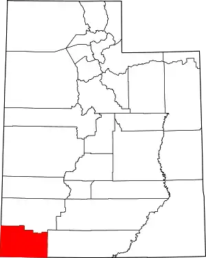 Map of Utah highlighting Washington County | |
| Towns | ||
| CDPs | ||
| Unincorporated communities | ||
| Ghost towns | ||
| Indian reservation | ||
| Footnotes | ‡This populated place also has portions in an adjacent county or counties | |
| ||
| Authority control |
|---|